Research Project Archive
EMRRP Program Reviews. Access is on the USACE network only.
Ecosystem Goods and Services (EGS) Framework, Tool Development and Methods Refinement

Guidance that Incorporates Ecosystem Goods and Services in Corps Planning and Environmental Benefits Evaluation
Fiscal Year Start: 2013 Fiscal Year Ending: 2019
POC: Elizabeth Murray
SON: Strategic Research HQ Initiative
Factsheet
Reference SON: Strategic Research HQ Initiative
Lead PI: Elizabeth Murray (ERDC)
Project Development Team (PDT): Tim Lewis, Sherry Whitaker (ERDC); Wen Chang, Jeanette Gallihugh, Shawn Komlos (Co-leads, IWR); Chad Markin, Forrest Vanderbilt (IWR); Chuck Theiling (MVR/ERDC); Kim Gazenski, Kristen Hychka, Anna McMurray, Lisa Wainger (U of Maryland); Frank Casey, Janet Cushing (USGS)
Proponent(s)/District
Collaborators: Maria Wegner (HQUSACE); Paul Scodari, Brian Harper, Dick Cole (IWR); Kelly Keefe (SAJ); Donald Cresitello, Jenine Gallo (NAN); Mary Brandreth (NAP)
Other Partners: Lydia Olander, Carl Shapiro (Duke U/EAB); Jim Boyd (RFF); Greg Arthaud (USDA FS)
Funded: 2013-2019
Keywords: Ecosystem goods and services, USACE planning tools, SMART Planning, EGS tools, GIS
Last updated: 06/10/2025
Ecosystem Goods and Services (EGS) Framework, Tool Development and Methods Refinement
Research Need
Many federal agencies are beginning to formally recognize and consider in their decision-making processes services yielded by ecosystems that benefit humans. USACE currently lacks a structured approach to adequately consider appropriate ecosystem services in a manner scalable to its disclosure and decision-making contexts. The general purpose of this project is to improve our understanding and ability to incorporate consideration of ecological goods and services (EGS) in Corps planning, including the development of new tools that would make the implementation of EGS assessment in Corps planning easier and more consistent.
Project Objectives & Plan
We used the expertise of Corps Planners and academics working in the EGS field to test, develop example applications, and refined the Proposed Framework developed in Phase I. We also provided Districts with tools to more consistently address elements of non-use services that address societal preferences - without attempting to monetize the benefits of those services - using the best available science in a systematic and repeatable way. Efforts included:
- Multiple case studies testing the Proposed Framework in different types of projects and different parts of the country, and a write up of each as a chapter in a technical report.
- Two integrated EGS tools (Connectivity and Scarcity/Restorability) in a technical note on each.
Payoff
This project will advance the Corps’ capabilities to capture the full range of relevant benefits and losses resulting from Corps projects via EGS assessment. The tests of the Proposed Framework will provide planners with examples of EGS assessment in several settings and project types, in the event that future planning policy enables the use of EGS assessment in Corps planning. The tools being developed will also promote eventual EGS assessment but may also be used under existing planning procedures in budget justification.
Products
Journal Articles (JAs)
- Wainger, L.A., Murray, E.O., Theiling, C.H., McMurray, A.M., Cushing, J.A., Komlos, S.B. and Cofrancesco, A.F. (2023). Broadening benefits and anticipating tradeoffs with a proposed ecosystem service analysis framework for the US Army Corps of Engineers. Environmental Management 71, 901–920. https://link.springer.com/article/10.1007/s00267-022-01777-7
Technical Reports (TRs)
- Cushing, J.A., Komlos, S.B., Barnes, T.K., Theiling, C.H. and Murray, E.O. (2025). Incorporating ecosystem goods and services into USACE project planning: a retrospective analysis (ERDC/EL SR-25-1), Special Report. U.S. Army Engineer Research and Development Center, Vicksburg, Mississippi. https://dx.doi.org/10.21079/11681/49519
- Hychka, K., Wainger, L.A., Murray, E.O. and Price, E.W. (In review). Using connectivity to improve non-monetary benefit relevant indicators of non-use ecosystem service values from restoration, Technical Report. U.S. Army Engineer Research and Development Center, Vicksburg, Mississippi.
- Murray, E.O., Theiling, C.H. and Wainger, L.A. (2025). Developing an ecosystem goods and services assessment framework: Products and Resources ERDC/TN EMRRP-EBA-28), Technical Report. U.S. Army Engineer Research and Development Center, Vicksburg, Mississippi. https://dx.doi.org/10.21079/11681/49786
- Reed, D., Martin, L. and Murray, E.O. (In review). Using scarcity and reliability data to value ecosystem services: assessment of currently available resources and metric aggregation methods, Technical Report. U.S. Army Engineer Research and Development Center, Vicksburg, Mississippi.
- Tazik, D.J., Cushing, J.A, Murray, E.O. and Wainger, L.A. (2013). Incorporating ecosystem goods and services in environmental planning: a literature review of definitions, classification and operational approaches (ERDC/EL TR-13-17), Technical Report. U.S. Army Engineer Research and Development Center, Vicksburg, Mississippi. https://hdl.handle.net/11681/7189
- Wainger, L.A., Filoso, S., Gazenski, K., Theiling, C.H. and Murray, E.O. (2025). Applying the ecosystem goods and services (EGS) framework: Meramec case study (ERDC/EL TR-25-1), Technical Report. U.S. Army Engineer Research and Development Center, Vicksburg, Mississippi. https://dx.doi.org/10.21079/11681/49520
- Wainger, L.A., Filoso, S., Murray, E.O., Weber, M.A., Price, E.W., Flemming, T.H. and Hychka, K. (In editing) Assessing relative wetland flood risk management benefits using COPE: An exploration of Capacity, Opportunity, Payoff and Equity (ERDC/ EL TR-25-XXX), Technical Report. U.S. Army Engineer Research and Development Center, Vicksburg, Mississippi.
- Wainger, L.A., McMurray, A., Griscom, H.R., Murray, E.O., Cushing, J.A., Theiling, C.H. and Komlos, S.B. (2020). A proposed ecosystem services analysis framework for the U.S. Army Corps of Engineers (ERDC/EL SR-20-2), Special Report. U.S. Army Engineer Research and Development Center, Vicksburg, Mississippi. https://dx.doi.org/10.21079/11681/37741
Technical Notes (TNs)
- Murray, E.O., Cushing, J.A., Wainger, L.A. and Tazki, D.J. (2013). Incorporating ecosystem goods and services in environmental planning: definitions, classification and operational approaches (ERDC TN-EMRRP-ER-18), Technical Note. U.S. Army Engineer Research and Development Center, Vicksburg, Mississippi. https://hdl.handle.net/11681/7189
Other Publications
- Reed, D., Martin L. and Cushing J.A. (2013). Using information on ecosystem goods and services in Corps planning: an examination on authorities, policies, guidance, and practices (2013-R-07), Institute for Water Resources Report. U.S. Army Corps of Engineers Institute for Water Resources, Alexandria, Virginia.
Conference Presentations/Webinars/Workshops
- Gazenski, K., Wainger, L.A. and Murray, E.O. (2016). Using scarcity data to value ecosystem services: assessment of currently available resources, Poster. A Community for Ecosystem Services (ACES), Jacksonville, Florida.
- Murray, E.O. (2016). Framing climate change science and adaptation in the context of ecosystem services: moving the ball forward, Panelist. A Community for Ecosystem Services (ACES), Jacksonville, Florida.
- Murray, E.O. (2016). What’s next for ecosystem services in decision making? Priorities and pathways, Panelist. A Community for Ecosystem Services (ACES), Jacksonville, Florida.
Project Activities
- Coordinate with HQ on integration of multiple planning initiatives, including EGS, into Corps planning.
- Attend HQ Meetings on developing policy guidance on EGS application.
1Project Alias – Work Unit Documentation Title: Ecosystem Goods and Services Tools Development and Methods Refinement (Incorporating EGS into Corps Planning, Phase II)
EFM and GeoEFM (Ecological Function Models) Development
Enhanced technologies that link H&H tools and ecosystem assessments
Fiscal Year Start: 2015; Fiscal Year Ending: 2018.
POC: John Hickey
SON: Strategic Discretionary Effort: Ecosystem Modeling – HEC Ecosystem Functions Model
Factsheet
Reference SON: Strategic Discretionary Effort: Ecosystem Modeling – HEC Ecosystem Functions Model
Lead PI: John Hickey (HEC)
Project Development Team (PDT): Multiple coding teams: HEC-EFM and DFCE, HEC -GeoEFM and ESRI, HEC -EFM Plotter and RMA
Proponent(s)/District Collaborators: Chip Hall (LRN); Rose Reilly (LRP), Alex Nelson, Dave Potter (MVP); Brad Palmer, Lucy Sawyer (MVR); Christine Ceislik (NWO); Lawrence Pico, Jean Reed, Elizabeth Richards, Mike Snyder (NWK); Jeff Ballantine, Matt Fraver, Chris Nygaard (NWP); Stan Simpson (SAS); Rene Vermeeren (SPL); Danny Allen, Bret Higginbotham (SWF); David Gade (SWT)
Funded: 2015-2018
Keywords: Ecosystem model, Ecosystem response, Ecosystem dynamics, Planning, HEC-EFM
Last updated: 05/09/2025
EFM and GeoEFM (Ecological Function Models) Development1
Research Need
Most ecosystem models are developed for specific projects and locations. There are few tools that are applicable to a wide range of ecosystems and even fewer that utilize the existing capabilities of hydrologic and hydraulic (H&H) modeling packages to help simulate ecosystem responses to typical project actions (e.g., reservoir reoperations, levee alterations, nonstructural flood risk management measures) in Corps’ mission areas. This limits synergies between restoration projects (lessons learned, staff and technology exchanges) and different professional communities in the Corps (e.g., environmental planners, engineers, and regulators).
Improving a software tool that connects H&H to ecosystem dynamics will enable Corps Districts (and other users) to have greater capabilities in the ecosystem planning and management arena specifically in regards to its restoration and water resource missions.
Project Objectives & Plan
Hydrologic Engineering Center-Ecological Function Model (HEC-EFM) is designed to help study teams determine ecosystem responses to changes in the flow regime of a river or connected wetland. EFM is a generic software tool, applicable to a wide range of ecosystems and works with existing hydrologic databases and hydraulic modeling packages to make predictions of ecosystem responses. Since July 2008, EFM has been available via the web at no cost, and downloaded thousands of times (www.hec.usace.army.mil). This research continues development of EFM and its spatial accessory GeoEFM, which is also web available.
Feature enhancements 2015:
- Completion of habitat suitability features
- Integration of suitability and connectivity features
- Allow users to customize output styles
- Allow flexibility in types of output written
- Enable batch compute
Feature enhancements for 2016:
- HDF data import
- Location-based eco-values
- GeoEFM journal paper
- Map upgrades
- User guidance updates
Feature enhancements for 2017:
- Relative velocity
- Post-processing of patches for index of functionality
- EFM and GeoEFM journal paper about watershed-scale use of statistics
- Enable EFM to track age and origin of simulated communities
- Assess habitat connectivity
Payoff
By advancing new generic software tools, this work unit improves the capabilities of planners and engineers around the Corps who are working in the ecosystem planning and management arena. Products of this work unit will provide immediate utility to a growing EFM user base, as evidenced by recent applications of the software by NWK, NWO, NWP, MVP, and others.
Products
Journal Articles (JAs)
- Hickey, J.T., Shafroth, P.B. and Fields, W.L. (2020). Flow-ecology modelling to inform reservoir releases for riparian restoration and management. Hydrological Processes 34, 4576-4591. https://doi.org/10.1002/hyp.13901
- Hickey, J.T., Huff, R. and Dunn, C.N. (2015). Using habitat to quantify ecological effects of restoration and water management alternatives. Environmental Modelling & Software. https://doi.org/10.1016/j.envsoft.2015.03.012
- Julian, D.P., Hickey, J.T., Fields, W.L., Ostadrahimi, L., Maher, K.M., Barker, T.G., Hatfield, C.L., Lutz, K., Marks, C.O., Sandoval-Solis, S. and Lund, J.R. (2015). Decision support for water and environmental resources in the CT River Basin. Journal of Water Resources Planning and Management. https://doi.org/10.1061/(ASCE)WR.1943-5452.0000538
Technical Reports (TRs)
- U.S. Army Corps of Engineers (2017). HEC-EFM – ecosystem functions model: Quick start guide version 4.0 (CPD-80a), Computer Program Documentation. Hydrologic Engineering Center, Davis, CA. http://www.hec.usace.army.mil/software/hec-efm/documentation/HEC-EFM_40_Quick_Start_Guide.pdf
Conference Presentations/Webinars/Workshops
- Multiple web-based trainings and project support activities.
Models and Applications
- HEC-GeoEFM is an ArcMap extension developed to support spatial analyses commonly used during applications of the Ecosystem Functions Model (HEC-EFM). Use of HEC-GeoEFM requires a user license for ArcMap. Spatial Analyst and 3D Analyst extensions for ArcMap must also be installed and activated. https://www.hec.usace.army.mil/software/hec-geoefm/
- HEC-GeoEFM provides three primary capabilities for users planning ecosystem restoration projects or water management scenarios: 1) management of spatial data sets, 2) computation and comparisons of habitat areas, and 3) assessment of habitat connectivity.
- HEC-GeoEFM has been certified for use in USACE Planning Studies by USACE Headquarters as recommended by the National Ecosystem Planning Center of Expertise as being sound in contemporary theory, computationally correct, and compliant with USACE policy.
Project Activities
- (Software deployment) EFM 4.0, online April 2017; EFM Quick Start Guide, Version 4.0. Links:
- https://www.hec.usace.army.mil/software/hec-efm/
- https://www.hec.usace.army.mil/software/hec-efm-plotter/
- https://www.hec.usace.army.mil/software/hec-geoefm/
- https://www.hec.usace.army.mil/software/hec-efm/documentation/HQ_Certification_HEC-EFM_and_HEC-GeoEFM.pdf
- https://www.hec.usace.army.mil/software/hec-efm/documentation/ECO-PCX_Certification_HEC-EFM_and_HEC-GeoEFM.pdf
- (Software updates), available for download at: https://www.hec.usace.army.mil/software/hec-geoefm/download.aspx
- EFM v 5.0, September 2020
- EFM Plotter v 3.0, September 2020
- EFM Plotter v 3.1, February 2021
- GeoEFM v 2.0, August 2024
- EFM v 6.0, April 2025
- (Award) ASCE EWRI Quentin Martin Best Practice-Oriented Paper in 2017. Julian, D.W., Hickey, J.T., Fields, W.L., Ostadrahimi, L., Maher, K.M., Barker, T.G., Hatfield, C.L., Lutz, K., Marks, C.O.,Sandoval-Solis, S., and Lund, J.R. (2015). Decision support system for water and environmentalresources in the Connecticut River Basin. Journal of Water Resource Planning and Management. https://dx.doi.org/10.1061/(ASCE)WR.1943-5452.0000538.
1Project Alias – Work Unit Documentation Title: HEC-EFM (Ecosystem Functions Model) ERDCWiki Title: EMRRP: Ecosystem Functions Model
Tools to Assess Offsite and Cumulative Benefits in Watershed Assessments
Protocols and guidelines for prioritization of sites for stream stabilization based on greatest anticipated downstream sediment reduction benefits to navigation, flood risk management and ecosystem restoration
Fiscal Year Start: 2015; Fiscal Year Ending: 2019.
POC: Chris Haring
SON: 2015-ER-3
Factsheet
Reference SON: 2015 ER-3 Tools to Assess Offsite and Cumulative Benefits in Watershed Assessment
Lead PI: Chris Haring (ERDC)
Project Development Team (PDT): Craig Fischenich (ERDC), Brad Palmer, Jeff Trulick (HQUSACE), Kathryn Herzog (MVP), Charles Theiling (MVR/ERDC), Tom Darby, Davi Michl, Michael Dougherty (MVR)
District Collaborators: Camie Knollenberg, Marshall Plumley (MVP), Jason Smith (MVR), Monique Savage (MVS)
Funded: 2015-2019
Keywords: Watershed assessment, Ecological restoration benefits
Last updated: 05/09/2025
Tools to Assess Offsite and Cumulative Benefits in Watershed Assessments1
Research Need
The Illinois River Basin has experienced the loss of ecological integrity due to sedimentation of backwaters and side channels, degradation of tributary streams, increased water level fluctuations, reduction of floodplain and tributary connectivity, and other adverse impacts caused by human activities (Rock Island District). Illinois Basin Restoration (IL519) was designed, in part, to retain sediments in upland streams and thereby protect bottomland floodplain habitat from sediment impacts.
Sediment transport in watershed studies is typically estimated using statistical models and not field measurements. Statistical model estimates may be acceptable for general planning and regional assessments, but not for Corps project benefit analysis; the Corps 3x3x3 planning processes require a rapid, field-based benefit metric that evaluates sediment reduction anticipated from specific stream stabilization projects.
Project Objectives & Plan
This study will develop tools to prioritize sites offering the greatest downstream sediment reduction benefits to navigation (reduced dredging), flood risk management (floodway maintenance), and ecosystem restoration (floodplain habitat) objectives. An HQ certified sub-watershed sediment transport evaluation procedure that estimates existing sediment transport and the incremental reduction resulting from individual ecosystem restoration projects will be developed.
This project will take a scaled watershed approach that:
- Identifies stream conditions over large spatial areas (i.e., watersheds) using existing watershed and valley characterization tools
- Develops stream channel classification tools to estimate stream mechanics using high resolution elevation data
- Assesses watershed and stream channel restoration potential in a selected watershed (Senachwine Creek), and
- Defines aquatic habitat
Under this project, researchers will also:
- Devise a new methodology for developing Regional Hydraulic Geometry Curves based on existing LiDAR data.
- Incorporate new Regional Curves to delineate stream channel metrics using remote sensing (LiDAR) terrain data for the entire watershed.
- Develop GIS toolbox to make the process efficient over entire watershed areas.
- Develop tools that will be transferable wherever appropriate terrain data exists.
Payoff
Watershed restoration program managers will have tools to estimate the relative sediment reduction benefits of each increment of restoration in a long-term restoration program. The existing condition and cumulative benefits of incremental restoration can be monitored as part of an adaptive management program that can identify when sediment transport reduction targets are met.
Products
Technical Notes (TNs)
- Haring, C.H, Theiling, C.H. and Dougherty, M.P. (2018). Rapid watershed assessment planning tools based on high-resolution terrain analysis. ERDC/CHL CHETN-VII-22. U.S. Army Engineer Research and Development Center, Vicksburg, Mississippi. https://apps.dtic.mil/sti/trecms/pdf/AD1101348.pdf
Conference Presentations/Webinars/Workshops
- Haring, C. River Mechanics and Regional Sediment Management Workshop. (2016). Instructor. Grenada, MS.
- Haring, C. Systems Approach to Erosion Control and River Rehabilitation Workshop. (2017). Instructor. Vicksburg, MS.
Project Activities
- Development of geomorphic channel assessment tools; these are html based expert systems tools to facilitate watershed assessment based on channel and watershed characteristics.
1Project Alias – Work Unit Documentation Title: Tools to Assess Offsite and Cumulative Benefits in Watershed Assessment
Data Assessment of Species and Habitat Migration Due to Changing Conditions
Model framework and web visualization tool that allows USACE Districts to best manage for ecosystem restoration projects with ongoing changes as a result of changing conditions
Fiscal Year Start: 2016; Fiscal Year Ending: 2020.
POC: Jacob Jung
SON: 2015-ER-14
Factsheet
Reference SON: 2015-ER-14 Data Assessment of Species and Habitat Migration Due to Changing Conditions
Lead PI: Jacob Jung (ERDC)
Project Development Team (PDT): Eric Britzke, Austin Davis, Richard Fischer, Michael Guilfoyle, Christina Saltus (ERDC)
Fleeger (LRP); Mark Cornish (MVP); Rena Weichenberg (CoP Lead), Mike Vissichelli (NAD); Todd Randall (NAN); David Schulte (NAO); Beth Adams (NAP); Mike Scuderi (NWD); Gina Paduano Ralph (SAJ)
Funded: 2016-2020
Keywords: Changing Conditions, Habitat migration, Restoration prioritization, TES, TERS
Last updated: 05/09/2025
Data Assessment of Species and Habitat Migration due to Changing Conditions1
Research Need
USACE is tasked with the monitoring and conservation of numerous threatened, endangered, and at-risk species (TER-S) over more than 12 million acres. Managing a number of TER-S spread across a large geographic area makes conservation efforts difficult particularly when complicated by habitat shifts driven by changing conditions.
Changing conditions, such as temperature and precipitation changes, can impact vegetation phenology and may disrupt ecosystems in ways that change the habitat of TER-S; such changes may also influence the dispersal of invasive species.
With the wide breadth of potential impacts from changing conditions, earlier efforts have focused on developing tools for specific circumstances and/or impacts. However, as influencing factors change independently, a more comprehensive methodology is needed to predict the impacts of changing conditions across a variety of situations and locations. What is needed is a tool that enables managers to prioritize conservation actions to get the most return on investment. Given that a large number of species/geographic areas are impacted by changing conditions, a framework is needed to enable site comparisons and allow for prioritization of restoration efforts.
Project Objectives & Plan
This effort will develop a working model that can serve as a tool to predict range shifts of threatened, endangered, at-risk species (TER-S), and invasive species as environmental conditions are altered. This tool will assist the USACE with restoration project planning and preparation that incorporates management for TER-S and invasive species. A case study of the tool will be in the North Atlantic Division (NAD). The tool also will serve as an early detection warning for invasive species that are likely to invade sites and thus allow for proactive management to reduce impacts to the environment and to TER-S.
Products developed from the proposed work will directly support the USACE Environmental Changes Adaptation Plan and the Infrastructure and Installation Resilience Community of Practice. While the initial development will utilize NAD as an example of its utility, this approach will be easily transported to other locations throughout USACE.
The primary products will be a series of Tech Notes that demonstrate and detail the capabilities of the predictive model for TER-S and invasive species migration associated with changing conditions. A web-based GIS visualization tool will also be developed to display regions of vulnerability for given species. Additional major deliverables will include the conceptual and actual predictive model for TER-S migration in the NAD. Results will also be disseminated to the USACE via a webinar demonstration.
Payoff
The predictive model for TER-S in NAD will assist USACE in both Planning and Operations business lines (restoration efforts and mission requirements for project operations) by predicting range shifts of TER-S and invasive species that occur within the NAD. This model can be extended to incorporate other Areas of Responsibility (e.g., USACE Divisions, training areas) to assist in a proactive approach and early awareness to changes in habitat, shifts in plant communities associated with both TER-S and invasive species, and species composition. In addition, the model could aid the USACE in establishing better interagency cooperation to support environmental change adaptation including involvement with groups such as the Infrastructure and Installation Resilience CoP and the Climate Data and Tools Working Group.
Products
Technical Reports (TRs)
- Jung, J.F., Guilfoyle, M.P., Saltus, C.L., Britzke, E.R., Fischer, R.A. and Davis, A.V. (2021). Threatened, endangered, and at-risk species for consideration into climate change models in the Northeast (ERDC/EL SR-21-7), Special Report. U.S. Army Engineer Research and Development Center, Vicksburg, Mississippi. https://dx.doi.org/10.21079/11681/42143
Technical Notes (TNs)
- Davis, A.V., Fuentes, A.A., Jung, J.F., Theel, H.J., Britzke, E.R. and Fischer, R.A. (2019). Tools for predicting wildlife species distribution response to ecological shifts (ERDC/TN EMRRP-EI-05), Technical Note. U.S. Army Engineer Research and Development Center, Vicksburg, Mississippi. https://apps.dtic.mil/sti/trecms/pdf/AD1077124.pdf
1Project Alias – Work Unit Documentation Title: Data Assessment of Species and Habitat Migration due to Changing Conditions
Assessing and Improving the Resilience of Bay and Coastal Marshes and Islands
Fiscal Year Start: 2017; Fiscal Year Ending: 2020.
POC: Bobby McComas
SON: 2016-ER-5
Factsheet
Reference SON: 2016-ER-5 Assessing and Improving the Resilience of Bay and Coastal Marshes and Islands
Lead PI: Bobby McComas (ERDC)
Project Development Team (PDT): Damarys Acevedo-Mackey, Carra Carrillo, Craig Fischenich, Brook Herman, Candice Piercy, Christine VanZomeren (ERDC); Dave Schulte (NAO)
District Collaborators: James Miller (LRB); David Bucaro (LRC); Jeffrey Corbino (MVN); Larry Oliver (NAE); Rena Weichenberg (NAD); Dave Schulte (NAO); Justin McDonald (SAM); Jim Hutchison (SPL)
Funded: 2017-2020
Keywords: Coastal marshes, Coastal vulnerability, Coastal processes, Decision support
Last updated: 06/11/2025
Assessing and Improving the Resilience of Bay and Coastal Marshes and Islands1
Research Need
Coastal marsh and island features provide many critical functions including storm surge protection, water filtration, CO2 sequestration, and support to the fish and wildlife that utilize these systems. Many coastal systems are experiencing accelerated degradation and acreage loss due to factors such as sea level change, salt water intrusion, and introduction of invasive species among others. Criteria to assess the vulnerability of marsh and island systems to specific drivers are needed to assist the planning community in assessing the restoration potential of sites across the Corps of Engineers, and to prioritize restoration actions. Linkage of restoration techniques to the site-specific processes driving degradation will enhance the likelihood of success of restoration projects, while increasing system sustainability and the provision of goods and services at regional (multi-project) levels.
Project Objectives & Plan
This research will address the following objectives:
- Identify and characterize the processes and conditions contributing to loss of coastal wetland and island features
- Establish criteria for assessing the vulnerability of coastal features and coastal systems to degrading processes and conditions
- Develop, test, and document a methodology to prioritize sites/features based on vulnerability, restoration potential, and return on investment
- Link restoration methods/strategies to the vulnerability classification.
Anticipated products of this research include:
- Criteria to assess the vulnerability of coastal wetland and island features
- Guidance for the restoration/preservation of vulnerable sites
Payoff
Products of this work effort will assist Corps planners in identifying, screening, and prioritizing candidate restoration projects in coastal environments and will assist operations personnel in designing, operating, and maintaining coastal flood and storm damage reduction and navigation projects. Consequently, Corps projects are expected to provide greater benefits and the coastal systems in which they are implemented are expected to demonstrate greater resilience. The products will be aimed at streamlining the planning process for related projects providing more timely and cost-effective product delivery.
Products
Technical Reports (TRs)
- Van Zomeren, C. and Acevedo-Mackey, D. (2019). A review of coastal vulnerability assessments: definitions, components, and variables (ERDC/EL SR-19-05), Technical Report. U.S. Army Engineer Research and Development Center, Vicksburg, Mississippi. https://dx.doi.org/10.21079/11681/33289
Presentations
- (2017). Dredging Operations and Environmental Research Program (DOER) IPR, Presentation.
- (2018). Poster Presentation highlighting work unit (SuperRARG).
Project Activities
- An extensive literature search was conducted to compile existing data and models pertinent to marsh and island vulnerability assessments and associated management; ongoing outreach to USACE Districts to identify specific management challenges, to locate case studies and compile data.
1Project Alias – Work Unit Documentation Title: Assessing and Improving the Resilience of Bay and Coastal Marshes and Islands
Managing Movement of Threatened, Endangered, and Invasive Species Using Corps Water Resources Infrastructure
Fiscal Year Start: 2013; Fiscal Year Ending: 2019.
POC: David Smith
SON: 2015-ER-12
Factsheet
Reference SON: 2015-ER-12 Analytical Techniques to Assess Fish Passage Connectivity & Identify Patterns & Triggers in Ecological Response to Hydrologic Processes
Lead PI: David L. Smith (ERDC)
Project Development Team (PDT): Keith Martin, John Nestler, Tammy Threadgill, Christa Woodley (ERDC)
District Collaborators: Tom Maier (LRP); Mark Cornish (MVR); Jason Farmer (MVS); Andrew Roach (NAB); Larry Oliver (NAE); Curtis Miller (NWO); Brad Eppard (NWP); Derek Fryer (NWW); Joe Moran (SAC); Brian Zettle (SAM); Stanley Simpson (SAS); Mick Porter (SPA); Brian Mulvey (SPK)
Other Partners: John Stark (TNC)
Funded: 2013-2019
Keywords: Fish passage, Locks and Dams, TES, ANS
Last updated: 09/23/2024
Managing Movement of Threatened, Endangered, and Invasive Species Using Corps Water Resources Infrastructure1
Research Need
Corps’ river infrastructure projects have the potential to disrupt river connectivity and impede movement of desirable migratory aquatic species, many of which are threatened or endangered (T&E species). Simultaneously, river infrastructure can block the spread of aquatic nuisance species (ANS). For example, the Brandon Road Lock and Dam (L&D) is thought to block the movement of Asian Carp into the Great Lakes through the Illinois River Waterway and the Upper and Lower St. Anthony Falls Lock & Dams (L&Ds) are thought to block the spread of ANS into the upper reaches of the Mississippi River. Traditional fish passage strategies to restore connectivity for T&E species now compete with strategies to block or impede movement of nuisance invasive species. Corps’ river infrastructure projects could contribute to river system restoration if they could be designed or operated to serve as selective distributional controls (i.e., passage for some species and barrier to others) for highly mobile aquatic biota at either single-project or system-wide scales. Unfortunately, there are no operational guidelines or designs for selectively passing desirable migratory species or impeding nuisance species.
Project Objectives & Plan
The goal of the proposed work is to develop planning and engineering tools for application at L&Ds that allow Corps’ scientists and engineers to develop project alternatives that selectively pass desirable aquatic species and block or impede ANS. This research is intended to be conducted in parallel with a Pittsburgh District USACE ongoing navigation modernization feasibility study for three locks on the upper Ohio River and the USFWS Biological Opinion on Ohio River Navigation System operation and maintenance. Anticipated products include:
- Tech Note: Novel approach for using computation fluid dynamics (CFD) modeling to support feasibility studies.
- Software: Generalized CFD models of L&Ds for feasibility studies of proposed fish passage strategies.
- Movement rules that can be used to forecast the migratory path made by different target fish species.
- Adaptive Management Plan for application of fish passage strategies at Corps L&Ds.
Payoff
L&Ds are a major component of the Nation’s navigation infrastructure and have the potential for dual use as a major contributor to the Corps ecosystem and restoration business line. The extension to dual use is possible with relatively little additional investment and either no impact or very little impact on navigation efficiency. This work, with its initial formulation at Pittsburgh District (LRP), will establish a sound foundation for the design and evaluation of selective fish passage strategies at replacement lock chambers on the Upper Ohio River to support a Great Lakes and Ohio River Division (LRD) environmental commitment. This work also supports initiatives identified in the agreement executed between The Nature Conservancy and LRD for cooperative projects involving dam management for native fish passage, floodplain protection, invasive species, and fish and mussel reproduction needs. It further supports initiatives of the Council on Environmental Quality and Pennsylvania Fish and Boat Commission to restrict the spread of Asian carp. Methods developed in this research will be broadly applicable to USACE navigation infrastructure nation-wide.
Products
White Papers
- Smith, D.L. White paper: building a generalized fish passage assessment tool for application at Corps lock and dams, Technical Note. U.S. Army Engineer Research and Development Center, Vicksburg, Mississippi.
Project Activities
- Laboratory and computational fish movement studies/simulations to assess attraction flow effectiveness; Non-physical barrier simulation at a Lock and Dam (Deterrence technology will be an important consideration for fish movement management – tools are needed to anticipate impacts and plan implementation)
1Project Alias – Work Unit Documentation Title: Managing Movement of Threatened, Endangered, and Invasive Species Using Corps Water Resources Infrastructure
Developing community-based models for freshwater mussels
Ecological model development applicable to future ecosystem restoration and planning projects for mussel communities.
Fiscal Year Start: 2015; Fiscal Year Ending: 2018.
POC: Todd Swannack
SON: Multiple freshwater mussel SONs submitted in FY15
Factsheet
Reference SON: Multiple freshwater mussel SONs submitted in FY15
Lead PI: Todd Swannack (ERDC)
Project Development Team (PDT): Carra Carrillo, Brook Herman, Jack Killgore, Michael Kjelland, Kyle McKay, Molly Reif, Christina Saltus, Todd Slack (ERDC)
District Collaborators: Nathan Richards (EcoPCX); Tomma Barnes (NAB), Larry Oliver (NAE); Dan Kelner (MVP); Kat McCain (MVS), Steve Allen (NAP)
Funded: 2015-2018
Keywords: Freshwater mussels, Mussel community modeling, Mussel guilds
Last updated: 06/11/2025
Developing community-based models for freshwater mussels1
Research Need
Freshwater mussels are one of the most imperiled taxa in the US. Endangered mussels occur across the nation and every USACE district must plan for the potential of their endemic mussels to be placed on the endangered species list. Endangered species models are generally developed for a single-species, but given that there are over 300 mussel species in the US, new methods must be developed that focus on community-based approaches. A standardized general methodology is needed for endangered freshwater mussel community modeling that meets the guidelines set in EC 1105-2-412 (or subsequent policies) and allows models to bedeveloped in a faster, more efficient manner, whilemaintaining scientific integrity and transparency throughoutmodel development process.
Project Objectives & Plan
This work will focus on conceptual modeling for multiple species - involving stakeholders – and will include quantitative model development, spatially explicit index-based modeling approaches, model application, model certification, and technology transfer. The primary products of this effort will include a series of Technical Notes and webinars illustrating the steps involved in community-based modeling. Additional major deliverables will include a conceptual and actual ecological model(s) that have been applied and can be used for future ecosystem restoration and planning projects for mussel communities.
Payoff
The payoff for this effort will be a standardized methodology for modeling mussel communities that can be used by the USACE planning community of practice. Standardizing the approach for endangered freshwater mussel modeling will provide an advancement over current ad-hoc approaches and will enable Corps managers and planners to more effectively and efficiently support the Corps ecosystem restoration project life-cycle from planning to construction and into operations and maintenance.
Products
Technical Notes (TNs)
- Herman, B., Slack, T., and T. Swannack. (2021). Developing conceptual models for assessing benefits and impacts of USACE activities on freshwater mussel communities, (RDC/TN EMRRP-EBA-25) Technical Note. U.S. Army Engineer Research and Development Center, Vicksburg, Mississippi. https://apps.dtic.mil/sti/trecms/pdf/AD1149084.pdf
Model Certification
- (2023). General Freshwater Mussel Habitat Model - Eco-PCX Certification for National use. https://ecolibrary.sec.usace.army.mil/...
Conference Presentations/Webinars/Workshops
- (2017). The critical species mussel modeling team was invited to give a workshop to the mussel team of the Upper Miss River Commission. Red Wing, MN. The team presented a workshop on innovative community based modeling approaches developed at ERDC.
- (2024). Overview of the General Freshwater Mussel Habitat Model. This presentation will describe the development and application of a general freshwater mussel habitat model. The objectives of the model are to be applicable throughout the range of the North American freshwater mussel species, be sensitive to differences in proposed restoration actions or sites and contain parameters that reflect system-level functions that provide suitable habitat for freshwater mussels. https://emrrp.el.erdc.dren.mil/webinars.html
1Project Alias – Work Unit Documentation Title: Developing models for endangered mussel communities: formalizing and quantifying approaches for ubiquitous threatened taxa
Watershed Level Effects of Multiple Ecosystem Restoration Projects
Develop a proof of concept approach for assessing the cumulative value of multiple projects in a single watershed. The capability developed will be used for demonstrating the value of completing multiple local projects over time at a watershed scale.
Fiscal Year Start: 2015; Fiscal Year Ending: 2017.
POC: Burton Suedel
SON: 2014-ER-24
Factsheet
Reference SON: 2014 ER-24: Watershed Level Effects of Multiple Ecosystem Restoration
Lead PI: Burton Suedel (ERDC)
Project Development Team (PDT): Christy Foran, Cate Fox-Lent, Chuck Theiling (ERDC)
District Collaborators: Wendy Gendron, Larry Oliver (NAE)
Other Partners: Narragansett Bay Estuarine Research Reserve, NOAA Restoration Center, RI Coastal Resources Management Council, RI Division of Fish and Wildlife, Save the Bay, USFWS
Funded: 2015-2017
Keywords: Ecosystem restoration benefits, Watershed restoration, Cumulative benefits assessment
Last updated: 06/12/2025
Watershed Level Effects of Multiple Ecosystem Restoration Projects1
Research Need
Since the Water Resources and Development Act of 1986 (WRDA) re-established and refined the federal interest in water resources development, and added an ecosystem restoration mission, USACE – independently and in cooperation with other agencies – has completed numerous ecosystem restoration projects throughout the United States. The benefits of these projects, where designed and executed in isolation from the larger landscape, has come into question however. There is a perceived benefit to designing discrete ecological restoration projects in a manner that considers multiple objectives and the physical and environmental linkages that exist on a watershed scale.
Watershed level planning, however, presents a number of challenges, including the constraints of agency mission areas and the need for broader, more comprehensive – and costly – supporting planning studies. Such studies may be difficult to support in the current 3x3x3 planning process climate as well. As a result, project sponsors are often focused on planning for a specific site.
Despite the lack of connection in the planning and execution phases, many of these discrete projects may have nonetheless resulted in greater, though undocumented, realized benefits at larger ecosystem and watershed scales. An assessment of the cumulative and interrelated effects of multiple ecosystem restoration projects could quantify and demonstrate the added function and value provided by completed and future projects – i.e., a post-project cumulative assessment at the watershed scale.
Project Objectives & Plan
This project will examine multiple completed projects and projects currently planned in the Narragansett Bay watershed in an attempt to display and quantify the interrelationship among the projects as well as between the projects and the surrounding ecosystems. The assessment will demonstrate the cumulative benefits of the restoration investments over the past two to three decades providing the basis for the development of a general methodology for assessing benefits of multiple discrete projects by documenting changes in ecosystem quality and function at a watershed scale taking advantage of synergies and inter-connectedness among projects.
The primary deliverable will be a proof of concept demonstration of the cumulative effects assessment approach applied at the watershed scale. The capability developed will be used for demonstrating the aggregate value to the watershed of multiple local projects completed over time. Once developed, the approach will be available for widespread use to encourage application in other watersheds throughout the USACE. The primary written deliverables will include a Technical Report and manuscript for peer-reviewed publication illustrating the demonstration of the approach in Narragansett Bay, Rhode Island. Deliverables will be co-developed with District collaborators to ensure that the products are useful and understandable to a broad audience.
Payoff
This work develops an approach that is a transparent, defensible assessment of the cumulative effects of USACE project activities at the watershed scale. The approach will be used to identify and, to the extent possible, quantify the ecosystem benefits resulting from NAE and other agency work in the Narragansett Bay watershed during the past 20 years. The approach will assist the Civil Works Transformation process by adding efficiency in identifying aquatic ecosystem restoration benefits. The approach will be developed for use on future projects but generalized for multiple USACE needs.
Products
Technical Reports (TRs)
- Foran, C.M., Fox-Lent, C., Chaderton, C., Gendron, W., Oliver, L., Monroy, E., Turek, J., Edward, P. and Suedel, B. (2018). Watershed level effects of multiple ecosystem restoration projects (ERDC/EL TR-18-10), Technical Report. U.S. Army Engineer Research and Development Center, Vicksburg, MS. https://dx.doi.org/10.21079/11681/29528
1Project Alias – Work Unit Documentation Title: Watershed Level Effects of Multiple Ecosystem Restoration Projects
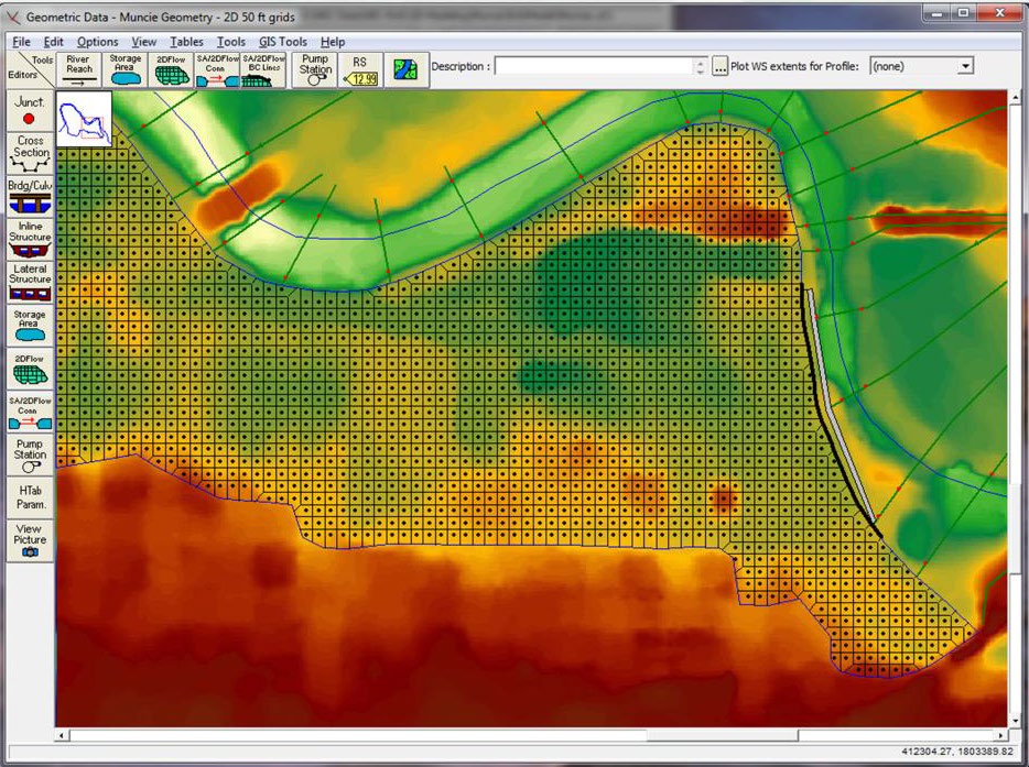
Multi-dimensional Modeling of Interactions between Nutrients and Riparian Vegetation for Improved Riverine Ecosystem Management
2D nutrient transport and vegetation interaction module for HEC-RAS
Fiscal Year Start: 2013; Fiscal Year Ending: 2019.
POC: Billy Johnson
SON: 2015-ER-1: Multidimensional Modeling of Interactions between Nutrients and Riparian Vegetation for Improved Riverine Ecosystem Management
Factsheet
Reference SON: 2015-ER-1: Multidimensional Modeling of Interactions between Nutrients and Riparian Vegetation for Improved Riverine Ecosystem Management
Lead PI: Billy Johnson (ERDC)
Project Development Team (PDT): Chuck Theiling, Zhonglong Zhang (ERDC), Mark Jensen, Alex Sanchez, Todd E. Steissberg (HEC)
District Collaborators: Craig Evans (SWL), Brian Zettle (CoP Rep/MVP), Jeff Tripe (NWK)
Funded: 2013-2019
Keywords: Water quality modeling, Nutrient vegetation interactions, Riparian ecosystem management
Last updated: 08/13/2025
Multi-dimensional Modeling of Interactions between Nutrients and Riparian Vegetation for Improved Riverine Ecosystem Management1
Research Need
Current capabilities allow one to model fully mixed riverine systems with riparian vegetation growth and mortality being a function of flow and sediment. Improvements to the system will allow two-dimensional (vertically averaged) simulations, thus improving model results in large river and estuary systems, enabling modeling of interactions between flow, nutrient fate and transport, and riparian vegetation life cycles in the floodplain.
Project Objectives & Plan
The general purpose of the project is to improve the current nutrient simulation and riparian vegetation module formulations and integrate them into the latest HEC-RAS-2D program.
Riparian vegetation formulations will be improved to incorporate the effects of nutrient uptake on plant growth and mortality, thus allowing one to evaluate the effects of wetlands and backwater areas on recycling nutrients and reducing nutrient loads in downstream water bodies. These improvements in modeling capability will improve the science, economics, and decision support for ecosystem management and restoration.
The primary product of this research will be an improved HEC-RAS-2D model with more advanced nutrient and riparian vegetation dynamics. The advanced nutrient capabilities will be accomplished with updates to the Nutrient Simulation Module (NSM), and improved riparian vegetation dynamics will be accomplished through improvements to the Riparian Vegetation Simulation Module (RVSM). Technical reports, testing, validation studies, and updated versions of the HEC-RAS User’s Manual and Applications Guide will be available from the HEC website.
Payoff
The updated HEC-RAS-2D model will support the Corps’ most pressing need for a cost-effective science-based impact assessment for ecosystem restoration and management. Because of its widespread use in flood analysis and other hydraulic studies, most large river systems as well as many smaller rivers and streams in the U.S. have already been modeled with HEC-RAS. The overall cost to stakeholders interested in modeling water quality and interactions of flow, nutrients and vegetation for improved riverine and estuarine ecosystem management and restoration is dramatically reduced due to leveraging these analyses against existing modeling efforts.
Products
Technical Reports (TRs)
- Zhang, Z. and Johnson, B.E. (2016). Testing and validation studies of the NSMII-benthic sediment diagenesis module (ERDC/EL TR-16-11), Technical Report. U.S. Army Engineer Research and Development Center, Vicksburg, Mississippi. https://apps.dtic.mil/sti/pdfs/AD1012495.pdf
- Zhang, Z. and Johnson, B.E. (2016). Aquatic nutrient simulation modules (NSM) developed for hydrologic and hydraulic models (ERDC/EL TR-16-1), Technical Report. U.S. Army Engineer Research and Development Center, Vicksburg, Mississippi. https://apps.dtic.mil/sti/pdfs/AD1002483.pdf
Technical Notes (TNs)
- Zhang, Z., Johnson, B. and Greimann, B. (2019). HEC-RAS-RVSM (Riparian Vegetation Simulation Module), (ERDC/TN EMRRP-SR-87), Technical Note. U.S. Army Engineer Research and Development Center, Vicksburg, Mississippi. https://apps.dtic.mil/sti/pdfs/AD1074004.pdf
- Zhang, Z., Johnson, B., Wang, J., & Greimann, B. (2019). Application and validation study of the HEC-RAS-RVSM model to the Sacramento River (ERDC/TN EMRRP-SR-88), Technical Note. U.S. Army Engineer Research and Development Center, Vicksburg, Mississippi. https://erdc-library.erdc.dren.mil/server/api/core/bitstreams/85912209-04ad-43d2-8157-9b3254952b40/content
Journal Articles (JAs)
- Wang, J., Zhang, Z., Greimann, B. and Huang, V. (2018). Application and evaluation of the HEC-RAS - riparian vegetation simulation module to the Sacramento River, Ecological Modeling. https://doi.org/10.1016/j.ecolmodel.2017.11.011
Conference Presentations/Webinars/Workshops
- Zhang, Z., Johnson, B.E. and Greimann, B.P. (2017). Application and evaluation of HEC-RAS – RVSM to the Sacramento River, Presentation. CWEMF Conference, Folsom, California.
- Zhang, Z. and Jensen, M. (2022). HEC-RAS One-Dimensional Riverine Water Quality Modeling. Environmental Water Resources Institute (EWRI), American Society of Civil Engineers (ASCE) Conference. June, 2022.
- Steissberg, T.E., Johnson, B.E., Zhang, Z., Jensen, M.A., and Sanchez, A. (2022). ClearWater-Riverine: An Integrated Water Quality Modeling Framework for Riparian and Floodplain Ecosystems. iEMSs 2022 Conference. International Environmental Modelling and Software Society. Brussels, Belgium. June 2022.
- Zhang, Z., Steissberg, T.E., and Johnson, B.E. (2022). Linked Riverine and Reservoir Hydraulic and Water Quality Modeling for Ecological Impact Assessment. American Geophysical Union (AGU) Frontiers in Hydrology Conference. Session: Working with Nature-Based Features in Inland and Coastal Tropical Environments. American Geophysical Union. San Juan, Puerto Rico. June 2022.
- Steissberg, T.E., Johnson, B.E., Zhang, Z., Jensen, M.A., and Sanchez, A. (2022). ClearWater-Riverine: A New Two-Dimensional River and Floodplain Water Quality Model. American Geophysical Union (AGU) Frontiers in Hydrology Conference. Session: Working with Nature-Based Features in Inland and Coastal Tropical Environments. American Geophysical Union. San Juan, Puerto Rico. June 2022.
Models and Applications
- Columbia River System Operations (CRSO) Project, USACE Northwest Division (2020)
1Project Alias – Work Unit Documentation Title: Multi-dimensional Modeling of Interactions between Nutrients and Riparian Vegetation for Improved Riverine Ecosystem Management ERDCwiki Title: Multi-Dimensional Modeling of Nutrients and Riparian Vegetation for Improved Riverine Ecosystem Management
Ecosystem Restoration in Variable Environments
Provide a suite of techniques and methods for conceptualizing, quantifying, and managing variable ecosystems using restoration alternatives that design for or manage variability.
Fiscal Year Start: 2013; Fiscal Year Ending: 2017.
POC: Kyle McKay
SON: Strategic initiative
Factsheet
Reference SON: Strategic initiative
Lead PI: Kyle McKay (ERDC)
Project Development Team (PDT): Bruce Pruitt, Katherine Chambers (ERDC), Tom Prebyl (U of Georgia)
District Collaborators: Brian Zettle (SAM), Mick Porter (SPA), Joshua Willis (SWG DA Intern)
Other Partners: Caitlin Conn, Amy Rosemond, Natalia Shim, Seth Wenger (U of Georgia); Brian Crawford, Mary Freeman (USGS); Rachel Katz (USFWS)
Funded: 2013, 2015-2017
Keywords: Hydrologic variability in aquatic systems, Temporal ecology, Environmental flows, Hydropeaking effects
Last updated: 06/11/2025
Ecosystem Restoration in Variable Environments1
Research Need
Adequately accounting for environmental variability is a critical concern in quantifying long-term success of ecosystem restoration projects. Ecosystems and ecological processes experience numerous sources or expressions of periodic stochastic and catastrophic environmental variation (e.g., seasonal temperature dynamics, rainfall fluctuations, and large floods), respectively2. These dynamic environmental conditions lead to variable and uncertain ecological benefit provided by these systems. For instance, an arid stream may be a significant source of aquatic habitat during wet years, and a nearly dry riverbed during drought. Moreover, many restoration projects have operational elements that respond to, and are often designed to change, ambient conditions (diversion structures, flood control features, etc.). Additionally, disturbance and land use change may alter future levels of environmental variability and potentially increase uncertainty as ecological responses change and adjust.
In order to better design, efficiently operate, and adaptively manage project features to optimize environmental benefits, project planners and operational specialists require tools for responding to variability and disturbance (e.g., drought).
Project Objectives & Plan
This project seeks to provide a suite of techniques for quantifying and incorporating environmental variability into project planning. Three primary and several secondary deliverables are proposed for this project:
- Review the state-of-the-science and synthesize techniquesfor quantifying environmental variability.
- Review the role of variability in setting and crossingecological thresholds, maintaining ecosystem resilience, anddesigning restoration projects accordingly.
- Develop a case study to demonstrate accounting forvariability of environmental benefits of restoration projects.
- Present findings to users in webinars, conferencepresentations, and on-site demonstrations with collaboratingfield personnel.
Payoff
Understanding and quantifying variability is particularly important in non-stationary environments, which are the new norm in aquatic ecosystems2. Developing techniques for evaluating variability will help practitioners to plan and design for fluctuating environments, increase the resilience of restoration projects, and avoid negative thresholds in restoration outcomes.
Products
Journal Articles (JAs)
- McKay, S., Freeman, M. and Covich, A. (2016). Application of Effective Discharge Analysis to Environmental Flow Decision-Making. Environmental Management. 57. https://doi.org/10.1007/s00267-016-0684-4.
- Shrestha S., Dwivedi P., McKay S.K., and Radcliffe D. (2019). Assessing the potential impact of rising production of industrial wood pellets on streamflow in the presence of projected changes in land use and climate: A case study from the Oconee River Basin in Georgia, United States. Water, 11(1), 142; https://doi.org/10.3390/w11010142.
Technical Reports (TRs)
- McKay, S.K., Pruitt, B.A., Zettle, B.A., Hallberg, N., Hughes, C., Annaert, A., Ladart, M. and McDonald, J. (2018). Proctor Creek ecological model (PCEM): phase 1 site screening (ERDC/EL TR-18-11), Technical Report. U.S. Army Engineer Research and Development Center, Vicksburg, Mississippi. https://dx.doi.org/10.21079/11681/29514
- McKay, S.K., Pruitt, B.A., Zettle, B.A., Hallberg, N., Moody, V., Annaert, A., Ladart, M., Hayden, M. and McDonald, J. (2018). Proctor Creek ecological model (PCEM): phase 2 benefits analysis (ERDC/EL TR-18-11), Technical Report. U.S. Army Engineer Research and Development Center, Vicksburg, Mississippi. https://dx.doi.org/10.21079/11681/29515
Technical Notes (TNs)
- Bhattacharjee, N.V., Willis, J.R., Tollner, E.W. and McKay, S.K. (2019). Habitat provision associated with environmental flows (ERDC/TN EMRRP-SR-85), Technical Report. U.S. Army Engineer Research and Development Center, Vicksburg, Mississippi. https://dx.doi.org/10.21079/11681/32406
- McKay, S.K. (2022). Is mean discharge meaningless for environmental flow management? (ERDC/TN EMRRP-SR-91), Technical Note. U.S. Army Engineer Research and Development Center, Vicksburg, Mississippi. https://dx.doi.org/10.21079/11681/45381
Other
- Bhattacharjee, N.V. (2017). Assessing Water Body Ecological Indicators using Time Series Analysis and Physics-based Modeling Approaches. Doctoral Dissertation, University of Georgia, Athens, Georgia. https://openscholar.uga.edu/record/19635?v=pdf
- Bumpers, P., Skaggs, J., and Wenger S. (2017). Response of shoal-dwelling fish to the cessation of hydropeaking on the Etowah River. Project Report, University of Georgia, Athens, Georgia.
Conference Presentations/Webinars/Workshops
- Pruitt, B. A. and McKay, S. K. (2013). Integration of stream flow duration with hydraulic geometry in the southern Piedmont. Proceedings of the 2013 Georgia Water Resources Conference.
- McKay, S.K. (2015). Quantifying hydrologic variability, Presentation. Ecological Society of America, Baltimore, Maryland.
- McKay, S.K. and Conn, C. (2017). Using ecosystem functions to inform water management decisions, Webinar. U.S. Army Engineer Research and Development Center, Vicksburg, Mississippi.
- McKay, S.K. (2017). Ecosystem restoration webinar series – SMART planning and ecological model development – a case study in Proctor Creek, Atlanta, GA, Webinar. U.S. Army Engineer Research and Development Center, Vicksburg, Mississippi.
- McKay/Conn (2017). Making sense of noisy environmental systems: characterizing and quantifying variability, Webinar. U.S. Army Engineer Research and Development Center, Vicksburg, Mississippi.
- (2017). The messy business of urban stream restoration – a case study in the southeastern United States. IGB Leibniz-Institute of Freshwater Ecology and Inland Fisheries, Berlin, Germany.
- (2017). Capturing the socio-economic payoff from managing rivers for environmental objectives. PIANC Smart Rivers, Pittsburgh, Pennsylvania.
- (2017). Trading-off socio-economic and ecological outcomes associated with municipal water supply. Society for Freshwater Science, Raleigh, North Carolina.
- (2017). The messy business of urban stream restoration in Proctor Creek, Atlanta. Symposium on Urban Stream Ecology, Browns Summit, North Carolina.
1Project Alias – Work Unit Documentation Title: Ecosystem restoration in variable environments
2Milly P.C.D., Betancourt J., Falkenmark M., Hirsch R.M., Kundzewicz Z.W., Lettenmaier D.P., and Stouffer R.J. 2008. Stationarity is dead: Whither water management? Science, 319, 573-574.
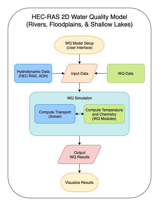
Integrating Environmental Considerations with Water Resource Simulations
An enhanced HEC-ResSim software package with an integrated water quality modeling system capable of one-dimensional and two-dimensional water quality simulations.
Fiscal Year Start: 2015; Fiscal Year Ending: 2020.
POC: Todd Steissberg
SON: 2015-ER-5
Factsheet
Reference SON: 2015 ER-5 Integrating Environmental Considerations with Water Resource Simulations
Lead PI: Todd Steissberg (ERDC)
Project Development Team (PDT): Barry Bunch, Billy Johnson, Zhonglong Zhang (ERDC); Mark Jensen, Joan Klipsch, Leila Ostadrahimi, (HEC); Steve Andrews, John DeGeorge (RMA)
District Collaborators: Erich Emery (LRD); Jeff Gregory (LRN); Scott English (NWD); Jeff Tripe (NWK); Kathryn Tackley, Dan Turner (NWP); Brian Zettle (SAM); J.J. Baum, Zach Jelenek (SPK)
Funded: 2015-2020
Keywords: Watershed runoff, Water quality modeling, Non-point input modeling, Reservoir models, River models, CWMS, HEC-RAS, HEC-HMS, HEC-ResSim
Last updated: 06/12/2025
Integrating Environmental Considerations with Water Resource Simulations1
Research Need
As watersheds are subjected to escalating pressures of land development, environmental degradation, and weather-related impacts, managing reservoir and riverine systems to address environmental considerations is an increasingly complex but important task. Historically, reservoir operations have focused on balancing multiple authorized project purposes (i.e., flood control, water supply, fish and wildlife conservation, power production, navigation, and recreation). More recently, meeting environmental objectives has become an increasingly important consideration in reservoir operations, and demand for watershed scale water quality modeling is significantly increasing. However, the water resources community lacks simulation software with the capability to fully integrate environmental and ecosystem provisions into reservoir release decision-making. Due to data, time, and resource limitations, water quality models have typically been constructed to represent only a single reservoir or tributary system even though in many watersheds there are multiple reservoirs that influence system-wide water quality. To enable the most effective water management alternatives for meeting multiple objectives, new modeling tools are needed.
Project Objectives & Plan
The purpose of this project is to construct a next-generation reservoir water quality modeling system by embedding water quality capabilities within the Hydrologic Engineering Center’s Reservoir System Simulation program (HEC-ResSim). HEC-ResSim is a reservoir operations simulation program that is extensively used by the Corps for water management and water resource planning. An enhanced HEC-ResSim software package with water quality modeling and analysis capabilities will fully integrate water quality into the reservoir release-decision-making process enabling improved environmental and ecosystem management. The software will be capable of performing 1D (one-dimensional) and 2D (two-dimensional) simulations. Reservoirs will be represented by 1D vertically stratified or 2D vertically stratified and longitudinally varying water bodies, while rivers will be represented by 1D longitudinally varying water bodies. The water quality capabilities will be provided by a hydrodynamic and water quality engine, water quality libraries, and an expanded user interface developed in close collaboration between HEC and ERDC Environmental Lab (EL). The user will be able to define water quality operation rules that specify water quality objectives (either at-site or downstream) to be considered by HECResSim in making reservoir release decisions. The HEC-ResSim user interface will support water quality model setup (including all relevant water quality and meteorological parameters), data visualization, analysis, and reporting. The updated HEC-ResSim program and documentation, technical reports, and validation studies will be available from the HEC’s and EL’s web sites.
Payoff
Integrating water quality modeling capabilities into HEC-ResSim directly supports the Corps’ high priority needs for including water quality and related environmental objectives with other project purposes into reservoir operations modeling, assessment, and management. Furthermore, it facilitates cost-effective, science-based environmental impact assessment and management. Through the Corps Water Management System (CWMS) implementation project, over 200 watersheds will have HEC-ResSim models constructed and ready for deployment over the next several years. The ability to add water quality modeling and operating objectives to these watershed models and use them in CWMS for real-time decision support and in planning studies will provide an effective, efficient, and economical approach to addressing environmental requirements.
Products
Software
- Software: HEC-ResSim Version 4.0 with Water Quality Modeling Capability
- Documentation:
- Design Specification: HEC-ResSim Water Quality Modeling Capability Development
- HEC (2020). HEC-ResSim Water Quality Modeling User’s Manual. USACE Hydrologic Engineering Center, Davis, California.
Publications:
- Steissberg, T. and L. Ostadrahimi. (2020). Water Quality Modeling Capability Development for Integrated Environmental Watershed Support. Annual Newsletter of the USACE Committee on Water Quality.
- Steissberg, T., L. Ostadrahimi, J. DeGeorge, S. Andrews, J. Klipsch, Z. Zhang, B. Johnson. (In preparation). Integrating Water Quality Objectives into Reservoir Operations Simulations. Environmental Modelling and Software.
- Zhang, Z. and Johnson, B.E. (2014). Application and evaluation of the HEC-RAS – nutrient simulation module (NSM I), EMRRP Technical Notes Collection. ERDC/TN EMRRP-SR-47. U.S. Army Engineer Research and Development Center, Vicksburg, MS. https://usace.contentdm.oclc.org/digital/collection/p266001coll1/id/3855/
- Zhang, Z. and Johnson, B.E. (2016a). Aquatic nutrient simulation modules (NSMs) developed for hydrologic and hydraulic models, ERDC/EL TR-16-1. U.S. Army Engineer Research and Development Center, Vicksburg, MS. https://hdl.handle.net/11681/10112
- Zhang, Z. and Johnson, B.E. (2016b). Aquatic contaminant and mercury simulation modules developed for hydrologic and hydraulic models, ERDC/EL TR-16-8. U.S. Army Engineer Research and Development Center, Vicksburg, MS. https://hdl.handle.net/11681/20249
- Zhang, Z. and Johnson, B.E. (2016c). Testing and validation studies of the NSMII - benthic sediment diagenesis module, ERDC/EL TR-16-11. U.S. Army Engineer Research and Development Center, Vicksburg, MS. https://apps.dtic.mil/sti/pdfs/AD1012495.pdf
- Zhang, Z. and Johnson, B.E. (2017). Hydrologic engineer center-river analysis system (HEC-RAS) water temperature models developed for the Missouri River recovery management plan and environmental impact statement, ERDC/EL TR-17-18. U.S. Army Engineer Research and Development Center, Vicksburg, MS. https://hdl.handle.net/11681/23707
Project Activities
- Development of HEC-ResSim unit test program with 1D WQ capabilities (temperature, conservative constituents, and eutrophication)
- EL water quality libraries developed and ready to link with HEC-ResSim
- HEC-ResSim v4.0 with Water Quality Modeling Capability
- HEC-ResSim v4.0 Water Quality Modeling User’s Manual
- HEC water quality modeling tools web site: https://www.hec.usace.army.mil/software/waterquality/hec-ressim.aspx
1Project Alias – Work Unit Documentation Title: Integrating Environmental Considerations with Water Resource Simulations
Ambient Noise Level Measurement in the Aquatic Environment
Ambient and anthropogenic aquatic sound database, equipment, guidance and software enabling field ambient sound capture capability.
Fiscal Year Start: 2015; Fiscal Year Ending: 2019.
POC: Alan Katzenmeyer
SON: 2014-ER-6
Factsheet
Reference SON: 2014-ER-6: Ambient Noise Measurements on Aquatic Environments
Lead PI: Alan W. Katzenmeyer (ERDC)
Project Development Team (PDT): Matt Balazik, Charles Dickerson, Jan Hoover, Kevin Reine, James Tallent, Christa Woodley (ERDC)
District Collaborators: Andrew Hannes (LRB); Matthew Miller (SAJ), Natalie Martinez-Takeshita, Richard Ruby, Lawrence Smith (SPL)
Funded: 2015-2019
Keywords: Ambient noise levels, Underwater acoustics, Sound exposure levels, Sound files, Sound database
Last updated: 06/11/2025
Ambient Noise Level Measurement in the Aquatic Environment1
Research Need
Broad ranges of environmental circumstances such as water quality, surface conditions, underwater objects, and diversity and abundance of sound-sources, both natural and anthropogenic, influence the level and variability of ambient noise in the aquatic environment. Models demonstrating noise permeation through the aquatic environment are available but they lack the resolution needed for impact assessment (Schreiner 1990).
There is a need for a database of consistent, high-quality sound measurements reflecting ambient conditions in aquatic environments for comparison to sound levels produced by aquatic activities such as pile driving, dredging, dredged material placement, navigation and other anthropogenic sound sources. The USACE must be able to identify and differentiate ambient and construction related noise levels in order to assess environmental impacts, identify areas and organisms potentially affected, and determine where management or mitigation is necessary.
Project Objectives & Plan
The purpose of this work unit is to collect, process, and analyze ambient sounds and anthropogenic noise in aquatic environments. The principal goals are to sample and characterize acute and chronic noise associated with USACE activities (e.g., dredging, pile driving, bank armoring, and dredged material placement) and to establish ambient sound levels in harbors and shipping canals for comparison.
An available database of underwater sound files will support more quantitative assessment of impacts associated with aquatic construction activities, and inform management or mitigation needs.
Primary products of this research will include:
- An archived library of underwater sounds produced by natural processes (e.g., water movements, animal behaviors) and by anthropogenic activities (e.g., construction, navigation)
- A consistent and systematic methodology for sampling, processing and analyzing underwater sounds to ensure high quality data supporting assessment of impacts associated with dredging and construction activities;
- A self-contained sampling system that can be readily deployed and used by field crews to accurately measure noise levels.
Payoff
The proposed sound database will provide baseline data for comparison of anthropogenic to ambient noise levels. This project has wide application to Corps underwater construction and maintenance activities in both freshwater and marine environments, and will have particular utility in assessment of potential for impact of such activities on sensitive, or threatened and endangered species. The ability to deploy commercially available hydrophones with user-friendly interfaces will also enable USACE Districts to collect their own sound data, in a consistent and technically sound manner, to support defensible noise impact evaluations.
Products
Software
- Software has been developed to assess the impact of underwater anthropogenic sound on marine mammals by application of marine mammal auditory weighting functions for permanent threshold shift onset acoustic thresholds. Contact EMRRP program manager for Python file and user guide.
Presentations
- (2019). Conference Presentation Yangtze/Mississippi River meeting. Demonstration of software capabilities and how masking and behavior levels are determined.
- (2019). Poster Presentation - UAS community of practice.
Project Activities
- Established Inter-agency collaboration – National Marine Fishery Service, current regulatory agency – established collaboration, possible future training course. USACE lead: Katzenmeyer.
1Project Alias – Work Unit Documentation Title: Ambient Noise Level Measurements in Aquatic Environments ERDCpedia Title: Ambient and Anthropogenic Sound in the Aquatic Environment
Classifying Benthic Habitats in the Great Lakes and Coastal Environments
A repeatable, streamlined approach for classifying bottom types in shallow, aquatic and marine habitats, using existing/new geospatial technologies (e.g. lidar, sonar, high resolution imagery).
Fiscal Year Start: 2015; Fiscal Year Ending: 2019.
POC: Molly Reif
SON: 2015-ER-8
Factsheet
Reference SON: 2015-ER-8 Detection of Benthic Habitats to Improve Understanding of Species-level Impacts
Lead PI: Molly Reif (ERDC)
Project Development Team (PDT): Jan Hoover, Jack Kilgore, Christina Saltus, Todd Slack (ERDC)
District Collaborators: Mike Greer (LRB); David Bucaro (LRC); Erich Emery (LRD)
Other Partners: Bottom Mapping Work Group, Brandon Krumwiede (NOAA), Nearshore Framework Advisory Panel (GLWQA, Nearshore Annex), Illinois State Geological Survey
Funded: 2015-2019
Keywords: Benthic habitat classification, Geospatial technologies, Bottom habitat, Aquatic habitat, Marine habitat
Last updated: 09/23/2024
Classifying Benthic Habitats in the Great Lakes and Coastal Environments1
Research Need
Understanding bottom type variation is critical to coastal management and to understanding how to create mutually supporting economic and environmentally sustainable solutions to coastal planning challenges, consistent with the Corps’ Environmental Operating Principles.
Mapping bottom type variation at a high resolution and demonstrating how the resulting maps can be used to understand and forecast spatial variation in species guilds and key population processes of native and invasive species (e.g., spawning locations), will provide critical information to support environmentally sustainable coastal management.
Project Objectives & Plan
A streamlined approach for classifying bottom types, and their association with key biological parameters in shallow (nearshore) aquatic and marine habitats, will be developed using the Great Lakes as a case study. The proposed effort aims to utilize existing and new geospatial technologies to improve the resolution and accuracy of our understanding of bottom type variation, and associated critical habitat parameters that influences native and non-native biota important to ecosystems and their derived services (e.g., fisheries production). The work will be coordinated with other Great Lakes initiatives, including the Great Lakes Aquatic Habitat Framework (GLAHF), the Habitat and Species Annex (Annex 7) of the Great Lakes Water Quality Agreement (GLWQA), and the joint National Oceanic and Atmospheric (NOAA)/National Park Service (NPS) Benthic Mapping for Coastal Restoration projects.
Available geospatial data resources and technologies suitable for benthic habitat characterization in coastal environments will be synthesized, including high resolution imagery, lidar and sonar data. A bottom type classification scheme that characterizes geomorphic structure, substrate, and biological potential of bottom types will be developed to rate different macrohabitats according to their functional value to support sensitive, recreational, and commercial species in coastal aquatic habitats. A pilot study will be conducted in one of the Great Lakes to apply the classification methodology for select native and invasive species, and summarize results in a technical report for wider application in other coastal environments.
Payoff
The product will provide a repeatable approach for mapping bottom types that could be applied in other shallow coastal environments, allowing state and federal agencies to:
- Use a consistent framework to identify characteristics in underwater features using remote sensing data (lidar, sonar, imagery, etc.),
- Support the goals of Annex 7, GLAHF, and the Great Lakes Fisheries Commission, and
- Support planning for economic and environmentally sustainable solutions to coastal management challenges. The product will provide a methodological template that can be transferred to other USACE projects with interest in the quality and aerial extent of substrates and benthic habitats.
Products
Journal Articles (JAs)
- Reif, M.K., Krumwiede, B.S., Brown, S.E., Theuerkauf, E.J., and Harwood, J.H. (2021). Nearshore Benthic Mapping in the Great Lakes: A Multi-Agency Data Integration Approach in Southwest Lake Michigan. Remote Sensing 13, 3026. target="_blank">https://doi.org/10.3390/rs13153026
White Papers
- (2017). Conference summary: NOAA integrated ocean and coastal mapping, Great Lakes Coastal Mapping Summit Summary. Office of Coastal Survey, Chicago, IL.
Conference Presentations/Webinars/Workshops
- (2017). Classifying Coastal Benthic Habitats: A Great Lakes Example, Meeting Author/Presenter. Great Lakes Coastal Mapping Summit, Chicago, Illinois.
- Menza, C. (presenter), Sautter, W., Kendall, K., Costa, B. and Reif, M.K. (2017). Using LIDAR surveys to map habitats and archaeological sites in western Lake Michigan, Presentation. International Association of Great Lakes Research Conference 2017, Detroit, Michigan.
Project Activities
- Field data acquisition - Recent changes in Lake Michigan's water clarity have exposed large expanses of shallow lakebed areas to aerial imagery and other remote sensing technologies. The Joint Airborne LIDAR Bathymetry Technical Center of Expertise collected airborne laser scanning LIDAR (Light Detection and Ranging) along Lake Michigan's coasts in 2008 and in 2012 to identify and characterize nearshore lakebed habitats and submerged archaeological sites in the proposed Wisconsin-Lake Michigan National Marine Sanctuary. Our developed coastal benthic habitat maps will offer new substrate, hazard and archaeological information to coastal managers tasked with maintaining lake-derived ecosystem services and protecting the exceptional historic and recreational value of the area.
- Coordination with the Illinois State Geological Survey and NOAA regarding airborne and boat-based survey activities (June 2018), to include collection of high resolution hyperspectral imagery and bathymetric LiDAR along the nearshore of Western Lake Michigan at Illinois Beach State Park, leveraging other multi-agency studies in the area with the USACE-Chicago District, NOAA, USGS, and others. Goals include developing sustainable nearshore management solutions to prevent critical habitat loss, field and modelling investigation to solve sand management challenges, USACE and USGS Effectiveness of Nearshore Placement of Dredged Material Study and USACE Waukegan Harbor Section 107 Feasibility Study.
- Joined Steering Committee for the Great Lakes Bottom Mapping Workgroup inter-agency/academic partnership regarding nearshore mapping with the goal of harmonizing, collecting, processing, and sharing continuous high resolution maps of bathymetry, sonar reflectance, bottom type, and derived products.
- Multi-agency (NOAA, USACE, NPS, and state agencies) coordination pertaining to future file/data sharing, and modifications to the Coastal and Marine Ecological Classification Standard (CMECS) as needed to adapt to the nearshore freshwater environments in the Great Lakes.
1Project Alias – Work Unit Documentation Title: Classifying Benthic Habitats in the Great Lakes and Other Coastal Environments ERDCpedia Title: EMRRP: Classifying Coastal Benthic Habitats - A Great Lakes Example
Hydrologic Water Quality Modeling in Support of Watershed Based Planning Decision Support
Embedded watershed runoff water-quality modeling capabilities within HEC-HMS (Hydrologic Modeling System), for multiple parameters (temperature, DO, nutriets, salts, sediment, etc.)
Fiscal Year Start: 2017; Fiscal Year Ending: 2021.
POC: Todd Steissberg POC: Billy Johnson
SON: 2016-ER-20 (2015-ER-12)
Factsheet
Reference SON: 2016-ER-20 (2015-ER-12) Hydrologic Water Quality Modeling in Support of Watershed Based Planning Decision Support
Lead PI: Todd Steissberg (ERDC) and Billy Johnson (HEC)
Project Development Team (PDT): Zhonglong Zhang (ERDC); Paul Ely, Bill Scharffenberg, (HEC)
District Collaborators: Erich Emery (LRD); Jeff Gregory (LRN); Jeff Tripe (NWK); Brian Zettle (SAM, CoP Lead)
Funded: 2017-2021
Keywords: Watershed runoff, Water quality modeling, Non-point input modeling, Reservoir models, River models, CWMS, HEC-WAT, HEC-HMS
Last updated: 06/12/2025
Hydrologic Water Quality Modeling in Support of Watershed Based Planning Decision Support1
Research Need
The Hydrologic Engineering Center’s Hydrologic Modeling System (HEC-HMS) is extensively used by the Corps for watershed flow and sediment modeling in support of water management and water resource planning. The Corps needs a generalized next-generation watershed water quality modeling system, capable of simulating non-point source water quality (nutrients, dissolved oxygen, phytoplankton, and bacteria) and characterizing watershed-scale water quality impacts to improve water management for environmental and ecosystem benefits.
Project Objectives & Plan
The purpose of this project is to build new capabilities within the HEC-HMS, in collaboration with ERDC Environmental Laboratory (ERDC-EL). This project will produce a new version of HEC-HMS with water quality modeling and analysis capabilities, simulating water temperature and general constituent transport for overland flow, streams, and reservoirs:
- The new software will integrate water quality into thehydrologic modeling process to improve watermanagement for environmental and ecosystem benefits.
- Overland flow water quality capabilities will provide vitalnon-point source inputs for dedicated river and reservoirwater quality models.
- Stream and reservoir capabilities will allow users tocharacterize watershed-scale water quality impacts.
These capabilities will be provided by a water quality engine and an expanded user interface, developed in close collaboration between HEC and ERDC-EL. The HEC-HMS user interface will support water quality model setup (including all necessary model parameters), water quality and meteorological data input, data visualization, analysis, and reporting requirements.
The updated HEC-HMS program, documentation, technical reports, and validation studies will be available from the HEC’s and ERDC’s web sites.
Payoff
Integrating watershed water quality modeling capabilities into HEC-HMS directly supports the Corps’ high priority needs to assess project impacts and improve management of the watershed to meet environmental objectives, which range from endangered species protection to invasive species control, as well as to improve reservoir operations decision-making to meet downstream environmental requirements. The new HEC-HMS software will provide the Corps with integrated hydrologic and water quality capabilities, providing accurate non-point inputs for streams and reservoirs and extensive data visualization and reporting capabilities for analysis and decision support. The software will be intuitive, powerful, and easy to use, facilitating cost-effective, science-based environmental impact assessment and management. Furthermore, it will form the foundation for more extensive generalized watershed water quality modeling capabilities (e.g., nutrients, dissolved oxygen, bacteria, and phytoplankton) in the next major stage of development. The Corps is rapidly building real-time watershed-scale forecasting models across the nation, incorporating HEC-HMS and other models in the Corps Water Management System (CWMS). Through the CWMS implementation project, more than 200 watersheds will have HEC-HMS models constructed and ready for deployment over the next several years. The ability to add water quality to these watershed models and use them in CWMS for real-time decision support as well as planning studies provides an effective, efficient, and economical approach to addressing environmental requirements.
Products
Conference Presentations/Webinars/Workshops
- Steissberg, T. (2017). Water temperature modeling workshop, Workshop. Hydrologic Engineering Center, Davis, California.
Project Activities
- Literature review pertaining to temperature modeling as conservative, surrogate WQ model parameter; begin developing outline for software design document.
Models and Applications
- HDF5 interface libraries were built that can be used with FORTRAN, .Net (Visual Basic and C#), and Java. These libraries provide a user-friendly interface for exchanging data with HDF5 files. These are general-purpose libraries that can be used by HEC-ResSim, HEC-RAS, HEC-HMS, and other programs to store and retrieve hydrologic and environmental data. Downloadable model versions and documentation: https://www.hec.usace.army.mil/software/hec-hms/downloads.aspx
1Project Alias – Work Unit Documentation Title: Hydrologic Water Quality Modeling in Support of Watershed Based Planning Decision Support
Watershed Planning and Evaluation Tools
Toolkit facilitating: 1) Stakeholder collaboration - serious games and other communication and visualization tools, including - time series satellite data historical and predictive graphics 2) Systems-based understanding and multipurpose prioritization/planning and 3) Vulnerability and uncertainty assessments.
Fiscal Year Start: 2016; Fiscal Year Ending: 2020.
POC: Billy Johnson POC: John Kucharski
SON: 2016-ER-23
Factsheet
Reference SON: 2016-ER-23: Watershed Planning and Evaluation Tools
Lead PI: Billy Johnson (ERDC), John Kucharski (ERDC)
Project Development Team (PDT): Matthew Bates (ERDC); Guillermo Mendoza, Jennifer Olszewski (IWR); Gregory Karlovits, William Lehman, Todd Steissberg (IWR-HEC); Bart Wickel (SEI), Patrick Ray (UC)
District Collaborators: Brian Skahill (CHL); Andrea Carson (IWR); Aaron Snyder (MVP); Jason Smith (MVR); Randall Goss (SAJ); Cindy Tejeda (SPD); Hunter Merritt, Rhiannon Kucharski (SPK); Eileen Takata (SPL)
Other Partners: CA DWR, Cornell University, University of Cincinnati, Deltares, Stockholm Environmental Institute and others
Funded: 2016-2020
Keywords: Watershed planning, Changing conditions, Precipitation, Flow modeling
Last updated: 06/13/2025
Watershed Planning and Evaluation Tools1
Research Need
Watershed planning goes beyond project planning (for specific USACE projects) towards more comprehensive and strategic evaluations and analyses that include diverse political, geographic, physical, institutional, technical, and stakeholder considerations. Watershed planning addresses identified water resources needs from any source, regardless of agency responsibilities, and provides a joint vision of a desired end state that may include recommendations for potential involvement by USACE, other federal agencies, or non-federal interests.
In conducting watershed planning, USACE uses its planning capability in a broader sense, to meet the changing water resources needs of the nation. Ultimately, watershed assessments should inform multiple audiences and decision makers at all levels of government, and provide a strategic roadmap to inform future investment decisions by multiple agencies. A system-wide watershed planning tool that integrates water quantity, water quality, ecological data, and uncertainty with stakeholder values and regulatory requirements is needed to effectively evaluate and integrate watershed management alternatives to achieve multiple objectives.
Project Objectives & Plan
The US Army Engineer Research and Development Center (ERDC) Environmental Laboratory (ERDC-EL), ERDC Coastal and Hydraulics Laboratory (ERDC-CHL), US Army Corps of Engineers Institute for Water Resources Hydrologic Engineering Center (IWR-HEC) and others will develop software and tools for Watershed Assessment Teams, informing modeling of watersheds, rivers, and reservoirs and enabling more effective alternatives comparison and stakeholder communication. These tools will include:
- Serious Games to support Stakeholder Collaboration
- Satellite Data Tools to support Systems Analysis
- Weather Generator to support Systems Analysis
- Vulnerability Assessment Tools for Future Risks
Pilot studies will be conducted in: South Pacific Division, Chesapeake Bay & CA Central Valley and Sacramento Watershed. A tabletop version of the Serious Games concept has been developed and demonstrated within USACE; the game concept is being refined as a Stakeholder communication tool enabling stakeholders with widely varying technical backgrounds to understand the tradeoffs of various project alternatives; a later interactive module is planned as a follow-on effort. The Satellite Data Time Series Animation Proof of Concept has been developed and will be applied to a concept case study; this tool will enable not only systems analysis but also effective stakeholder communication, by visually illustrating the spatial impacts of various watershed project alternatives.
An atmospheric module and a weather generator are under development that will exploit the connection between climate and weather, capturing the causal mechanism – the weather regime – and addressing certain deficiencies in current modeling capabilities, including:
- Disparity of resolution between catchment being modeled and general circulation models
- Lack of understanding of how drought influences flood, and vice versa
- Inability to model low flow events or reproduce long term drought events
Payoff
To date, limited effort has been put into developing multi-criteria decision frameworks to evaluate potential actions across a watershed. Thus, there is a need to develop a complement of system-wide watershed planning tools encompassed by this effort. This R&D will provide capabilities currently not available to the USACE planning community, increasing their ability to successfully assess projects on a watershed scale for multiple objectives, scenarios, and criteria, resulting in a more efficient planning process and greater optimization of management and restoration alternatives over a watershed scale.
Products
Journal Articles (JAs)
- Kucharski, J., Steinschneider, S., Herman, J., Olszewski, J., Arnold, W., Rahat, S., Maendly, R., Ray, P. (2024). Bridging the gap between top-down and bottom-up climate vulnerability assessments: process informed exploratory scenarios identify system-based water resource vulnerabilities. Water Resources Research, 60, https://doi.org/10.1029/2023WR036649
Technical Reports (TRs)
- Cole, R.A. (2016). Case study application of the biodiversity security index to ranking feasibility studies for ecosystem restoration projects of the U. S. Army Corps of Engineers (ERDC/EL CR-16-1), Technical Report. US Army Engineer Research and Development Center, Vicksburg, Mississippi. https://hdl.handle.net/11681/20262
Technical Notes (TNs)
- Crawford, B.A., Katz, R.A. and McKay, S.K. (2017). Engaging stakeholders in natural resource decision-making (ERDC/TN EMRRP-SR-83), Technical Note. U.S. Army Engineer Research and Development Center, Vicksburg, Mississippi. https://hdl.handle.net/11681/23956
Other Reports
- Mendoza, G., Jeuken, A., Matthews, J.H., Stakhiv, E., Kucharski, J. and Gilroy, K. (2018). Climate risk informed decision analysis (CRIDA): Collaborative water resources planning for uncertain future. United Nations Educational, Scientific and Cultural Organization (UNESCO) and International Center for Integrated Water Resources Management. UNESCO and ICIWaRM Press. https://unesdoc.unesco.org/ark:/48223/pf0000265895
White Papers
- Bureau of Reclamation and U.S. Army Engineer Research and Development Center, (2016). National large wood manual: assessment, planning, design, and maintenance of large wood in fluvial ecosystems: restoring process, function, and structure, White Paper. https://cw-environment.erdc.dren.mil/restore/pdfs/2016%20National%20Large%20Wood%20Manual.pdf
- Kucharski et al. Vulnerability based risk mitigation and robust plan selection at the Iolanda Water Treatment Plant, Technical Report. U.S. Army Engineer Research and Development Center, Vicksburg, Mississippi.
Conference Presentations/Webinars/Workshops
- (2017). Watershed planning and evaluation tools scoping workshop, Workshop. Davis, California.
- (2017). Collaborative risk informed decision analysis training workshop, Workshop. USAID
- (2018). Workshop on natural and nature-based flood risk management, Workshop. Asian Institute of Technology, Bangkok, Thailand.
Project Activities
- Multi-agency coordination to identify needs of planners dealing with complicated watershed alternatives analysis and optimization, and stakeholder communication. Development of a cross section of tools pertaining to climate and water supply/flooding projections, use of time series satellite images for alternatives impacts visualization, and planning-oriented serious games stakeholder communication tools.
1Project Alias – Work Unit Documentation Title: Watershed Planning and Evaluation Tools
Growth Enhancing Bio-Polymer Use in Ecosystem Restoration
Development of a soil amendment to increase plant soil-holding capability in saline environments for improved wetland restoration and other applications
Fiscal Year Start: 2016; Fiscal Year Ending: 2017.
POC: Steve Larson
SON: Strategic R&D
Factsheet
Reference SON: Strategic R&D
Lead PI: Steve Larson (ERDC)
Project Development Team (PDT): Steve Larson, Catherine Nestler (ERDC)
District Collaborator: Susan Rees (SAM)
Funded: 2016, 2017
Keywords: coastal restoration, levee restoration, biopolymer soil amendment, erosion control
Last updated: 06/13/2025
Growth Enhancing Bio-Polymer Use in Ecosystem Restoration1
Research Need
Sea level change due to future weather-related conditions is predicted to impact nearly all coastal wetlands, with continued losses causing negative impacts to tourism, the fishing industry, wildlife habitats, protective barrier islands, and residential areas. For example, data from past hurricanes indicates that the loss of every one-mile strip of wetlands along the coast corresponds to an estimated $5.8M average annual increase in property damage (Restore or Retreat.org).
Grasses and grass-like plants of tidal salt marshes on the coasts of the United States, as well as mangrove and tupelo gum swamps, are important to sustainability of wetland and marsh areas and critical to restoration efforts in these low lying areas. However, it is often difficult to re-establish this native vegetation because soil loss can be more rapid than root development. This effect is particularly acute in tidal wetlands and salt marshes, where establishment of salt-tolerant species is slow compared to grasses. A method of soil amendment, particularly for use in increasingly saline environments, is needed to improve success of wetland restoration, reduce sediment losses, increase slope stability, improve soil germination rates, increase drought resistance and improve revegetation rates on disturbed lands.
Exopolysaccharides (EPS) are produced by numerous rhizobium species, symbiotic bacteria that nodulate plant roots using plant sugars to produce a biopolymer (BP) film. The functions of this film include surface adhesion, water retention and nutrient accumulation. In field demonstrations, a single application of concentrated EPS to soil at the beginning of the growing season has resulted in plants with larger root masses. In regions with saline soils, EPS can also increase the salt tolerance of some plants which improves plant growth and reproduction. These biopolymers have potential to fill a unique niche in ecological restoration by facilitating more rapid and successful vegetation establishment.
Project Objectives & Plan
Rhizobia will be isolated from saline tolerant legumes, cultured, and grown in batch – and subsequently pilot scale – reactors, and effects on plant growth in saline environment tested in lab and field scale.
The production of soil amendments using monocultures in bioreactors, developed using Rhizobium tropici, has been patented to the US Army and licensed to industrial partners (Newman et al. 2010). The same industrial process will be used to produce a novel rhysobially based material, to geoengineer soil systems such that plants are better protected from salt stress. In the laboratory, the rhizobia will be isolated from the soil around this saline tolerant legume, cultured, and grown in batch reactors, where the microbes are stimulated to produce large quantities of this biopolymer.
Laboratory, mesoscale (lysimeter), and field-scale soil tests will be conducted employing grasses used for wetlands restoration, to assess benefit to plant growth in a saline environment. Metrics, compared to plants grown in non-amended (control) soil, will include:
- Root mass and shoot length
- Root architecture
- Total suspended solids (TSS) in leachate and runoff water
- Nutrient concentration (TKN, nitrate, phosphate) in leachate and runoff water
- Changes in total organic carbon (TOC) in soil over time
Payoff
This research constitutes an important leveraging opportunity to adapt biopolymer technology developed for military applications to ecological restoration, and levee and coastal management needs. By combining modern bioengineering with an understanding of the natural symbiotic relationship between plants and soil microbial communities, soils can be rapidly adapted for enhanced re-vegetation during wetland and restoration efforts. The biopolymer can be used as a soil amendment to induce rapid root and shoot development. This root development can facilitate soil stabilization to encourage both stability of current wetlands and development of new or restored wetlands, as well as dunes, levees or other areas. Imparting salt tolerance in brackish wetlands is key to rapid establishment of vegetation in brackish and saline environments.
Products
Technical Reports (TRs)
- Larson, S.L., Martin, W.A., Wade, R., Hudson, R. and Nestler, C. (2016). Technology transfer of biopolymer soil amendment for rapid re-vegetation and erosion control at Fort A. P. Hill, Virginia (ERDC/EL TN-16-2), Technical Report. U.S. Army Engineer Research and Development Center, Vicksburg, Mississippi. https://usace.contentdm.oclc.org/digital/collection/p266001coll1/id/3776
- Larson, S. L., Nijak, G., Corcoran, M., Lord, E. and Nestler, C. (2016). Evaluation of rhizobium tropic-derived biopolymer for erosion control of protective berms. Field Study: Iowa Army Ammunition Plant (ERDC TR-16-5), Technical Report. U.S. Army Engineer Research and Development Center, Vicksburg, Mississippi. https://usace.contentdm.oclc.org/digital/collection/p266001coll1/id/3898
- Larson, S. L., Busby, R., Martin, W. A., Medina, V. F., Seman, P., Hiemstra, C. A., Mishra, U. and Larson, T. (2017). Sustainable carbon dioxide sequestration as soil carbon to achieve carbon neutral status for DoD lands (ERDC TR-17-13), Technical Report. U.S. Army Engineer Research and Development Center, Vicksburg, Mississippi. https://usace.contentdm.oclc.org/digital/collection/p266001coll1/id/5914
- Larson, S.L., Corcoran, M.K., Gent, D.B., Butler, A.D. and Nestler, C.C. (2019). Improved levee resilience through soil application of a natural organic polymer – field study Kaufman Levee No. 1. (ERDC TR-19-6), Technical Report. U.S. Army Engineer Research and Development Center, Vicksburg, Mississippi. https://hdl.handle.net/11681/33068
White Papers
- Larson, S. L. (2017). Levee resilience or “getting the grass to grow”. Flood Risk Management (FRM) Newsletter, 10(3).
Conference Presentations/Webinars/Workshops
- (2016). Biopolymer levee field test and revegetation under saline conditions, Webinar.
- (2016). Soil as a sink for atmospheric carbon sequestration, Webinar. Center for the Advancement of Sustainable Innovations (CASI), Seven Webinar Series.
- (2017). Evaluation of biopolymer for erosion control of protective berms”, Webinar. SERDP-ESTCP Webinar Series.
1Project Alias – Work Unit Documentation Title: Improved Plant Survival and Wetland Stability ERDCwiki Title: Revegetation of Coastal Wetlands using Biopolymer and Salt Tolerant Plants
Techniques and Methods for Salt Marsh Restoration to Account for Sea Level Change
Comprehensive guidance for restoration and maintenance of salt marshes affected by sea level change.
Fiscal Year Start: 2015; Fiscal Year Ending: 2018.
POC: Elizabeth Murray POC: Damarys Acevedo-Mackey
SON: 2015-ER-20
Factsheet
Reference SON: 2015 ER-20: Techniques and Methods for Salt Marsh Restoration to Account for Sea Level Change
Lead PI: Elizabeth Murray & Damarys Acevedo-Mackey (ERDC)
Project Development Team (PDT): Jacob Berkowitz, Tommy Berry, John Childs, Kevin Philley, Candice Piercy, Todd Swannack, Christine VanZomeren, Tim Welp, (ERDC)
District Collaborators: Lawrence Oliver (NAE); Monica Chasten (NAP); Rebecca Rule (NWS); Eric Summa (SAJ); Craig Conner (SPN)
Other Partners: Jacki Jahn (GreenVest, Avalon); Metthea Yepsen (NJ DEP, Avalon); Jennifer White (USFWS, Narrow River); Kirk Gilligan, Richard Nye (USFWS, Seal Beach)
Funded: 2015-2018
Keywords: Sea level change, Coastal marshes, Thin-layer placement, Site characterization
Last updated: 06/13/2025
Techniques and Methods for Salt Marsh Restoration to Account for Sea Level Change1
Research Need
Loss of coastal marsh areas critical for their ecological and storm protection functions has become a national concern, with decline attributed to sediment starvation and exacerbated by the impacts of sea level change and subsidence. Little guidance exists pertaining to sustainable restoration and management of impacted marsh areas. Studies are needed to address information gaps such that suitable approaches can be developed and disseminated to agencies responsible for stewardship of these areas.
Project Objectives & Plan
Technical guidelines for restoring and sustaining ecological function of coastal marshes impacted by sea level change will be developed through the efforts of a multi-disciplinary team focused on the environmental and ecological aspects of planning, designing, implementing and monitoring such projects. Objectives of the effort include:
- Consolidate a knowledge base incorporating relevant literature, case studies, lessons learned and best management practices for restoring and sustaining ecological function in salt water marshes impacted by sea level change
- Quantify environmental “impacts” (positive and negative) of material placement (dredged material or other fill material) to nourish inter-tidal wetlands for the purpose of offsetting sea level change
- Quantify environmental “impacts” (positive and negative) of other management practices intended to mitigate effects of sea level change on inter-tidal wetlands
- Identify and address regulatory authority, stakeholder concerns, restrictions, and limitations related to all aspects and stages of a restoration project
- Develop recommended requirements for characterizing a restoration site, control site, and source materials for placement in ecologically sensitive areas
- Develop appropriate performance criteria to assess environmental and ecological response to management activities intended to offset adverse impacts of sea level change
- Integrate historic and ongoing efforts with other projects focused on engineering aspects of material placement and site stabilization, such as placement methods, hydrodynamics and sediment transport
- Collaborate using multiple technology transfer platforms to achieve widest dissemination of information produced, to build multi-agency partnerships to leverage future efforts, and to establish a robust resource that will be continually updated as the body of available information grows
Products will include a technical summary of relevant literature and case studies, based upon available data and reports obtainable from participating agencies. Projects summaries will include technical, environmental and impacts considerations, with site selection and field monitoring to address data gaps. A factsheet will be developed and updated annually for each selected project. All documents will be housed on publicly available ERDC-hosted websites specific to beneficial use of dredged material, thin layer placement and engineering with nature, as appropriate.
A technical framework will be developed to delineate environmental considerations relevant to restoration of salt marshes for the purpose of offsetting effects of sea level change, based on field monitoring for selected projects where appropriate management activities are planned. The work will be closely coordinated with related efforts examining the engineering aspects of material placement, stability, and material fate for different placement methods and hydrodynamic conditions. Work products will include project factsheets, a technical summary document, and a literature and case study review. Additional topic-specific papers and journal articles will include monitoring recommendations to evaluate effectiveness of management measures.
At least three web meetings are planned to engage interested representatives from USACE, regulatory agencies and resource agencies, to identify, develop and discuss relevant technical topics of mutual concern, common issues and management approaches, and a foundation for further collaborative work in these areas in the future.
Payoff
While there is significant interest in active management of coastal marsh areas to mitigate for sea level change, technical uncertainties present a significant obstacle to implementation. Engagement with key stakeholders in the development of technical guidance will facilitate identification and resolution of key issues in order to move the state of the science forward. By making use of web-based tech transfer tools, more continuous and effective information sharing will be possible over a broader user base. We envision that this will motivate additional studies by other agencies and create new collaborative opportunities for data sharing, to strengthen the technical basis for development of mitigation measures and guidance. By developing a more structured approach to evaluating management alternatives to offset sea level change, resources can be invested in execution rather than consensus building, with greater assurance of successful ecological and financial outcomes.
Products
Journal Articles (JAs)
- Berkowitz, J.F., VanZomeren, C.M., Piercy, C.D. and White, J.R. (2018). Evaluation of coastal wetland soil properties in a degrading marsh. Estuarine, Coastal and Shelf Science, 212(15), pp. 311-317. https://doi.org/10.1016/j.ecss.2018.07.021
- Berkowitz, J.F., VanZomeren, C.M. and Piercy, C. (2017). Marsh restoration using thin layer sediment addition: initial soil evaluation. Wetland Science and Practice, 34(1). pp. 13-17. http://dx.doi.org/10.1672/UCRT083-265
- VanZomeren, C.M., Berkowitz, J.F., Piercy, C.D. and White, J.R. (2018). Restoring a degraded marsh using thin layer sediment placement: short term effects on soil physical and biogeochemical properties. Ecological engineering, 120, pp.61-67. https://doi.org/10.1016/j.ecoleng.2018.05.012
Technical Reports (TRs)
- Thorne, K.M. and Freeman, C.M. (2017). Thin-layer sediment application pilot project at Seal Beach National Wildlife Refuge: elevation change analysis, Unpublished Data Summary Report. U.S. Geological Survey, Western Ecological Research Center, Vallejo, California.
- VanZomeren, C.M., Acevedo-Mackey, D., Murray, E.O. and Estes, T.J. (2019). Maintaining salt marshes in the face of sea level rise - review of literature and techniques (ERDC/EL SR-19-4), Technical Report. U.S. Army Engineer Research and Development Center, Vicksburg, Mississippi. https://apps.dtic.mil/sti/tr/pdf/AD1075958.pdf
Technical Notes (TNs)
- VanZomeren, C.M., Murray, E.O. and Acevedo-Mackey, D. (2017). Marsh assessment and restoration implementation at three salt marshes in response to relative sea level rise: a report from webinars and supplemental findings (ERDC/TN EMRRP-EBA-23), Technical Note. U.S. Army Engineer Research and Development Center, Vicksburg, Mississippi. https://apps.dtic.mil/sti/pdfs/AD1069314.pdf
White Papers and Factsheets
- Acevedo-Mackey, D., Murray, E.O. and VanZomeren, C. (2017). Salt marsh function and sea level rise field activities factsheet, Factsheet. Seal Beach National Wildlife Refuge, Seal Beach, California.
- Acevedo-Mackey, D., Murray, E.O. and VanZomeren, C. (2017). Salt marsh function and sea level rise field activities factsheet, Factsheet. Narrow River Estuary.
- Acevedo-Mackey, D., Murray, E.O. and VanZomeren, C. (2017). Salt marsh function and sea level rise field activities factsheet, Factsheet. Avalon.
Conference Presentations/Webinars/Workshops
- Acevedo-Mackey, D. (2017), Long-term coastal zone dynamics: interactions and feedbacks between natural and human processes along the U.S. Gulf Coast, Presenter/Representative. LA National Academies of Sciences, Engineering and Medicine (NASEM), New Orleans, Louisiana.
- Acevedo-Mackey, D. (2016). Poster. Restore America’s Estuaries and The Coastal Society 2016 Summit, New Orleans, Louisiana.
- Murray, E.O. (2017). Addressing sea level rise research and projects in southern California and the east coast, Workshop. The Southwest Climate Science Center Briefing and Research Priorities Workshop, Los Angeles, California.
- Murray, E.O. (2017). Sediment augmentation in a California salt marsh, Presentation. Headwaters to Oceans (H2O), University of California, Irvine, California.
- Murray, E.O. (2016). First National Nearshore Collaboration Workshop, Presenter/Moderator. American Shore and Beach Preservation Association, Kitty Hawk, North Carolina.
- Oliver, L., Gilligan, K., White, J., Yepsen, M. (2016). Ecological Function of Coastal Salt Marshes in Response to Sea Level Rise - Part 1. EMRRP webinar.
- VanZomeren, C.M. (2017). Short term response of coastal marsh functions to restoration using thin layer placement of dredged material, Presentation. Society of Wetland Scientists, San Juan, Puerto Rico.
- White, J., Jahn, J., Gilligan, K. (2016). Ecological Function of Coastal Salt Marshes in Response to Sea Level Rise - Part 2. EMRRP webinar.
- White, J., Jahn, J., Gilligan, K. (2016). Ecological Function of Coastal Salt Marshes in Response to Sea Level Rise - Part 3. EMRRP webinar.
- (2018). Thin layer placement of dredged material to maintain elevation in salt marshes facing sea level rise, Conference Session – 3 project-associated papers. National Conference on Ecosystem Restoration (NCER), New Orleans, Louisiana.
Project Activities
- Ongoing multi-agency collaboration at Seal Beach, CA and Avalon, NJ marsh restoration sites through field demonstrations of thin layer placement and other measures to counteract the effects of sea level change. Access to extensive datasets will help USACE address uncertainties in management of salt marshes and inform development of a best practices framework to identify threatened areas, determine causes of deterioration, and determine appropriate measures to sustain viability and preserve ecological, aesthetic and storm protection functions.
- Ongoing multi-agency collaboration at Narrow River, RI. FWS personnel requested ERDCs assistance in determining causes of observed changes in soil morphology and vegetation mortality a year following placement of dredged material in two pilot plots. Sediment was collected and a simple laboratory pH incubation study followed. Findings will improve sediment testing and inform expected changes in sediment chemistry and test parameters for marsh restoration projects incorporating thin layer placement.
- Mentored an ERDC University participant during the spring of 2017 addressing sulfide issues in saltmarsh areas due to TLP at the Narrow River site.
- Advisory roles: Acevedo-Mackey advised on a National Estuary Research Reserve System (NERRS) effort to create a data portal focused on TLP site selection. Murray is serving as technical advisor on a NERRS project conducting TLP experiments in box frames across multiple marshes throughout the country.
1Project Alias – Work Unit Documentation Title: Restoring and Sustaining Ecological Function in Coastal Marshes Affected by Sea Level Change – Current Practice, Management Alternatives and Guidance Development
Assessing Barrier Island Ecosystem Vulnerability to Future Conditions and Sea Level Change
Spatially-explicit screening-level tool to assess ecosystem vulnerability with minimal pre-existing data and/or existing storm data to a suite of storm events of specific magnitude.
Fiscal Year Start: 2013; Fiscal Year Ending: 2017.
POC: Candice Piercy
SON: Strategic Research Initiative, FY13 RFP
Factsheet
Reference SON: Strategic Research Initiative, FY13 RFP: Assessing Barrier Island Vulnerability to Future Conditions and Sea Level Change
Lead PI: Candice Piercy (ERDC)
Project Development Team (PDT): Kate Brodie, Duncan Bryant, Brook Herman, Bradley Johnson, Jesse McNinch, Todd Swannack, (ERDC); Adam Duarte (HX-5)
District Collaborators: Tomma Barnes (formerly LRP); Angie Sowers (NAB); Larry Oliver (NAE)
Other Partners: Bill Hulslander (Assateague Island National Seashore)
Funded: 2013-2017
Keywords: Barrier island vulnerability, Dune degradation, Community shifts, Future Conditions, Coastal modeling framework, SMART Planning, Scenario comparisons
Last updated: 06/18/2025
Assessing Barrier Island Ecosystem Vulnerability to Future Conditions and Sea Level Change1
Research Need
Planning, managing, and engineering natural or nature-based systems such as barrier islands requires integrated solutions that consider the complex interactions between physical and ecological processes controlling island development, evolution, and stability. Modeling is often required to study and evaluate such systems. Simulating the dynamic feedbacks between collision, overwash, inundation, and vegetation necessitates the integration of multiple data sources, tools, and physically based models.
Project Objectives & Plan
The purpose of this project is to develop an assessment framework that can model the response of barrier island systems to disturbances, including storms and changing environmental conditions such as sea level change and weather-related hazards. The modeling framework developed is tiered to best suit USACE District and Division needs. In its simplest form (Tier 1), it can be used as a screening tool for SMART Planning. Higher levels of complexity (Tier 2) can be implemented for quantitative scenario comparison. To support the modeling framework, specific products include technical notes describing the overall framework and each Tier, a Tier 1 executable including a user’s guide, a technical report describing the application of the framework to a field site, and webinar and web content describing the modeling framework were developed.
Payoff
The multi-tiered approach is an advancement over current approaches as it integrates existing tools and data in such a way that considers the complex ecogeomorphic feedbacks controlling barrier island morphological and ecological function. Results provide a quantifiable way to target and prioritize areas that will require and benefit from restoration interventions, in addition to providing multiple benefits beyond those conveyed by the initial ecosystem restoration efforts. This approach will lead to better allocation of project resources by enabling focus on areas with the greatest uncertainty and risk, and is compatible with USACE SMART Planning.
Products
Journal Articles (JAs)
- Charbonneau, B., Duarte, A., Swannack, T., Johnson, B., and Piercy , C. 2022. DOONIES: A process-based ecogeomorphological functional community model for coastal dune vegetation and landscape dynamics. Geomorphology, 398, https://doi.org/10.1016/j.geomorph.2021.108037.
Conference Presentations/Webinars/Workshops
- (2018). ASBPA beaches and dunes workshop presentation, Workshop. USGS collaboration workshop, NOAA-USACE Natural and Nature Based Features (NNBF) workshop (Assessing Barrier Island Ecosystem Vulnerability to Climate Change and Sea Level Rise Work Unit)
- (2018). CSHORE-veg: Development of an Integrated Morphology and Vegetation Growth and Distribution Model for Coastal Dunes, Presentation. Eighth International Symposium on Environmental Hydraulics, Notre Dame, Fort Wayne, Indiana.
- Johnson et al. (2016). CSHORE use in modeling long term dynamics of barrier islands - Deltares/Rijkswaterstaadt - USACE modeling meeting, Vicksburg, Mississippi.
Models and Applications
- CSHORE-veg: Objectives to enable prediction of dune restoration impact on storm response and ecosystem recovery, and subsequent changes over multi-decadal timescales – informing and prioritizing remedial measures to maintain and increase coastal resilience. Now integrated with DOONIE (above).
- Dune resilience tool (final name not determined) – Excel-ArcGIS tool to rank sites based on potential for long term resilience
1Project Alias – Work Unit Documentation Title: Assessing Barrier Island Ecosystem Vulnerability to Future Conditions and Sea Level Change
Ecological Effects of Sediment Erosion and Transport Associated With Dam Removal
Framework for assessment of sediment impacts associated with dam removal projects.
Fiscal Year Start: 2017; Fiscal Year Ending: 2020.
POC: Susan Bailey
SON: 2008 ER-37
Factsheet
Reference SON: 2008 ER-37: Ecological Effects of Sediment Erosion and Transport Associated With Dam Removal
Lead PI: Susan Bailey (ERDC)
Project Development Team (PDT): Waleska Echevarria-Doyle, Craig Fischenich, Earl Hayter, Tahira Lackey, Kyle McKay (ERDC)
District Collaborators: John Bianco (IWR); Larry Oliver (NAE); Mike Scuderi (CoP Lead, NWS); Zac Corum (NWS); David Olson (Regulatory)
Funded: 2017-2020
Keywords: Dam removal, Sediment transport, Sediment characterization
Last updated: 06/24/2025
Ecological Effects of Sediment Erosion and Transport Associated With Dam Removal1
Research Need
A relatively large inventory of aging dams exists on rivers and streams throughout the United States; increasing numbers of these structures are slated for removal due to safety concerns and associated environmental issues. Environmental benefits derived from dam removal include improved environmental connectivity and restored sediment transport within the natural stream system. However, there is also potential for adverse environmental impacts associated with release of sediments accumulated behind these dams. Guidance is needed to inform planning efforts, including pre-demolition characterization of behind-dam sediments and assessment of anticipated impacts due to contaminant release and re-deposition of sediments downstream.
Project Objectives & Plan
The purpose of this effort is to develop a framework for screening potential sediment-related issues associated with dam removal, and to tailor SMART Planning compatible modeling tools for assessing anticipated downstream sediment impacts and benefits. The primary deliverables will include publications and webinars outlining the steps involved in assessing sediment issues associated with dam decommissioning. A state of the science review and a decision matrix/flowchart for screening and assessing risks and impacts associated with sediment transport are planned. Additional deliverables will include numerical models development enabling rapid screening of potential dam removal sites for sediment issues and assessing geomorphic response, sediment fate and ecological consequences of dam removal at a single site.
Payoff
The products of this effort will provide a more complete understanding of effects associated with dam removal and support prediction and management of adverse impacts. A streamlined assessment framework and guidance for quantifying and modeling sediment transport and impacts – including burial and contaminant release – will enable USACE planners to appropriately assess dam removal alternatives and manage anticipated impacts. These products will enable planners to undertake feasibility-level analyses within the time constraints imposed by SMART Planning while also informing preliminary engineering and design.
Products
Technical Reports (TRs)
- Echevarria-Doyle, W., McKay, S.K., and Bailey, S.E. (2023). Sensitivity of sediment transport analyses in dam removal applications (ERDC TR-23-15), Technical Report. U.S. Army Engineer Research and Development Center, Vicksburg, Mississippi. https://apps.dtic.mil/sti/html/trecms/AD1210482/index.html
Technical Notes (TNs)
- Bailey, S., McKay, K. and Hayter, E. (In prep). A research roadmap for the impacts of sedimentation associated with dam removal, Technical Note. U.S. Army Engineer Research and Development Center, Vicksburg, Mississippi.
Conference Presentations/Webinars/Workshop
- (2017) Impacts of sedimentation associated with dam removal – a multi-agency workshop to assess the state of the science with respect to multiple aspects of dam removal and technical guidance development, Workshop. New York, New York.
- McKay S.K., Lackey, T., Bailey S.E., Echevarria-Doyle, W. and Hayter E. (2019). Tools for evaluating sediment impacts from Dam Removal – qualitative guidance. Joint Federal Interagency Conference on Sedimentation and Hydrologic Modeling, Reno, NV.
- McKay, S.K., and Bailey, S. (2018). Sediment impacts associated with dam removal: State of the Science. EMRRP Webinar. https://emrrp.el.erdc.dren.mil/webinars.html.
Short Courses Posted on EMRRP: https://emrrp.el.erdc.dren.mil/webinars.html
- McKay, S.K., and Bailey, S. (2020). Dam removal short course – Part 1A: An overview, Webinar. U.S. Army Engineer Research and Development Center, Vicksburg, Mississippi.
- Duda, J. and Bountry, J. (2020). Dam removal short course – Part 1B: Synthesis of the science and case studies, Webinar. U.S. Army Engineer Research and Development Center, Vicksburg, Mississippi.
- McKay, S.K. (2020). Dam removal short course – Part 2A: Sediment management, Webinar. U.S. Army Engineer Research and Development Center, Vicksburg, Mississippi.
- Bailey, S., (2020). Dam removal short course - Part 2B: Sediment management, Webinar. U.S. Army Engineer Research and Development Center, Vicksburg, Mississippi.
- Lackey, T. (2020). Dam removal short course – Part 3A: Assessment methods, Webinar. U.S. Army Engineer Research and Development Center, Vicksburg, Mississippi.
- McKay, S.K. (2020). Dam removal short course – Part 3B: Assessment methods, Webinar. U.S. Army Engineer Research and Development Center, Vicksburg, Mississippi.
- Echevarria-Doyle, W. (2020). Dam removal short course – Part 4A: Modeling Techniques – 1-dimensional numerical model applications: Simkins Dam case study, Webinar. U.S. Army Engineer Research and Development Center, Vicksburg, Mississippi.
- Hayter, E. (2020). Dam removal short course – Part 4B: Modeling Techniques – Milltown Dam case study, Webinar. U.S. Army Engineer Research and Development Center, Vicksburg, Mississippi.
1Project Alias – Work Unit Documentation Title: Ecological effects of sediment erosion and transport associated with dam removal
Improving Ecological Modeling Practices for the USACE Planning Community of Practice
Standardized platform for index-based model execution, guidelines and training for ecological model development and application, and searchable model, modeling capability inventory.
Fiscal Year Start: 2016; Fiscal Year Ending: 2020.
POC: Todd Swannack POC: S. Kyle McKay
SON: 2016-ER-22
Factsheet
Reference SON: 2016-ER-22: Improving USACE Ecological Modeling Practices
Lead PI: Todd Swannack and S. Kyle McKay (ERDC)
Project Development Team (PDT): Safra Altman, Carra Carrillo, Lauren Dunkin, Brook Herman, Darixa Hernandez-Abrams, Sarah Miller, Molly Reif, Christina Saltus (ERDC)
District Collaborators: Greg Miller, Nathan Richards (EcoPCX); Michael Scuderi (NWS); Kat McCain (MVS)
Funded: 2016-2020
Keywords: Model inventory, Model selection tools, Model development
Last updated: 09/23/2024
Improving Ecological Modeling Practices for the USACE Planning Community of Practice1
Research Need
USACE decisions affect the environment across all business lines. Ecological models provide a means of quantifying decision outcomes. SMART Planning timelines require teams to rapidly develop and apply models in short horizons (often 18-24 months!). There is an urgent need to improve ecological modeling practice within the USACE Planning, Regulatory, and Operational Communities.
Project Objectives & Plan
This research project seeks to improve ecological modeling practice and decision-making within these USACE communities. To accomplish this objective, we will provide a set of analytical tools for practitioners to apply, with guidance on best practices for ecological modeling. We will develop an ecological modeling platform that standardizes the application of index-based models (e.g., habitat models) for the USACE planning community of practice, that meets the guidelines set in EC 1105-2-412 (or subsequent policies). This model platform will be explicitly designed to meet the needs of the SMART planning paradigm by facilitating the development and application of models in a faster, more efficient manner, while maintaining scientific integrity and transparency throughout model development process. Additionally, this project will develop guidelines and training for ecological modeling for practitioners of ecosystem restoration, regulatory, and operations communities of practice.
Two sets of deliverables are the emphasis of this work unit. First, an ecological modeling toolkit will be provided to facilitate the development and application of index-based models, which will contain several quantitative tools to:
- Generate equations for index-based models,
- Integrate equations into overall suitability indices in an error-checked, consistent platform,
- Perform basic analyses for model evaluation, and
- Produce integrated documentation of model equations and relevant, user-defined comments and assumptions.
The second set of deliverables will provide a thorough set of ecological modeling best practices covering each step of the model development process (i.e., conceptualization, quantification, evaluation, and application) in a complement of technical notes, journal papers, webinars, training courses, and web resources, as requested by field practitioners.
Payoff
This effort will result in a standardized methodology for developing and applying index-based models USACE-wide for applications in the ecosystem restoration, operations and, potentially, regulatory communities of practice. Standardizing the approach for index-based ecological modeling will be an advancement over current, ad-hoc approaches and will enable Corps managers and planners to more effectively and efficiently support USACE decision-making. The emphasis on modeling best practices will enhance agency capacity by providing repeatable processes and associated training in the development of ecological tools for a variety of purposes and applications.
Products
Book Chapters
- McKay, S.K. (2018). Visualization as a tool for ecological analysis, In: Fath, B.D. (Ed.) Encyclopedia of Ecology, Second Edition. Elsevier, Cambridge, Massachusetts.
Journal Articles (JAs)
- Herman, B., McKay, K., Altman, S., Richards, N., Reif, M., Piercy, C., and Swannack, T. (2019). Unpacking the black box: demystifying ecological models through interactive workshops and hands-on learning. Frontiers in Communication: Science and Environmental Communication 7. https://doi.org/10.3389/fenvs.2019.00122
Technical Notes (TNs)
- McKay, S.K., Richards, N., Swannack, T.S. (2019). Aligning ecological model development with restoration project planning (ERDC/TN EMRRP-SR-89), Technical Note. U.S. Army Engineer Research and Development Center, Vicksburg, Mississippi. https://hdl.handle.net/11681/33863
- Carrillo, C.C., McKay, S.K., Altman, S., and Swannack, T.M. (2022). Ecological model development: toolkit for interactive modeling (TAM) (ERDC/TN EMRRP-SR-90), Technical Note. U.S. Army Engineer Research and Development Center, Vicksburg, Mississippi. https://hdl.handle.net/11681/45101
- McKay, S.K., Richards, N., and Swannack, T.M. (2022). Ecological model development: evaluation of system quality (ERDC/TN EMRRP-EBA-26), Technical Note. U.S. Army Engineer Research and Development Center, Vicksburg, Mississippi. https://hdl.handle.net/11681/45380
Conference Presentations/Webinars/Workshops
- (2017). Mod Squad Workshop, ERDC Vicksburg. Organized by Dr. Pat Deliman, TD and Dr. Trudy Estes, PM for EMRRP. ERDC/IWR/HEC researchers met, along with Division, District and EcoPCX representatives, to discuss modeling related issues, including pros and cons of proprietary platforms, how best to categorize and organize available models and their capabilities in a user friendly fashion, and identifying capability gaps and redundancies.
- (2018). Empowering USACE Districts through collaborative ecological modeling, Presentation, USACE HQ, Washington, D.C.
- (2018). Ecological modeling workshop with Fort Worth District - Cypress Valley watershed, development and certification of Toolkit for Interactive Modeling (TAM) prototype Excel model calculator, completed Blue Book model database.
Models and Applications
- Index-based model construction tool.
- Model – Index-based model construction tool prototype development
- Habitat Suitability GIS Tools – Spatial Toolkit
- National Certification – Toolkit for Interactive Modeling (TAM). The ECO-PCX review team found the tool to have sufficient technical and system quality and to be compliant with USACE policies. The ECO-PCX Director has certified the toolkit for use by study teams nationwide. Any models developed in the future using the toolkit are subject to review and certification under EC 1105-2-412. The ECO-PCX and ERDC will announce the availability of the model development tool in an upcoming planning community newsletter and other publications across the Corps community.
1Project Alias – Work Unit Documentation Title: Improving Ecological Modeling Practices for the USACE Planning Community of Practice
Standard Monitoring Protocols for Herbaceous Vegetation
Standard monitoring and reporting protocols for ecosystem restoration projects aimed at restoring native herbaceous vegetation.
Fiscal Year Start: 2016; Fiscal Year Ending: 2019.
POC: Brook Herman
SON: 2015-ER-13
Factsheet
Reference SON: 2015-ER-13: Standards for Monitoring Herbaceous Vegetation
Lead PI: Brook Herman (ERDC)
Project Development Team (PDT): Kevin Philley, Tosin Sekoni, Todd Swannack (ERDC)
District Collaborators: Joshua Unghire (LRB); Robbie Sliwinski, Jason Zylka (LRC); Kat McCain (MVP); Rena Weichenberg (NAD); Larry Oliver (NAE); David Lattuca (SPJ); Danielle Galloway (SWA)
Funded: 2016-2019
Keywords: Vegetation monitoring, Herbaceous vegetation, Site characterization
Last updated: 06/17/2025
Standard Monitoring Protocols for Herbaceous Vegetation1
Research Need
Although the Corps has been addressing critical environmental problems through their authority to restore ecosystem integrity (ER 1105-2-100) at a national scale, the Corps has been unable to provide evidence of their success beyond number of acres or linear feet/miles restored. Questions about restoration success remain unanswered, such as: “How well did the chosen restoration techniques meet project goals and objectives?” and “What is the benefit of ecosystem restoration to the nation?”
Corps districts must develop a monitoring plan for each ecosystem restoration project. It is important that the monitoring plan include a set of standard data collection protocols that allows the District to report a standard set of metrics. Standardized reporting of how a project is progressing will ensure that the Corps has the ability to answer questions about ecosystem restoration success and benefit in a consistent and defensible manner, and interpret results across different sites.
Project Objectives & Plan
The purpose of this work is to develop standardized monitoring protocols for restored native herbaceous vegetation that meet the guidelines set forth in Section 2039 of WRDA 2007 Monitoring Ecosystem Restoration and Corps Planning Memorandum – Monitoring Ecosystem Restoration (2009). The primary deliverables will be a series of Technical Notes, training webinars and workshops, illustrating the steps involved in standard data collection and reporting for herbaceous vegetation monitoring. Technical Notes will include concepts such as:
- Detecting trends of change in plant communities
- Determining why certain metrics are/are not good indicators of vegetation condition
- Proof of concept through field testing of standard protocols in different regions.
Webinars and workshops will be focused on transferring knowledge and training district personnel to implement standard data collection protocols. An additional major deliverable will be a guidance manual that details the steps a District can take to implement standard monitoring protocols and reporting for native vegetation restoration projects.
Payoff
This effort will enable the Corps to monitor the condition of restored vegetation, quantitatively report on the success of restoration efforts, and enable a broader narrative to effectively communicate the large-scale benefits that result from Corps restoration projects. Standardized monitoring and reporting will allow the Corps to accumulate the data necessary to begin to answer the question: “What is the return on investment with ecosystem restoration?” Additionally, the results of this effort will allow a better understanding of restoration techniques and perhaps result in reduced construction costs as more efficient techniques are discovered.
Products
Technical Reports (TRs)
- Herman, B.D. (2019). Draft standard monitoring protocols for herbaceous vegetation (ERDC/EL TR-19-4), Technical Report. U.S. Army Engineer Research and Development Center, Vicksburg, Mississippi. https://hdl.handle.net/11681/33123
- Herman, B.D. (2022). Evaluation of methods for monitoring herbaceous vegetation (ERDC/EL SR-22-3), Technical Note. U.S. Army Engineer Research and Development Center, Vicksburg, Mississippi. https://hdl.handle.net/11681/45100
Journal Articles (JAs)
- Stern, J.L., Herman, B.D., and Matthews, J.W. (2021). Coefficients of conservatism for the flora of the Middle Rio Grande floodplain. Southwestern Naturalist 65, 141-151. https://doi.org/10.1894/0038-4909-65.2.141
- Stern, J.L., Herman, B.D., and Matthews, J.W. (2021). Determining vegetation metric robustness to environmental and methodological variables. Environmental Monitoring and Assessment 193, 647. https://doi.org/10.1007/s10661-021-09445-9
Conference Presentations/Webinars/Workshops
- (2017). Standard monitoring protocols for herbaceous vegetation, Workshop. U.S. Army Engineer Research and Development Center, Vicksburg, Mississippi.
- (2018). Mississippi Native Plant Society, Starkville, MS
- (2019). Ecological Society of America Annual Meeting, Louisville, KY
- (2019). EMRRP webinar series.
- (2019). Monitoring Methods and Monitoring and Adaptive Management Workshop, SWG, Galveston, TX
Project Activities
- Field surveys conducted to identify and select potential test sites for protocol demonstration. Draft protocols were tested in the field in 3 locations, Chicago Region, Albuquerque Rio Grande River and Rhode Island Coastal Marshes. Within each location, 3 restoration sites were sampled by 2 different observers. Data will be used to refine or revise protocols for next field season.
1Project Alias – Work Unit Documentation & ERDCWiki Title: Setting standards for the detection, monitoring, and eradication of invasive species to improve adaptive management outcomes and ecosystem restoration success
Salt Marsh Protection by Soil Bacteria
Fiscal Year Start: 2016; Fiscal Year Ending: 2016.
POC: Dmitri Mavrodi (USM)
SON: N/A
Factsheet
Reference SON: N/A
Lead PI: Dmitri Mavrodi (USM)
Project Development Team (PDT): Karl Indest (ERDC), Patrick Biber (USM GCRL), Dmitri Mavrodi (USM), Olga Mavrodi (USM)
District Collaborators: N/A
Funded: FY16
Keywords: Cordgrass, Restoration, Rhizosphere microbial communities, Soil, Tidal marsh revegetation
Last updated: 01/06/2025
Salt Marsh Protection by Soil Bacteria
Research Need
Salt marshes are the most productive ecosystems in the biosphere and provide multiple public benefits such as: absorbing excess nitrogen and phosphorus from sewage and fertilizer run-off into rivers which prevents algal blooms and hypoxia in coastal waters; detoxification of run-off from industrial areas; providing habitat and shelter for many hundreds of species of shellfish, finfish, migratory and sedentary birds, and other marine animals.
There have been an increasing number of reports of salt marsh dieback (SMD) in the United States over the past decade. The Mississippi River deltaic plain experienced a sudden dieback event that affected over 100,000 ha of Spartina alterniflora dominated salt marsh in 2000. Affected areas showed a progression from yellow to brown leaves to bare mud as S. alterniflora died. Both abiotic and biotic mechanisms have been implicated as causes of dieback events.
Project Objectives & Plan
Project objectives include 1) isolation and characterization of beneficial root zone bacterial isolates with antagonistic activity towards Fusarium species associated with SMD, and 2) characterization of the impact of SMD on the composition of rhizosphere microbial communities in S. alterniflora. We anticipate releasing a technical note and manuscript to provide a basic framework for establishing procedures for revegetating areas already impacted by dieback.
Payoff
The results from this Ecosystem Management and Restoration Research (EMRRP) study will be beneficial in protecting salt marsh ecosystems from dieback by establishing procedures for revegetating areas already impacted by dieback.
Products
Journal Articles (JAs)
- Mavrodi, O.V., Jung, C.M., Eberly, J.O., Hendry, S.V., Namjilsuren, S., Biber, P.D., Indest, K.J., and Mavrodi, D.V. (2018). Rhizosphere Microbial Communities of Spartina alterniflora and Juncus roemerianus From Restored and Natural Tidal Marshes on Deer Island, Mississippi. Frontiers in Microbiology 9: 3049. https://doi.org/10.3389/fmicb.2018.03049
Ecosystem Function and Restoration Success in Restored Marshes – Evaluating Trajectories through Retrospective and Current Case Studies
Fiscal Year Start: 2017; Fiscal Year Ending: 2021.
POC: Elizabeth Murray & Safra Altman (ERDC)
SON: 2017-ER-11 Evaluating ecosystem function and restoration success in restored marshes
Factsheet
Reference SON: 2017-ER-11 Evaluating ecosystem function and restoration success in restored marshes
Lead PIs: Elizabeth Murray & Safra Altman (ERDC)
Project Development Team (PDT): Abigail Eilar (ERDC- EL/CHL); Kyle Runion, Brian Harris, Brandon Boyd (ERDC - CHL) Proponent(s)/
Proponent(s)/District Collaborators: Eric Jolliffe (San Francisco District); Rena Weichenberg (North Atlantic Division); Angie Sowers (Baltimore District); Jeff Corbino (New Orleans District); Brian Zettle (previously Mobile District)
Other Partners: Lorie Staver, Jeff Cornwell (University of Maryland Center for Environmental Studies); Navid Jafari (Louisiana State University); Joel Kostka, Jose Rolando (Georgia Institute of Technology); James Morris (University of South Carolina)
Funded: FY17 - FY21
Keywords: Salt Marsh, Beneficial Use, Restoration Trajectory
Last updated: 06/18/2025
Ecosystem Function and Restoration Success in Restored Marshes – Evaluating Trajectories through Retrospective and Current Case Studies
Research Need
This project focuses on how to determine restoration success in salt marshes created or restored using Beneficial Use (BU) of dredged material across the nation and identify potential early indicator metrics.
Existing tidal marshes are vulnerable to degradation due to sea level change, sediment reduction and other factors. In order to maintain marshes in areas where they are disappearing, beneficially used dredged material has been used to restore or create tidal marshes. Enough of these projects now exist to offer project-specific assessments of success, but there has been little synthesis of data across projects or phases of projects to synthesize trajectories of ecological outcomes within regions, much less across regions where climate and species vary.
Project Purpose & Objectives
The purpose of this project is to develop regional trajectories for multiple coasts and correlate early-indicator metrics with long-term metrics and marsh function, offering implications for adaptive management. This project focused on the following objectives:
- Review of the methods, statistical approaches and metrics used to establish restoration trajectories in salt marshes.
- Use of regional case studies to develop restoration trajectories. Two approaches were used to develop restoration trajectories in regional case studies:
- Retrospective Single Site Trajectories
- Composite Time Series Trajectories
- Testing novel metrics in Composite Time Series sites to identify metrics that might provide early indication of restoration success.
- Assessing linkages between trajectories of different ecological components (e.g., soils, plants, birds) to help give a clearer picture of the holistic restoration evolution.
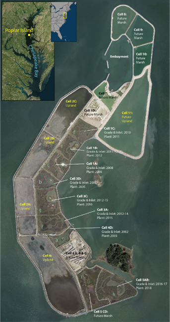
Value of Research and Development (Payoff)
This work provides science-based expectations for restorations of tidal salt marsh beneficially using dredged material in different parts of the country. By documenting and characterizing the rate of ecological function recovery at various trophic levels (e.g., soils, vegetation, birds) and showing interconnections, the success of individual restoration projects can be more effectively communicated.
Synthesis of regional trajectories across multiple projects or project phases provide science-based expectations for future tidal marsh restorations utilizing dredged material in different parts of the country. Finally, testing novel metrics may offer early indication of marsh restoration trajectories in order to allow early course-correction and adaptive management.
Documentation of these trajectories and early-indicator metrics will facilitate understanding by stakeholders, agencies, and regulators of realistic, science-based benefits of tidal marsh restoration utilizing BU dredged material.
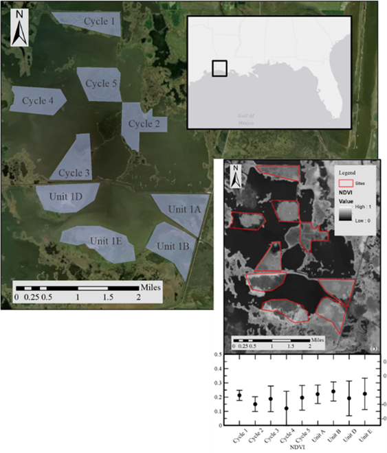
Products
Journal Articles (JAs)
- Murphy, N., Biber, P. and Altman S.A. (In Review). Comparison of vegetative community diversity, biomass, and sediment properties among constructed and reference salt marshes in the Northern Gulf of Mexico. Estuaries and Coasts.
Technical Reports (TRs)
- Runyon, K., Altman, S., and Murray, E.O. (2022). Analytic methods for establishing restoration trajectories (ERDC/EL SR-22-9), Technical Report. U.S. Army Engineer Research and Development Center, Vicksburg, Mississippi. https://hdl.handle.net/11681/45562
- Staver, L., Altman, S. et al. (In management review). Trajectories of Vegetative Parameters at Poplar Island Tidal Marsh Restoration Cells, FY2026-EL-F30-SR-##, Technical Report. U.S. Army Engineer Research and Development Center, Vicksburg, MS.
- Altman, S., Jafari, N., et al (In Preparation). Sabine NWR restoration trajectories, Technical Report. U.S. Army Engineer Research and Development Center.
Technical Notes (TNs)
- Harris, B., Harris, K., Jafari, N., Bekkaye, J., Murray, E., and Altman, S., (2023). Selection of a time series of beneficial use wetland creation sites in the Sabine National Wildlife Refuge for use in restoration trajectory development. ERDC/TN EMRRP-ER-25, Technical Note. U.S. Army Engineer Research and Development Center, Vicksburg, Mississippi. https://hdl.handle.net/11681/47579.
- Cornwell, J., Staver, J., Murray, E., and Altman, S. (In editing). The Trajectory of Iron Sulfide Oxidation and Production in Marshes Created from Dredged Sediments at Poplar Island: Implications for Wetland Plant Establishment. ERDC TN-EMRRP-##, U.S. Army Engineer Research and Development Center, Vicksburg, MS.
- Cornwell, J., Staver, L. et al. (In Editing) Iron Sulfide Oxidation and Production in Marshes Created From Dredged Materials at Poplar Island: Implications for Wetland Plant Establishment, Technical Note. U.S. Army Engineer Research and Development Center.
Conference Presentations/Webinars/Workshops
- (2024). National Conference on Ecosystem Restoration (NCER). Staver, L., Cornwall, J., Murray, E., Altman, S., Eilar, A., and Blanche, T. Restoration trajectories in created tidal marsh habitat – A case study from Poplar Island, MD, USA.
- Eilar, A. et al. (2022). Restoration trajectories at wetland creation sites utilizing dredged material: Case studies as Poplar Island, MD and Sabine National Wildlife Refuge, Presentation. American Shore and Beach Preservation Association, Long Beach, California.
- (2021). Society of Ecological Restoration. Biber, P. Vegetative community and health assessment of a constructed Juncus-dominated salt marsh in the northern Gulf of Mexico.
Other
- Murphy, N.& Biber, P. (2021). Vegetative community diversity assessment of a beneficial use salt marsh restoration. Research Square Preprint. https://doi.org/10.21203/rs.3.rs-507079/v1
- Murphy, N. (2020). Vegetative community and health Assessment of a constructed Juncus-dominated salt marsh in the northern Gulf Of Mexico. Master's Thesis. The University of Southern Mississippi, Graduate School. https://aquila.usm.edu/masters_theses/748/
Using Unmanned Aircraft System Imagery to Map Aquatic and Terrestrial Vegetation
Fiscal Year Start: 2017; Fiscal Year Ending: 2020.
POC: Sean Griffin, Kristofer Lasko & Michael Campbell
SON: 2017-ER-17 Evaluation and Optimization of Unmanned Aircraft Systems to Sense, Identify, and Map in Aquatic Systems
Factsheet
Reference SON: 2017-ER-17 Evaluation and Optimization of Unmanned Aircraft Systems to Sense, Identify, and Map in Aquatic Systems
Lead PIs: Sean Griffin, Kristofer Lasko & Michael Campbell
Project Development Team (PDT): Molly Reif (ERDC)
Proponent(s)/District Collaborators: Victor Wilhelm (SAJ, CoP), Eric Summa, Jon Morton, Jon Lane (SAJ)
Funded: FY17 - FY20
Keywords: UAS, unmanned aircraft system, vegetation, imagery, aquatic, terrestrial, mapping, ArcMap, ENVI
Last updated: 06/18/2025
Using Unmanned Aircraft System Imagery to Map Aquatic and Terrestrial Vegetation
Research Need
Mapping the precise spatial distributions of complex vegetation communities is a critical element in the planning, implementation, and monitoring of both small and large ecosystem management and restoration projects.
Project Purpose & Objectives
The objectives of this study are to develop and test multistage ecosystem monitoring methods that incorporate:
- Remotely sensed optical imagery, from both spaceborne and airborne sensors, with varying spatial and temporal resolutions
- Limited ground reference data collection
- Development of new ArcMap and ENVI image processing toolkits.
This will be achieved by identifying study sites within ongoing ecosystem restoration projects. Supporting imagery will include high-resolution multispectral data from commercial satellites and unmanned aircraft systems (UAS), verified with limited ground reference data. An image processing and geospatial analysis workflow will be developed and packaged into a user-friendly ArcMap toolkit, leveraging current and ongoing mapping research.
Value of Research and Development (Payoff)
Developing or improving vegetation mapping workflows using geospatial data-driven techniques will help managers better understand vegetation distribution and more effectively manage and restore habitats. In addition, custom image processing workflows using familiar ArcMap and ENVI software will streamline data processing, enabling rapid generation of information and mapping products.
Products
Technical Reports (TRs)
- Lasko, K. and Griffin, S. (2021). Monitoring Ecological Restoration with Imagery Tools (MERIT): Python-based Decision Support Tools Integrated into ArcGIS for Satellite and UAS Image Processing, Analysis, and Classification (ERDC/GRL TR-21-3), Technical Report. U.S. Army Engineer Research and Development Center, Vicksburg, Mississippi. https://hdl.handle.net/11681/40262
Technical Notes (TNs)
- Griffin, S.P. and Lasko, K.D. (2020). Using unmanned aircraft system (UAS) and satellite imagery to map aquatic and terrestrial vegetation (ERDC/GRL TN 20-4), Technical Note. U.S. Army Engineer Research and Development Center, Vicksburg, Mississippi. https://hdl.handle.net/11681/38086
Other
- Other Automated Training Data Generation from Spectral Indexes for Mapping Surface Water Extent with Sentinel-2 Satellite Imagery at 10 m and 20 m Resolutions (https://www.mdpi.com/2072-4292/13/22/4531)
- ArcGIS Tools, installer files, read me documents (https://emrrp.el.erdc.dren.mil/models/merit/2022-02-24-MERIT_Share.zip)
Incorporation of Natural and Nature-based Features into Feasibility Studies: Identification, Analysis, Benefits, and Costs
Fiscal Year Start: 2017; Fiscal Year Ending: 2019.
POC: Candice Piercy (ERDC)
SON: 2017-ER-18: Quantifying Coastal Storm (and Flood) Risk Management Benefits for Natural and Nature-based Features; 2017-F-8: Biophysical System Performance of Natural and Nature Based Features (NNBFs) for Coastal Storm Risk Management (CSRM) SMART Planning Studies
Factsheet
Reference SON: 2017-ER-18: Quantifying Coastal Storm (and Flood) Risk Management Benefits for Natural and Nature-based Features; 2017-F-8: Biophysical System Performance of Natural and Nature Based Features (NNBFs) for Coastal Storm Risk Management (CSRM) SMART Planning Studies
Lead PI: Candice Piercy (ERDC)
Project Development Team (PDT): Courtney Chambers, Dick Kasul, Todd Swannack (ERDC)
District Collaborators: Dave Schulte (NAO), Peter Weppler (NAN), (SWG), (NAD), (IWR), (HQUSACE)
Funded: FY17-FY19; Project was jointly funded by EMRRP, Flood Risk Management (FRM), and Dredging Operations and Environmental Research (DOER), before falling under the umbrella of the Engineering with Nature (EWN) program
For more details, please see EWN—International Guidelines on Natural and Nature-Based Features for Flood Risk Management
Last updated: 01/06/2025
Incorporation of Natural and Nature-based Features into Feasibility Studies: Identification, Analysis, Benefits, and Costs
Research Need
Coastal resources such as beaches, dunes, wetlands, islands, and biotic reefs are important for both their ecological and storm protection value. However, the use these natural and nature-based features (NNBF) as part of a holistic flood risk management scheme is limited. This is due to a number of factors including uncertainty about NNBF efficacy, difficulty estimating project cost, and lack of information regarding environmental impacts. Better integration of NNBF into USACE planning will require synthesis of available knowledge to address uncertainties.
Project Objectives & Plan
The objective of this project is to determine and prioritize research needs related to NNBF and to support USACE efforts to develop NNBF guidelines. This will be accomplished by distilling existing knowledge on NNBF practices to develop guidelines for implementation by USACE. Through a series of engagement exercises such as surveys, webinars, and meetings input on use of NNBF will be gathered from across USACE. In parallel to this effort, contributions to an international NNBF guidance document will be made.
Payoff
Greater understanding of the function of NNBF during and between storm and flood events will help USACE implement more holistic and resilient flood risk management projects that provide benefit to the ecosystem restoration and navigation missions using a full array of measures, not just limited to structural measures that are better defined and understood. The use of NNBF in conjunction with structural and non-structural measures can create more sustainable flood risk management projects that can provide benefits beyond just flood risk management, attracting more partners and affording better buy-in from communities and other stakeholders. Additional benefits to the ecosystem restoration and navigation mission areas creates synergy between major USACE business lines, leading to better management of coastal systems that can ultimately reduce costs.
Products
- Bridges, T. and King, J. and Simm, J.D. and Beck, M. and Collins, G. and Lodder, Q. and Mohan, R., eds. (2021). International Guidelines on Natural and Nature-Based Features for Flood Risk Management. USACE, Vicksburg. ISBN 978-1-7325904-9-6. https://hdl.handle.net/11681/41946
For more information please see:
https://ewn.erdc.dren.mil/international-guidelines-on-natural-and-nature-based-features-for-flood-risk-management/
Impact of Habitat Management on Bats
Fiscal Year Start: 2018; Fiscal Year Ending: 2022.
POC: Eric Britzke (ERDC)
SON: 2015-ER-7 Federally listed bat species response to invasive vegetation control in forest stands
Factsheet
Reference SON: 2015-ER-7 Federally listed bat species response to invasive vegetation control in forest stands
Lead PI: Eric R. Britzke (ERDC)
Project Development Team (PDT): Austin Davis, Christina Saltus (ERDC)
Proponent(s)/District Collaborators: Tim Higgs (LRN), Andrea Carpenter (MVM), Joe Jordan (MVR), Rhonda Lucas (NWS), Cherrie-Lee Phillip (SWL)
Funded: FY18-FY22
Keywords: Bat, Habitat, Management, Restoration, Model, Agent-based, Petri-network, Acoustic survey
Last updated: 01/06/2025
Impact of Habitat Management on Bats
Research Need
Bat species are an important part of a biological community, and their conservation is, therefore, a stewardship responsibility on USACE lands. Recently, bats have received increased attention from managers due to massive population declines resulting from the spread of White Nose Syndrome (WNS). These declines are ongoing and WNS is continuing to spread across the country resulting in the listing of once common species. Currently, USACE managers do not have sufficient information to determine how habitat restoration and management actions will affect bats, making project planning difficult. To address this information deficit and aid decision making, models that can predict the impact of habitat management and restoration actions on bats are needed.
Project Purpose & Objectives
The objective of this project is to develop a habitat model framework that can simulate the impact of restoration and management projects on bats. Model development will begin with a literature review to determine relevant model parameters. Draft models of habitat use by bats will then be constructed using an agent based petri-network model framework. Acoustic monitoring studies conducted throughout the country will be leveraged to parameterize and validate draft models. Finally, a user friendly implementation for models will be developed.
Value of Research and Development (Payoff)
Models which can simulate the effects of habitat restoration and management on bats will provide USACE planners with critical information. This will allow tailoring of habitat restoration and management actions to reduce potentially negative impacts and achieve maximum benefits for bat species on USACE lands.
Products
Technical Reports (TRs)
- Saltus, C.L. and Britzke, E.R. (2022). Literature Review: Macrohabitat metrics to identify presence of Chiroptera on the landscape in the United States. (ERDC/EL SR-22-8), Technical Report. U.S. Army Engineer Research and Development Center, Vicksburg, Mississippi. https://hdl.handle.net/11681/45523
Framework of Optimum Selection of Source Material and Geomorphological Characteristics for Desired Vegetation and SAV in Restoration Projects
Fiscal Year Start: 2017; Fiscal Year Ending: 2021.
POC: Damarys Acevedo-Mackey, Eve Eisemann & Amy Yarnell (ERDC)
SON: 2016 ER 12 - Correlation of Vegetative Density with Particle Size Distribution of Historically Placed Dredged Sediments for Substrate Nourishment to Enhance Ecosystem Function, 2017 ER 16 - Quantifying the relationship between SAV habitat and geomorphological features to inform SAV restoration efforts
Factsheet
Reference SON: 2016 ER 12 - Correlation of Vegetative Density with Particle Size Distribution of Historically Placed Dredged Sediments for Substrate Nourishment to Enhance Ecosystem Function, 2017 ER 16 - Quantifying the relationship between SAV habitat and geomorphological features to inform SAV restoration efforts
Lead PIs: Damarys Acevedo-Mackey, Eve Eisemann, Amy Yarnell (ERDC)
Project Development Team (PDT): Safra Altman, Susan Bailey, Jacob Berkowitz, Brandon Boyd, Robert McComas, Molly Reif (ERDC)
Proponent(s)/District Collaborators: Larry Parson, Elizabeth S. Godsey, Nathan Lowelace (SAM), James McMillan, Jarod Norton, Valerie Ringold, Cindy Studebaker (NWP)
Funded: FY17-FY21
Keywords: Coastal vegetation, restoration, substrate, source material
Last updated: 06/24/2025
Framework of Optimum Selection of Source Material and Geomorphological Characteristics for Desired Vegetation and SAV in Restoration Projects
Research Need
The success of coastal & estuarine vegetation restoration efforts requires the creation of a suitable and sustainable physical environment for growth. However, correlations between coastal vegetation growth, substrate characteristics and geomorphological conditions have not been developed. Improved guidance/best management practices are needed to aid in selection of source material and design of geomorphological features to enhance ecosystem function.
Project Purpose & Objectives
The objective of this research is to develop a framework that will inform and expedite decision making for future coastal vegetation restoration efforts during the planning process. This will be achieved through:
- analysis of previous restoration efforts
- assessment of the effectiveness of source material placement
- statistical analysis to establish correlations
- determination of suitable substrate and geomorphological characteristics required for a wide variety of coastal vegetation types
Value of Research and Development (Payoff)
The framework developed will directly benefit restoration project planning and adaptive management by informing manager decisions regarding source material selection for coastal ecosystem restoration.
Products
Technical Reports (TRs)
- Eisemann, E.R., Thomas, C.C., Balazik, M.T., Acevedo-Mackey, D., and Altman, S. (2021). Environmental factors affecting coastal and estuarine submerged aquatic vegetation (SAV) (ERDC/EL SR-21-6), Technical Report. U.S. Army Engineer Research and Development Center, Vicksburg, Mississippi. https://hdl.handle.net/11681/42185
- Yarnall, A.H., Eisemann, E.R., Reif, M.K., Slyvester, C.S., Balazik, M.T., and Altman, S. (In editing) Predicting seagrass habitat suitability with remote sensing and machine learning: A case study in the Mississippi-Alabama Barrier Islands. (ERDC/EL TR 25-X), Technical Report. U.S. Army Engineer Research and Development Center, Vicksburg, Mississippi.
Technical Notes (TNs)
- Eisemann, E.R., Altman, S., Acevedo-Mackey, D., and Reif, M.K. (2019). Relating seagrass habitat to geomorphology and substrate characteristics around Ship Island, MS (ERDC/TN EMRRP-EBA-24), Technical Note. U.S. Army Engineer Research and Development Center, Vicksburg, Mississippi. https://hdl.handle.net/11681/33023
Living Shoreline Implementation across USACE Districts
Fiscal Year Start: 2018; Fiscal Year Ending: 2019.
POC: Tosin Gaskin (ERDC)
SON: 2017-F-25 Implementation of Living Shoreline Techniques and Guidance in USACE Projects
Factsheet
Reference SON: 2017-F-25 Implementation of Living Shoreline Techniques and Guidance in USACE Projects
Lead PI: Tosin Gaskin (ERDC)
Project Development Team (PDT): Mathew Balazik, Brian Durham (ERDC), Jenny Davis (NOAA-NOS)
Proponent(s)/District Collaborators: Debby Scerno (SAD), Brian Zettle (SAM), Corraggion Maglio (SWG)
Funded: FY18-FY19
Keywords: Coastal restoration, Natural infrastructure, Erosion prevention, Green shorelines, Shore stabilization, Coastal resilience
Last updated: 06/24/2025
Living Shoreline Implementation across USACE Districts
Research Need
Living shorelines (also called green or soft shorelines) are coastal edges that have been stabilized through the installation of natural materials like rock, sand, and native plants. Living shorelines can provide habitat and contribute to carbon cycling processes in nearshore environments, and often cost less to maintain than artificial (also called hard) shorelines. Currently, there is limited guidance available on design, development, construction, maintenance, and implementation of living shoreline projects across USACE Districts nationwide. To better inform implementation of living shoreline projects, this effort assessed the current state of knowledge with respect to Living Shorelines and the utility of available guidance to USACE applications.
Project Purpose & Objectives
In order to identify knowledge gaps pertaining to the implementation of living shoreline restoration projects, a review assessing the literature, guidance materials, tools, applications, and engineering guidance on living shorelines projects currently available and accessible to USACE Districts was conducted. Once the existing knowledge base was identified, a technical report was synthesized to summarize current guidance.
Value of Research and Development (Payoff)
This project provided summary guidance to USACE districts on implementation of Living Shorelines projects to restore coastal ecosystems. It also elucidated areas where current information or guidance for these projects is deficient. In the future, research and development projects focusing on living shorelines will be able to target these areas and continue to innovate how USACE restores and manages shorelines.
Products
Technical Reports (TRs)
- Gaskin, T.A., Balazik, M., Thomas, C., Davis, J., Durham, B., Davis, B., and Ihametz, I. (In Editing). Living Shoreline in USACE Projects - A Review, Technical Report. U.S. Army Engineer Research and Development Center, Vicksburg, Mississippi. https://hdl.handle.net/11681/49678
Compilation and Assessment of USACE Suggested Management Practices used during Coastal Engineering to Benefit Coastal Shoreline-dependent Species along the Atlantic Coast
Fiscal Year Start: 2018; Fiscal Year Ending: 2021.
POC: Michael Guilfoyle (ERDC)
SON: 2016-ER-21; 2017-ER-8
Factsheet
Reference SON: 2016-ER-21; 2017-ER-8
Lead PI: Michael P. Guilfoyle (ERDC)
Project Development Team (PDT): Jacob Jung, Richard Fisher, Dena Dickerson (ERDC)
District Collaborators: Ed Creef (MVN), Keith McMullen (MVS), Keith Lockwood (NAB), Chris Akios, Rene Weichenberg (NAD), John Winkleman (NAE), Robert Smith, Peter Weppler (NAN), Robert Pruhs (NAO), Beth Brandreth (NAP), Mike Scuderi (NWS), Jon Hosaka (POH), Mark Messersmtih (SAC), Eric Summa (SAJ: CoP Lead), Elizabeh Godsey, Aubrey Hershorem, Terri Jordon-Sellers, Michael Simmons, Paul Stodola (SAJ), Chris Jones, Bonnie Rodgers (SPL), Caree Kovacevich (SAM), Mary Richards, Alan Shirey (SAS), Teresa Bullard, Lisa Finn, Emily Hughes (SAW)
Funded: FY18-FY21
Keywords: Best management practices, Birds, Coastal engineering, Satellite tags, Seasonal habitat use, Tracking
Last updated: 08/13/2025
Compilation and Assessment of USACE Suggested Management Practices used during Coastal Engineering to Benefit Coastal Shoreline-dependent Species along the Atlantic Coast
Research Need
A large number of shoreline-dependent species, some of which are listed under the Endangered Species Act (ESA), are impacted by coastal engineering operations. USACE Districts need improved Suggested Management Practices (SMPs) to create, enhance or mitigate for coastal habitats degraded or lost during coastal engineering.
Project Purpose & Objectives
The objective of this project is to work with USACE Districts and other stakeholders to compile and assess SMPs to improve habitats for coastal species while maintaining environmental compliance and meeting coastal engineering mission objectives. This will be accomplished by:
- Compiling, adapting, and revising existing SMPs forimplementation during USACE coastal engineering projects to benefit shoreline-dependent birds and nesting sea turtles
- Leveraging existing projects to procure monitoring datafrom pre-engineering, post-engineering, and beachnourishment projects for shoreline-dependent birds and turtles
- Selecting two or more demonstration sites to implement asuite of several SMPs for pre- and post-implementation monitoring
- Using ongoing projects to assess physiological condition orother population parameters on engineered and non-engineered sites and/or sites where selected SMPs have been implemented
- Capturing and affixing 5 g satellite tags on 3-4 shorebirds before spring and/or fall migration
- Integrating coastal SMPs into the USFWS Information andPlanning for Consultation (IPAC) online tool (https://ecos.fws.gov/ipac/)
- Transferring knowledge gained on SMPs through series of ERDC Technical Reports, Webinars, Workshops, Peer-reviewed manuscripts and conference participation
Payoff
The final products of this effort will provide the foundation of more informed planning efforts and coastal engineering along the Atlantic Coast. Implementation of SMPs in a proactive manner will improve flexibility of USACE engineering mission requirements, particularly through streamlining of ESA Section 7 consultations. SMP implementation also should provide measurable benefits to shoreline-dependent bird and turtle populations. This effort can also serve to promote proactive efforts that may minimize or reverse ongoing declines in shoreline-dependent birds and turtle populations. Reducing or eliminating declines of non-listed shoreline-dependent species may serve to limit or prevent future listings under the ESA.
Products
Technical Reports (TRs)
- Guilfoyle, M.P., Golder, W., Winn, B., Fischer, R.A., Jung, J.F. (In review) Suggested Management Strategies to Benefit Seasonal Coastal Bird Populations during Coastal Engineering Projects, Technical Report. U.S. Army Engineer Research and Development Center, Vicksburg, Mississippi.
- Reine, K. (2022). A literature review of beach nourishment impacts on marine turtles (ERD/EL TR-22-4) Technical Report. U.S. Army Engineer Research and Development Center, Vicksburg, Mississippi. https://hdl.handle.net/11681/43829
Technical Notes (TNs)
- Guilfoyle, M.P., Jung, J.F., Fisher, R.A., Dickerson, D.D. (2019). Developing Best Management Practices for Coastal Engineering Projects that Benefit Atlantic Coast Shoreline-Dependent Species (ERDC/TN-EMRRP-SI-38), Technical Note. U.S. Army Engineer Research and Development Center, Vicksburg, Mississippi. https://hdl.handle.net/11681/33203
- Guilfoyle, M.P., Catlin, D., Karpanty, S., Fraser, J., Alvino, C., Britton, W., Gibson, D., Hunt, K., Morelli, J., and Weithman, C. (In Prep). Application of GPS/GMS Tag Technology to Investigate Seasonal Habitat Use by Coastal Bird: A Pilot Study Using the Royal Turn (Thalasseus maximus), Technical Note. U.S. Army Engineer Research and Development Center, Vicksburg, Mississippi.
Conference Presentations/Webinars/Workshops
- (2018). Best management practices to benefit coastal bird and turtle populations along the Atlantic coast during coastal engineering operations, Poster. Super RARG.
- (2018). Kick-off meeting with Audubon North Carolina and Manomet Center for Conservation Science, Meeting. Wilmington, NC.
- (2019). Coastal States Organization Annual Meeting with Manomet Center for Conservation Science, Meeting. Providence, RI.
- (2019). Coastal States Organization Regional Meeting, Meeting. Richmond, VA.
- (2019). Meeting with Wilmington, Jacksonville, and Philadelphia Districts for establishing BMP demonstration sites, Meeting.
Quantifying Inundation Effects on Marsh Vegetation
Fiscal Year Start: 2017; Fiscal Year Ending: 2021.
POC: Glenn Suir (ERDC)
SON: 2016-ER-3 Use of Remote Sensing and Field Data Collection to Quantify Inundation Effects on Marsh Vegetation
Factsheet
Reference SON: 2016-ER-3 Use of Remote Sensing and Field Data Collection to Quantify Inundation Effects on Marsh Vegetation
Lead PI: Glenn M. Suir (ERDC)
Project Development Team (PDT): Jacob Berkowitz, Gary Brown, Sean Griffin, Shea Hammond, Kevin Philley, Molly Reif (ERDC)
District Collaborators: Elizabeth Behrens, Kevin Harper, William Klein (CoP); Jon Lane, Jon Morton, Micheal Simmons (MVN); Coraggio Maglio (Galveston)
Funded: FY17-FY21
Keywords: Coastal, Hydraulic regime, Marsh mortality, Remote sensing, Soil condition, Wetland productivity
Last updated: 08/26/2025
Quantifying Inundation Effects on Marsh Vegetation
Research Need
Currently, high levels of uncertainty exist regarding the effects of hydrologic alterations and water management actions on wetland resources. Coastal marsh ecosystems are sensitive to a number of vegetation and soil parameters, however there is still considerable uncertainty over effect of these parameters on coastal marsh mortality. Parameters associated with uncertainty are critical inundation depth for marsh mortality, inundation duration required for mortality, lag time between inundation and mortality, and effect of soil structure and function on mortality. This lack of knowledge hinders planning and adaptive management efforts. Therefore, there is an immediate need to evaluate the direct and indirect effects of inundation depth and duration on marshes in coastal wetlands.
Project Objectives & Plan
The purpose of this work unit is to improve understanding of impacts to coastal marsh vegetation resulting from changes in hydrologic regime. The impact of depth/duration of inundation will be evaluated for the following factors: wetland productivity, soil condition and function, vegetation sequencing and seasonal effects, tolerance across vegetation species and spatial integrity. Inundation-based indices and factors will be developed for decision-support tools/models. Mesocosm experiments will be conducted to evaluate the effects of inundation depth/duration in a controlled environment. These efforts will be transitioned to a field setting for additional testing.
Payoff
This project will provide the information needed to produce decision-support tool/models needed by project planners and aquatic habitat managers. Remote sensing methods developed will allow for efficient assessment of coastal marsh health and improve management outcomes.
Products
Journal Articles (JAs)
- Suir, G.M. and Sasser, C.E. (2019). Use of NDVI and Landscape Metrics to Assess Effects of Riverine Inputs on Wetland Productivity and Stability. Wetlands 39, 815-830. https://doi.org/10.1007/s13157-019-01132-3
- Suir, G.M., Sasser, C.E. and Harris, J.M. (2020). Use of remote sensing and field data to quantify the performance and resilience of restored Louisiana wetlands. Wetlands 40, 2643-2658. https://doi.org/10.1007/s13157-020-01344-y
- Wu, W., Grimes, E. and Suir, G. (2023). Impact of freshwater diversions on vegetation in coastal wetlands based on remote sensing derived vegetation index. Frontiers in Marine Science 10. https://doi.org/10.3389/fmars.2023.1202300
- Lambiotte, A.N., Berkowitz, J.F., Suir, G.M., and Willis, J.M. (2023). Aboveground wetland vegetation growth responses to simulated sediment diversion inundation scenarios. Ecological Engineering 190, 106943. https://doi.org/10.1016/j.ecoleng.2023.106943
- Grimes, E.S., Wu, W. and Suir, G. (2025). Evaluating the response of Sagittaria lancifolia to combined inundation and nitrogen addition using a marsh organ. Environmental Monitoring and Assessment, 197, 394. https://doi.org/10.1007/s10661-025-13743-x
Technical Reports (TRs)
- Suir, G.M. and Berkowitz, J.F. (2021). Inundation depth and duration impacts on wetland soils and vegetation: State of knowledge (ERDC/EL SR-21-5), Technical Report, U.S. Army Engineer Research and Development Center, Vicksburg, Mississippi. https://hdl.handle.net/11681/42146
Certified Habitat Models to Evaluate Ecosystem Restoration Projects
Fiscal Year Start: 2018; Fiscal Year Ending: 2019.
POC: Catherine Murphy (ERDC)
SON: 2017-ER-12 Certified Habitat Models for Ecosystem Restoration
Factsheet
Reference SON: 2017-ER-12 Certified Habitat Models for Ecosystem Restoration
Lead PI: Catherine Murphy (ERDC)
Project Development Team (PDT): Jan Hoover, Elizabeth Murray, Todd Slack, Bruce Pruitt, Jack Killgore (ERDC)
Proponent(s)/District Collaborators: Kent Parrish (MVK), Gary Young (MVD), Nathan Richards (CoP, MVP), Greg Miller (CoP)(EcoPCX)
Funded: FY18-FY19
Last updated: 08/26/2025
Certified Habitat Models to Evaluate Ecosystem Restoration Projects1
Research Need
Corps biologists and planners must anticipate ecological impacts when preparing a project and developing alternatives. Biomonitoring represents a useful tool for determining environmental health, especially for assessing the effects of anthropogenic stressors (Di Battista et al. 2016). However, without knowledge of the biotic responses that are sensitive to manipulations of the physical environment that will result from the project, environmental assessments and monitoring efforts might prove ineffective. In addition, the environmental gradient of interest, which often comprises several habitat variables, must be properly identified for cost-effective collection of appropriate data. Habitat gradients are critical to understanding differences in faunal diversity and abundance between impacted and reference sites. USACE Districts and Divisions are constrained by both time and funding in their planning guidelines.
Project Purpose & Objectives
Using existing databases, this work unit will identify biotic responses and habitat parameters germane to Corps Civil Works activities. The ERDC has access to long-term monitoring datasets which could be analyzed with multivariate methods to develop models for ecosystem restoration. The first set in this project will be compile and summarize information on available databases. Next, a case study will be conduct where models will be developed using the available databases. Finally, an analytical framework will be developed that will provide guidance for developing other models using existing datasets.
Value of Research and Development (Payoff)
This effort will enable USACE biologists and planners to determine the most relevant ecological indicators to address specific project alternatives or to evaluate the utility of existing data, when available. Relevant empirical models provide objectively derived statistical parameters to rate habitat quality for a broad suite of aquatic and wetland biota. Use of certified models expedites planning under the constraints of 3x3x3 paradigm.
Products
No products are known to have been produced.
1Project Alias – Work Unit Documentation Title: HEC-EFM (Ecosystem Function Model) ERDCWiki Title: EMRRP: Ecosystem Functions Model
Advancing Remote Sensing Techniques to Quantify Performance, Resilience, and Recovery of Under-studied Wetlands
Fiscal Year Start: 2022; Fiscal Year Ending: 2026.
POC: Christina Saltus and Sam Jackson (ERDC)
Reference SON: SON-2021-1657/1659
SON-2021-1657 - Remote Sensing for Back Bay Environments
SON-2021-1659 - Improved Methods and Best Practices for Monitoring and Surveying of Projects in Wetlands and Shallow Water Environments through Remote Sensing
Factsheet
Reference SON: SON-2021-1657/1659
SON-2021-1657 - Remote Sensing for Back Bay Environments
SON-2021-1659 - Improved Methods and Best Practices for Monitoring and Surveying of Projects in Wetlands and Shallow Water Environments through Remote Sensing
Lead PI(s): Christina Saltus and Sam Jackson (ERDC)
Project Development Team (PDT): Christina Saltus, Sam Jackson, Kenneth Matheson, Charles McKenzie, Michael Baker, Shea Hammond, Jenny Laird, Molly Reif, Nathan Beane, Wesley Cowan, Glenn Suir (ERDC); Karen Glennemeier (Habitat Research LLC); Douglas Wilcox (SUNY Brockport)
District Collaborators: Robbie Sliwinski (LRC)
Other Partners: Karen Glennemeier (Habitat Research LLC); Douglas Wilcox (SUNY Brockport)
Funded: FY22 – FY26
Keywords: UAS, Remote Sensing, Wetland Monitoring, Vegetation Metrics
Last updated: 09/23/2025
Advancing Remote Sensing Techniques to Quantify Performance, Resilience, and Recovery of Under-studied Wetlands
Research Need
Establishing performance standards or monitoring requirements for ecosystem restoration and natural resource management projects is important for maintaining, restoring, and maximizing beneficial ecological processes that support sustainable, resilient, and healthy wetland ecosystems. Commonly wetland monitoring includes links to structural and functional parameters such as vegetation health and biomass (typically related to established project goals) that require the appropriate monitoring temporal frequency and period. Additionally, these parameters are normally used in comparisons with historical, reference, or target conditions. However, the unique challenges for mapping and monitoring hard-to-access wetlands, due to their size, location, foliage architecture, and spectral characteristics, are intensified in these landscapes. Consequently, existing field-based, labor-intensive methods may not be fully adequate for these areas, highlighting the need for complementary monitoring approaches to evaluate wetland conditions and measure responses to environmental pressures and project actions.
Project Purpose & Objectives
The objective of this project is to assess the use of remotely sensed data and products to more efficiently and effectively evaluate key properties and conditions of difficult to monitor habitats (e.g., ephemeral ponds, multi-story wetlands, and back-bay environments). This will be accomplished by:
- Conducting a comprehensive search, review, and compilation of information regarding the current state of knowledge related to the use of remote sensing applications for wetland structure and function in target wetlands.
- Evaluating a range of remote sensors (e.g., UAS-mounted multispectral and hyperspectral sensors, and lidar sensor) and methods (e.g., sub-pixel value extraction, data fusion) to develop and apply vegetation metrics and multi-metric indices.
- Selecting study site(s) and collecting, processing, and analyzing air-borne and ground verification data.
- Performing cross-validations among remote sensors to assess correlations between ground- and remotely collected data and existing/developed metrics.
- Developing and testing semi-automated geospatial tools for extracting wetland properties and metrics from UAS.
- Documenting and disseminating tools and findings through publications, webinars, and conference presentations.
Value of Research and Development (Payoff)
Understanding the interactions that drive landscape change resulting from natural disturbances (e.g., hurricanes or floods) or management activities (e.g., restoration or water level management) in wetlands is critical. Yet many physical, biological, and chemical uncertainties exist, especially in hard to access or difficult to monitor wetlands. The proposed research and products will allow wetland resource managers to monitor and assess the condition, resilience, and recovery of wetland ecosystems across a wide range of wetland types, locations, pressures, and restoration strategies more efficiently. The proposed methods and tools will improve the understanding of wetland dynamics in these understudied ecosystems, assisting in the identification of actions required to enhance the sustainability and resiliency of those ecosystems, and ultimately promoting successful ecological and fiscal outcomes (including potential cost savings).
Products and Deliverables
Technical Reports (TRs)
- Suir, G.M., K. Glennemeier, R. Sliwinski, S. Jackson, and C. Saltus. (In Management Review). Assessing the Use of Unmanned Aircraft Systems to Monitoring Vegetation Dynamics in Forested Wetlands (ERDC/EL TR-XX-XX), Technical Report. U.S. Army Engineer Research and Development Center, Vicksburg, Mississippi.
Technical Notes (TNs)
- Jackson, S., C. Saltus, K. Glennemeier, R. Sliwinski, G. Suir. 2025. Considerations and Lessons Learned for Remote Sensing Data Acquisition of Understudied Wetland Vegetation Metrics (ERDC/TN EMRRP-RQ-5), Special Report. U.S. Army Engineer Research and Development Center, Vicksburg, Mississippi. https://dx.doi.org/10.21079/11681/49967
Special Reports (SR)
- Suir, G.M., K. Glennemeier, R. Sliwinski, and C. Saltus. 2025. Monitoring of Understudied Wetlands: State of Knowledge (ERDC/EL SR-25-5), Special Report. U.S. Army Engineer Research and Development Center, Vicksburg, Mississippi. https://dx.doi.org/10.21079/11681/49899
Other Reports/Models/Tools/Datasets
- Suir, G.M. 2022. Field study plan and project records (White paper and supporting documentation)
- Jackson, S., G. Suir, K. Matheson, M. Baker, J. Laird, C. Saltus, R. Sliwinski, and K. Glennemeier. 2023. Grainger Woods Conservation Preserve, IL Field Data Collection 2023: Geospatial Layers and Related Tables. Dataset. U.S. Army Engineer Research and Development Center, Vicksburg, Mississippi. https://dx.doi.org/10.21079/11681/49942
- Saltus, C., K. Glennemeier, R. Sliwinski, S. Jackson, K. Matheson, C. Mckenzie, N. Beane, and W. Cowan. 2025. Grainger Woods Conservation Preserve, IL Field Sampling Plan (White paper)
- Saltus, C., S. Jackson, K. Matheson, C. Mckenzie, N. Beane, W. Cowan, J. Laird, R. Sliwinski, and K. Glennemeier. 2025. Grainger Woods Conservation Preserve, IL Field Data Collection 2025: Geospatial Layers and Related Tables. Dataset. U.S. Army Engineer Research and Development Center, Vicksburg, Mississippi. https://dx.doi.org/10.21079/11681/49951
- 2025 Geospatial toolbox for WVCI metrics (Publish to ERDC Knowledge Core FY26)
- 2025 Grainger Woods species classification dataset (Planned for FY26)
- SR – Wetland Value Condition Index (WVCI) Geospatial toolbox user’s guide (Planned for FY26)
Conference Presentations/Webinars/Workshops
- Webinar to present remote sensing methods and use of the WVCI toolbox (Planned for FY26)
Communication (Social Media, Videos, Podcasts, Photos, etc.)
- CW Weekly Highlight, “Field Campaign for Characterizing Forested Wetland Habitat using Ground-Based Measurements and Multiplatform Remote Sensing” (June 2025)
Images
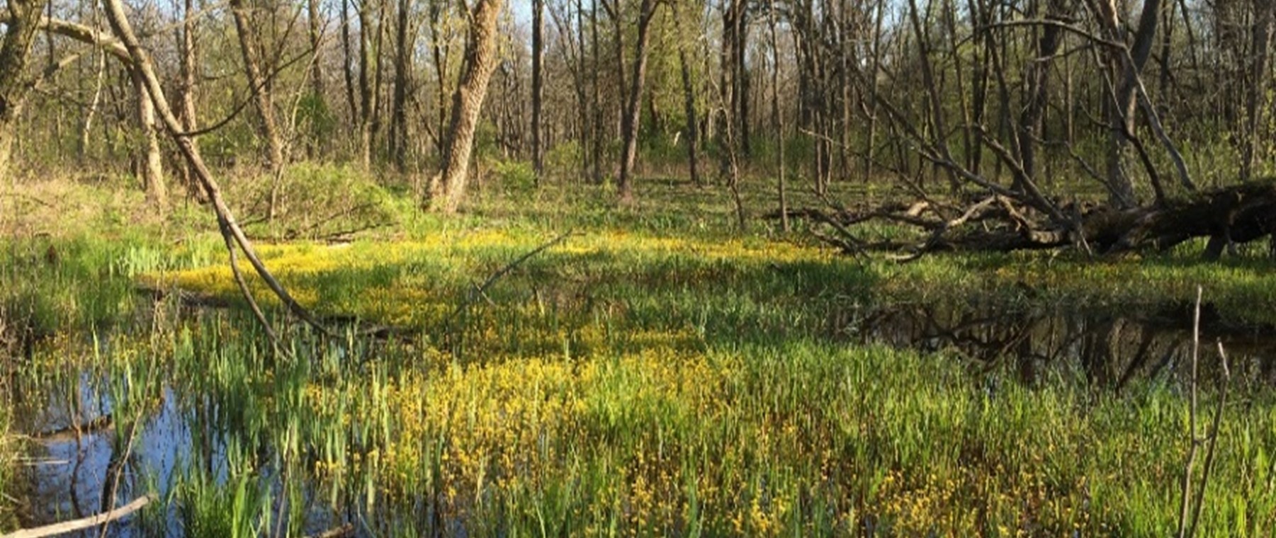
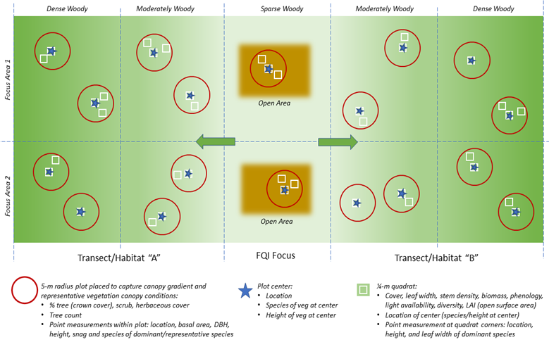
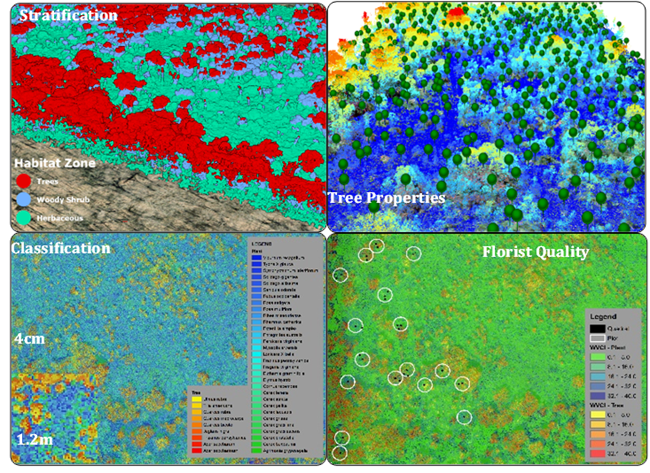
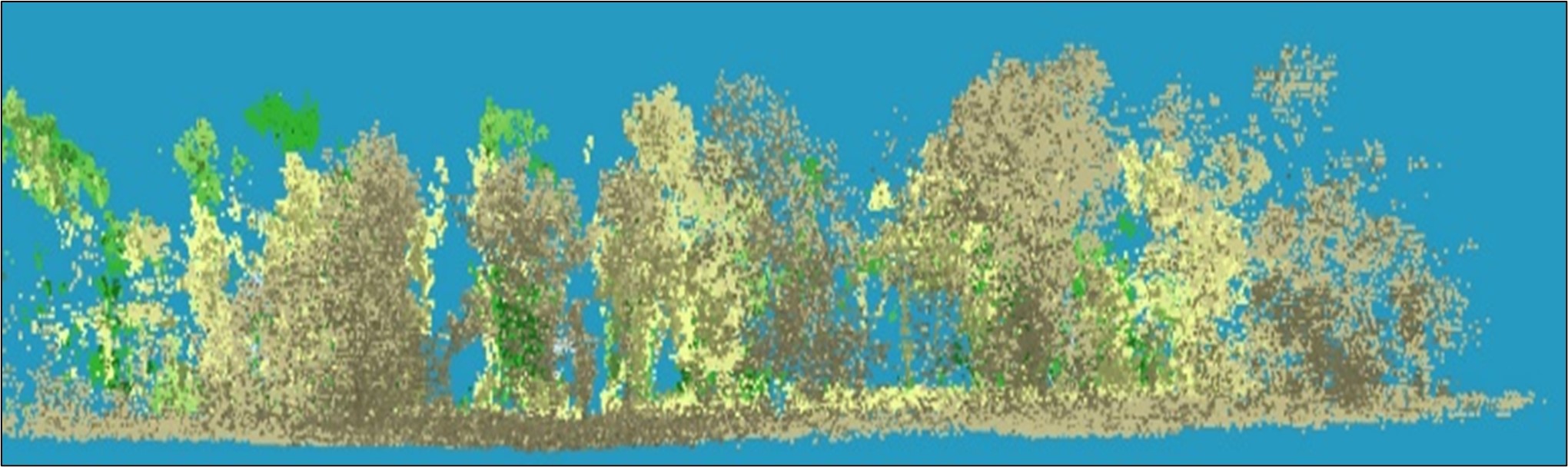
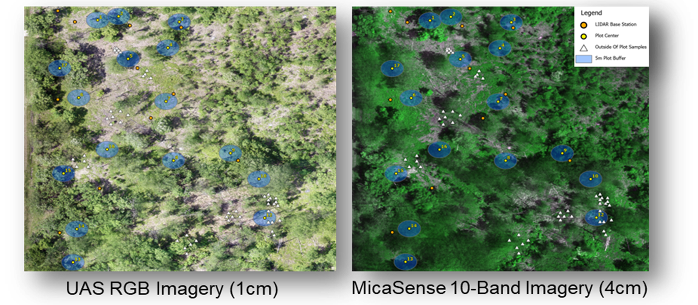
Integrating Ecological Community and Process-based Perspectives to Improve Habitat Suitability Models for Restoration Planning
Fiscal Year Start: 2025; Fiscal Year Ending: 2027.
POC: Jacob Jung (PI-ERDC) and Aubrey Harris (Co-PI-ERDC)
Reference SON: 2023-1937-Integrating ecological community and process-based perspectives to improve habitat suitability models for restoration planning
Factsheet
Reference SON: 2023-1937-Integrating ecological community and process-based perspectives to improve habitat suitability models for restoration planning
Lead PI(s): acob Jung (PI-ERDC) and Aubrey Harris (Co-PI-ERDC)
Project Development Team (PDT): Todd Swannack, Sydney Bufkin, Jacob Berkowitz, Samantha Wiest, Christina Saltus-ERDC; Ed Stowe (ERDC/UGA), David Potter, Aaron McFarlane-(MVP); Megan McGuire (MVD)
Proponent(s)/District Collaborators: David Potter, Aaron Mcfarlane, Megan McGuire
Other Partners: USFWS, USGS, UMRR Program
Funded: FY25-FY27
Keywords: Habitat Suitability Models (HSI), Hydrogeomorphic Models (HGM), Ecosystem Modeling
Last updated: 09/16/2025
Integrating Ecological Community and Process-based Perspectives to Improve Habitat Suitability Models for Restoration Planning
Research Need
This project will assess practical shortcomings of Habitat Suitability Models (HSI), Hydrogeomorphic Models (HGM), and other index-based analytical approaches for project analyses and will develop a framework to address identified shortcomings. USACE project habitat conditions span from terrestrial, aquatic, and wetland environments, but cross walking an assessment that addresses simultaneous functions of these environments have proven difficult. This has led to increasing interest of evaluating ecological-process and community level models for project analysis.
Research is needed to determine the source of HSI and other index-based model inaccuracy, limitations in HGM applicability outside of wetland contexts, and linkages to species outcomes. From these findings, we will develop an analysis framework, perhaps linking HGM and HSI for their respective strengths, to aid Districts in conducting effective project analyses.
Project Purpose & Objectives
A more holistic approach that targets the overall ecosystem rather than select species management, as well as incorporates additional environmental stressors (e.g., invasive species, changing conditions, sea-level change) is needed to adequately address potential impacts to the environment from project actions. USACE has a great opportunity to develop physical process models that fit these objectives and aligns with the current scientific paradigm of integrating ecosystem models for managing at the ecosystem level.
- Evaluate shortcomings of existing environmental project evaluation procedures, i.e., HEP/HSI, in a workshop with SMEs and USACE District practitioners.
- Review alternative process-based habitat evaluations in the context of multiple reference conditions: historic, best attainable, existing, future without action, socially desired, and multiple project alternatives.
- Develop a process-based and spatially explicit set of environmental attributes that can be used in USACE project planning. Example attributes include terrain geometry, inundation frequency, vegetation characteristics.
- Review and evaluate products with SMEs and District practitioners as they are developed. Feedback would be solicited from regulatory agencies responsible for the review of analyses/results within the permitting/NEPA approval process.
- Develop guidelines for process-based and spatially explicit ecologically planning models. Apply these planning models to previous projects to determine model performance.
Value of Research and Development (Payoff)
Review of existing model frameworks relative to restoration planning objectives will provide an opportunity to make recommendations for consistent ecological evaluation throughout project phases, from planning to monitoring. HSI may be a weak habitat model because it is performed at the planning stage but doesn’t fully leverage the surmountable monitoring datasets that USACE collects for project planning and implementation. Since this framework would require monitoring data for biological validation, it presents the opportunity to discuss consistent model use throughout planning and adaptive management. A model that can be used and improved through adaptive management will not only reduce uncertainty, but also better align USACE restoration with USACE business practices to Plan-Do-Check-Act (ER 5-1-11, Appendix A). There is also
Products and Deliverables
Technical Reports (TRs)
- Jung, J.F., A.E. Harris, T.M. Swannack, S.R. Wiest, C.L. Saltus, J.F. Berkowitz, S.D. Bufkin, E.S. Stowe, A.M. Mcfarlane, M.B. McGuire, and D.F. Potter. (In Prep). A framework for incorporating an ecosystem-based approach to aquatic and floodplain systems in the Upper Mississippi River system. (ERDC/EL TR-XX-XX), Technical Report. U.S. Army Engineer Research and Development Center, Vicksburg, Mississippi.
Technical Notes (TNs)
- Wiest, S.R., C.L. Saltus, J.F. Jung, J.F. Berkowitz, S.D. Bufkin, A.M. Mcfarlane, and A.E. Harris. (In Review). Opportunities to Improve Index-Based Habitat Modeling: A Case Study in the Upper Mississippi River System. (ERDC/TN EMRRP-XX-XX), Technical Note. U.S. Army Engineer Research and Development Center, Vicksburg, Mississippi. – Currently in Review in EPAS
Other Reports/Models/Tools/Datasets
- Harris, A.E, T.M. Swannack, C.L. Saltus, S.R. Wiest, and E.S. Stowe. (In prep.) A completed analysis of an aquatic framework for an ecosystem-based model in the Upper Mississippi. Model Dataset. U.S. Army Engineer Research and Development Center, Vicksburg, Mississippi.
- Jung, J.F., T.M. Swannack, C.L. Saltus, S.D. Bufkin, and J.F. Berkowitz (In prep.) A completed analysis of a floodplain framework for an ecosystem-based model in the Upper Mississippi. Model Dataset. U.S. Army Engineer Research and Development Center, Vicksburg, Mississippi.
- Jung, J.F., A.E. Harris, T.M. Swannack, S.R. Wiest, C.L. Saltus, J.F. Berkowitz, S.D. Bufkin, E.S. Stowe, A.M. Mcfarlane, M.B. McGuire, and D.F. Potter. (In planning). Demonstration of a framework for incorporating an ecosystem-based approach to aquatic and floodplain systems in the Upper Mississippi River system. Demonstration. U.S. Army Engineer Research and Development Center, Vicksburg, Mississippi.
Conference Presentations/Webinars/Workshops
- McGuire, M.B., J.F. Jung, A.E. Harris, T.M. Swannack, S.R. Wiest, C.L. Saltus, J.F. Jung, J.F. Berkowitz, S.D. Bufkin, E.S. Stowe, A.M. Mcfarlane, and D.F. Potter. (2025). Integrating ecological community and process-based perspectives to improve index-based habitat suitability models for restoration planning, Workshop. U.S. Army Engineer Research and Development Center, Vicksburg, Mississippi.
- McGuire, M.B., J.F. Jung, A.E. Harris, T.M. Swannack, S.R. Wiest, C.L. Saltus, J.F. Jung, J.F. Berkowitz, S.D. Bufkin, E.S. Stowe, A.M. Mcfarlane, and D.F. Potter. (In planning). Gaining feedback on development of ecological community and process-based approaches to improve index-based habitat suitability models for restoration planning, Webinar. U.S. Army Engineer Research and Development Center, Vicksburg, Mississippi.
Communication (Social Media, Videos, Podcasts, Photos, etc.)
Images
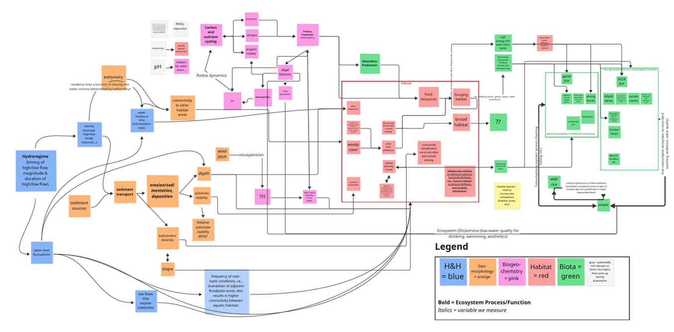
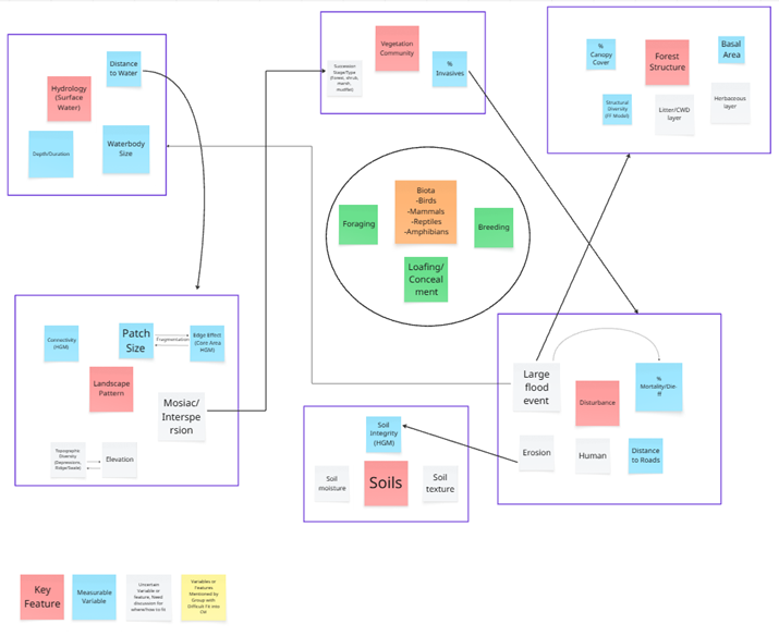
Framework for Integrating Indigenous Traditional Ecological Knowledge (ITEK) into USACE Decision Making
Fiscal Year Start: 2025; Fiscal Year Ending: 2027.
POC: Aubrey Harris (EL) and co-PI Mark Mark Gilfillan (TNTCX)
Reference SON: 2024-2106- Framework for Integrating Traditional Ecological Knowledge into Decision Making on USACE AER Studies
Factsheet
Reference SON: 2024-2106- Framework for Integrating Traditional Ecological Knowledge into Decision Making on USACE AER Studies
Lead PI(s): Aubrey Harris (EL), co-PI Mark Gilfillan (TNTCX)
Project Development Team (PDT): Scott Michael Slone (CRREL), Hailie Suk (CRREL), Judith Vendryzk (CERL)
Proponent(s)/District Collaborators: Jonathan Hallemeier (SPL)
Other Partners: Tribal Nations Technical Center of Expertise (TNTCX), Vanessa Quintana (ORISE Fellow/U of Maine graduate student)
Funded: FY25-FY27
Keywords: Indigenous traditional ecological knowledge, ITEK, TEK, knowledge co-production, restoration, valuation, socio-, ecological, technological nexus
Last updated: 09/12/2025
Framework for Integrating Indigenous Traditional Ecological Knowledge (ITEK) into USACE Decision Making
Research Need
Despite a rich body of resources for creating partnerships between western scientists and Indigenous knowledge holders (e.g., USACE Institute for Water Resources manual, Tribal Nations Technical Center of Expertise (TNTCX) initiatives, and the N-EWN Engineering with Empathy project’s relationship-building “roadmap”), a disconnect continues between high-level guidance and the operationalization of such guidance into USACE projects. While the directive to incorporate Indigenous Traditional Ecological Knowledge (ITEK) where applicable is clear, the ’how’ remains elusive. It is unclear if this gap is due to project processes and metrics, lack of participatory methods for tribal engagement, or other circumstances that make ITEK incorporation in USACE Ecosystem Restoration projects challenging.
Further, it is reasonable to expect that ITEK would influence decisions under the new Principles, Requirements, and Guidelines (PR&G) notion of “public benefit”. Although, not final, the new PR&G includes discrete focus on environmental and social outcomes to promote more holistic project planning and evaluation than its historical emphasis on National Economic Development. Integrating ITEK into USACE practice is an opportunity to improve project outcomes, enhance community buy-in, and implement the new PR&G, as ITEK is inherently place-based and promotes community values.
Inclusion of ITEK will allow USACE Districts to develop sustainable engineering solutions, increase resilience, increase social and economic benefits, and build collaborative relationships within their areas of responsibility. The incorporation of ITEK presents procedural challenges, as each Tribe, each USACE District, and therefore each partnership, will be unique.
Project Purpose & Objectives
This study will develop a framework for building stronger relationships with Tribal partners and integrating Indigenous Knowledge to achieve better ecological outcomes and more sustainable engineering solutions. The work will create a framework that recognizes there is no ‘one size fits all’ method for integrating ITEK and Western Science (WS) approaches. Current practice includes gleaning concepts from pre-existing, successful collaborations. This project will create a repository of methods and track two case studies to provide USACE Districts with examples of ITEK/WS collaborations, all of which will inform design of a framework to benefit USACE and Tribal communities. Additionally, this work will explore ways in which other cultures assign value to expand the USACE vision of what constitutes “public benefit” and how to measure it. Findings will:
- Empower USACE project teams to operationalize directives by aligning ITEK with leverage points that correlate to project planning processes (e.g., problem/opportunity definition, objective setting, alternative development, evaluation, modeling, decision-making, public dialog) and strengthen partnerships and collaboration with Tribal Partners.
- Empower Tribal partners and increase their sovereignty in USACE projects by integrating Tribal knowledge, perspectives, and sovereignty considerations throughout planning and execution.
- Bring together parallel audiences within the USACE and Tribal communities and facilitate effective dialog on co-led projects by creating a shared lexicon and framework.
Value of Research and Development (Payoff)
This research will emphasize the utility of ITEK and tribal engagement in all USACE restoration projects. Research deliverables will focus on added benefits and reduced risks that occur with proper engagement and integration of local knowledge and sensibility. The framework will ameliorate the current tension between the wisdom of policy directives and uncertainty present on-the-ground at the District level.
Planned Products and Deliverables
White Paper
- Suk, H., A.E. Harris, J. Hallemeier, S.M. Slone, B. Zettle, M. Gilfillan, V. Quintana, and J. Vendrzyk. (In Prep) Description of the data collection methods to survey the state of the practice of ITEK and USACE incorporation of ITEK. Internal Report. US Army Engineer Research and Development Center and Tribal Nations Technical Center of Expertise.
Technical Reports (TRs)
- Slone, S.M., A.E. Harris, H. Suk, J. Hallemeier, B. Zettle, M. Gilfillan, and V. Quintana. (In Prep) ITEK Vault: Developing a curated literature review Language Learning Module with Annotated Bibliography. US Army Engineer Research and Development Center and Tribal Nations Technical Center of Expertise.
- Hallemeier, J., S.M. Slone, B. Zettle, M. Gilfillan, H. Suk., A.E. Harris, V. Quintana, and J. Vendrzyk. (In Prep) State of the Practice in ITEK: USACE Surveys and Tribal Interviews. US Army Engineer Research and Development Center and Tribal Nations Technical Center of Expertise.
Technical Notes (TNs)
- Vendrzyk, J., J. Hallemeier, S.M. Slone, B. Zettle, M. Gilfillan, H. Suk, A.E. Harris, and V. Quintana. (In Prep) Valuation of ITEK outcomes and USACE Mission Areas. US Army Engineer Research and Development Center and Tribal Nations Technical Center of Expertise.
Other Reports/Models/Tools/Datasets
- Slone, S.M., A.E. Harris, H. Suk, and V. Quintana. (In Prep) ITEK Vault: Graphical User Interface. US Army Engineer Research and Development Center and Tribal Nations Technical Center of Expertise.
- Suk, H., A.E. Harris, J. Hallemeier, S.M. Slone, B. Zettle, M. Gilfillan, V. Quintana, and J. Vendrzyk. (In Planning). Framework for Integrating ITEK into USACE Aquatic Ecosystem Projects.
Conference Presentations/Webinars/Workshops
- Suk, H., M. Gilfillan, and S.M. Slone. (2025) Indigenous Ecological Knowledge: State of the Practice. EMRRP Webinar. U.S. Army Engineer Research and Development Center, Vicksburg, Mississippi.
- Gilfillan, M. and others. Draft Framework for Integrating ITEK into USACE Aquatic Ecosystem Restoration. American Indian Science and Engineering Society National Conference (2026) and/or Native American Fish and Wildlife Society Conference (Future work --2026)
- Harris, A. and others. Framework for Integrating ITEK into Aquatic Ecosystem Restoration. National Conference on Ecosystem Restoration (Future work -- 2027)
Communication (Social Media, Videos, Podcasts, Photos, etc.)
- Zettle, B., M. Gilfillan, H. Suk, A.E. Harris, J. Hallemeier, V. Quintana, and J. Vendrzyk. (Future Work). Webinar and Training Materials to Support USACE integrating ITEK into Aquatic Ecosystem Projects.
Images
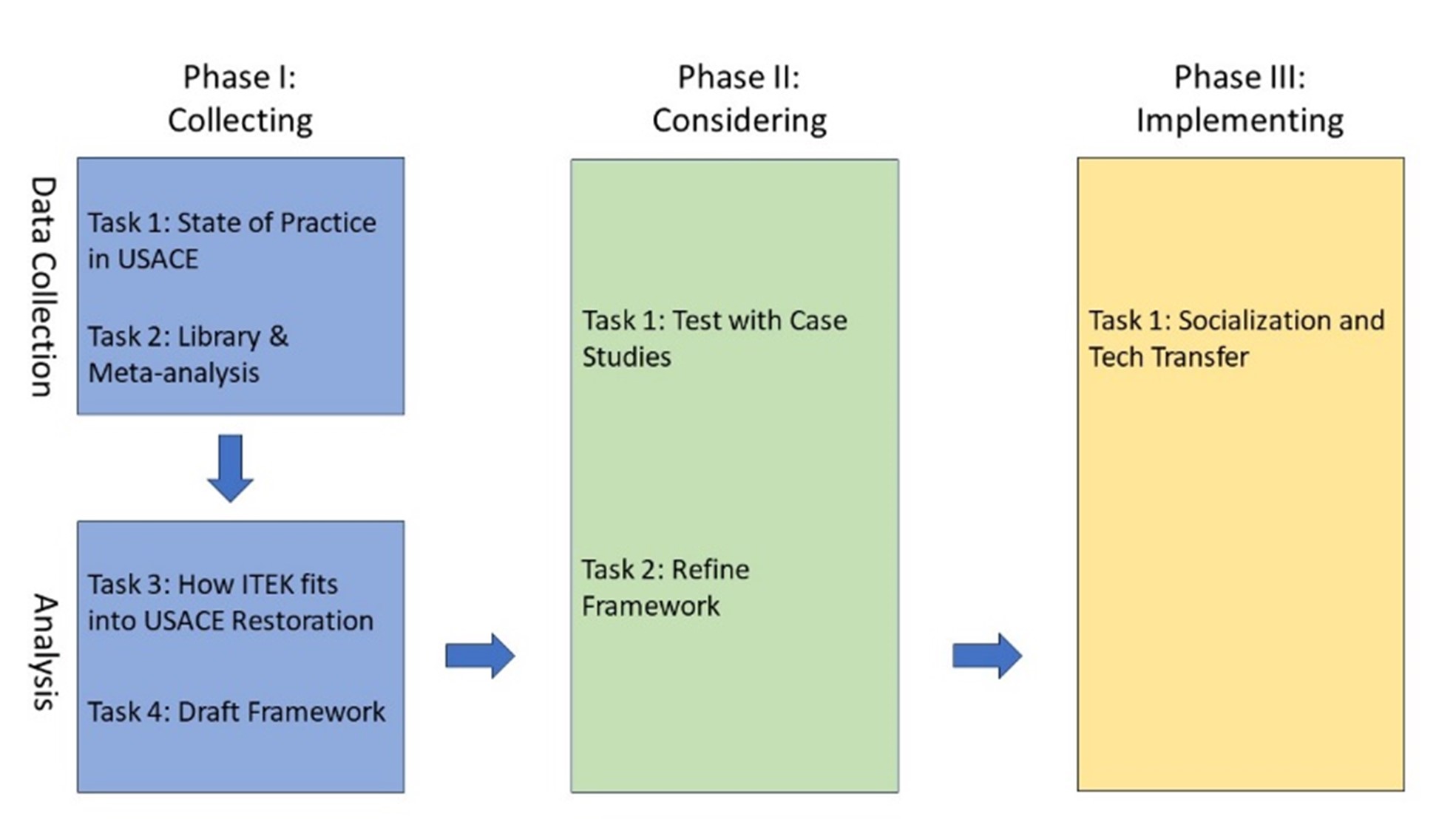
Advancing Environmental Evaluation Capabilities for Sustainable Sediment Management
Fiscal Year Start: 2025; Fiscal Year Ending: 2027.
POC: Darixa Hernandez-Abrams (ERDC) and Aubrey Harris (ERDC)
Reference SON: 2023-1957 - Evaluation Tools for Comprehensive Analysis of Sustainable Sediment Management and Ecological Impacts
Factsheet
Reference SON: 2023-1957 - Evaluation Tools for Comprehensive Analysis of Sustainable Sediment Management and Ecological Impacts
Lead PI(s): Darixa Hernandez-Abrams (ERDC); Aubrey Harris (ERDC)
Project Development Team (PDT): Garrett Menichino/Samantha Wiest/ Susan Bailey/Phil Gidley (ERDC)
Proponent(s)/District Collaborators: Paul Boyd (NWO), Laura Totten (NWK), Chris McGibbon/Jonathan Aubuchon (SPA), Trey Crouch/Betsy Summers (NWP)
Other Partners: Melissa Foster/Jennifer Bountry (USBR), Keith Gido/Trisha Moore/Logan Rowley (KSU), John Shelley (Sedimentation Institute)
Funded: FY25-FY27
Keywords: Reservoir sedimentation, Sustainable sediment management, Geomorphic change, Ecological forecasting, Water injection dredging
Last updated: 09/19/2025
Advancing Environmental Evaluation Capabilities for Sustainable Sediment Management
Research Need
USACE operates approximately 740 dams across the nation. Many U.S. reservoirs have reduced storage capacity and are approaching their economic design life due to sediment trapping and accumulation1. Dams disrupt sediment continuity and hydrologic regimes in rivers resulting in geomorphic and ecological effects on downstream ecosystems2,3. Both reservoir design life and ecosystem health could benefit from restoring sediment continuity through reservoirs. However, there is a need to better understand both the potential benefits and impacts of downstream sediment release4. Uncertainty and lack of capability to predict environmental impacts present a barrier to practitioners for implementing management techniques that release sediment downstream.
In order to inform regulatory compliance and facilitate planning for sustainable reservoir management, tools linking geomorphic change to water quality and ecological processes are needed.
Project Purpose & Objectives
This project will expand USACE capabilities to assess ecological outcomes in response to hydrogeomorphic changes resulting from sustainable sediment management practices. The project builds on a previous effort - Ecological Effects of Reservoir Sediment Release. Several deliverables are proposed for this project:
- Synthesize a library of references, case studies and tools related to sustainable sediment management; develop and document a web-based app to collate sources and identify key aspects of sediment management decisions.
- Compile data from existing projects for validation of a model linking physical and ecological parameters.
- Conduct workshop with practitioners and researchers to gather feedback for model development and approach.
- Develop a numerical model for a specific case study linking physical and ecological parameters to assess impacts and benefits of sediment release; use data compiled from existing projects for validation and refinement for submission to ECO-PCX for review and certification.
- Present model development through written documentation, conferences and webinars and develop training modules on developing linked physical and ecological models relevant to sediment release management alternatives.
Value of Research and Development (Payoff)
Sedimentation issues faced by USACE Districts will continue to worsen if not addressed promptly. Developing tools to assess impacts and benefits of sediment management strategies will inform USACE regulatory and feasibility studies and provide capabilities to restore reservoir benefits while providing opportunities to restore sediment regimes in sediment starved systems. This research will place USACE at the forefront of sustainable sediment management.
Products and Deliverables
Technical Notes (TNs)
- Harris, A.E., G. Menichino, D.D. Hernández-Abrams, and S.E. Bailey. (in prep.). Web application user’s guide for advancing ecological effect evaluation of sediment release (ERDC/TN EMRRP-??-??), Technical Note. U.S. Army Engineer Research and Development Center, Vicksburg, Mississippi.
Other Reports/Models/Tools/Datasets
- Menichino, G.T. (2025). Reservoir Sustainable Sediment Tool (RESST). Web App. U.S. Army Engineer Research and Development Center, Vicksburg, Mississippi. https://experience.arcgis.com/experience/b1eec438459e45c284df2fcf89e5d8e0.
Conference Presentations/Webinars/Workshops
- Harris, A.E., D.D. Hernández-Abrams and G.T. Menichino. (2025). Assessing Ecological Effects of Sediment Release, EMRRP Webinar. U.S. Army Engineer Research and Development Center, Vicksburg, Mississippi.
Communication (Social Media, Videos, Podcasts, Photos, etc.)
- Tuttle Creek Lake, U.S. Army Corps of Engineers Facebook page: https://www.facebook.com/USACETuttle/.
- News Release: Innovative Water Injection Dredging pilot project set to begin Sept. 17 at Tuttle Creek Lake. Kansas City District, Published Sept. 11, 2025. https://www.nwk.usace.army.mil/Media/News-Releases/Article/4301353/innovative-water-injection-dredging-pilot-project-set-to-begin-sept-17-at-tuttl/.
In-text Citations
- 1Randle, T., Morris, G., Whelan, M., Baker, B., Annandale, G., Hotchkiss, R., ... and Tullos, D. (2019). Reservoir sediment management: building a legacy of sustainable water storage reservoirs. National reservoir sedimentation and sustainability team white paper, 57.
- 2Graf, W. L. (2006). “Downstream hydrologic and geomorphic effects of large dams on American rivers”. Geomorphology, 79(3-4), 336-360.
- 3Kondolf, G. M., Gao, Y., Annandale, G.W., Morris, G.L., Jiang, E., Zhang, J., Cao, Y., Carling, P., Fu, K., Guo, Q., Hotchkiss, R., Peteuil, C., Sumi, T., Wang, H., Wang, Z., Wei, Z., Wu, B., Wu, C., and Yang, C.T. (2014) “Sustainable Sediment Management in Reservoirs and Regulated Rivers: Experiences from Five Continents.” Earth’s Future, 2:5, pp. 256-280.
- 4Juracek, K. E. (2015). “The aging of America's reservoirs: in‐reservoir and downstream physical changes and habitat implications”. JAWRA Journal of the American Water Resources Association, 51(1), 168-184.
Images
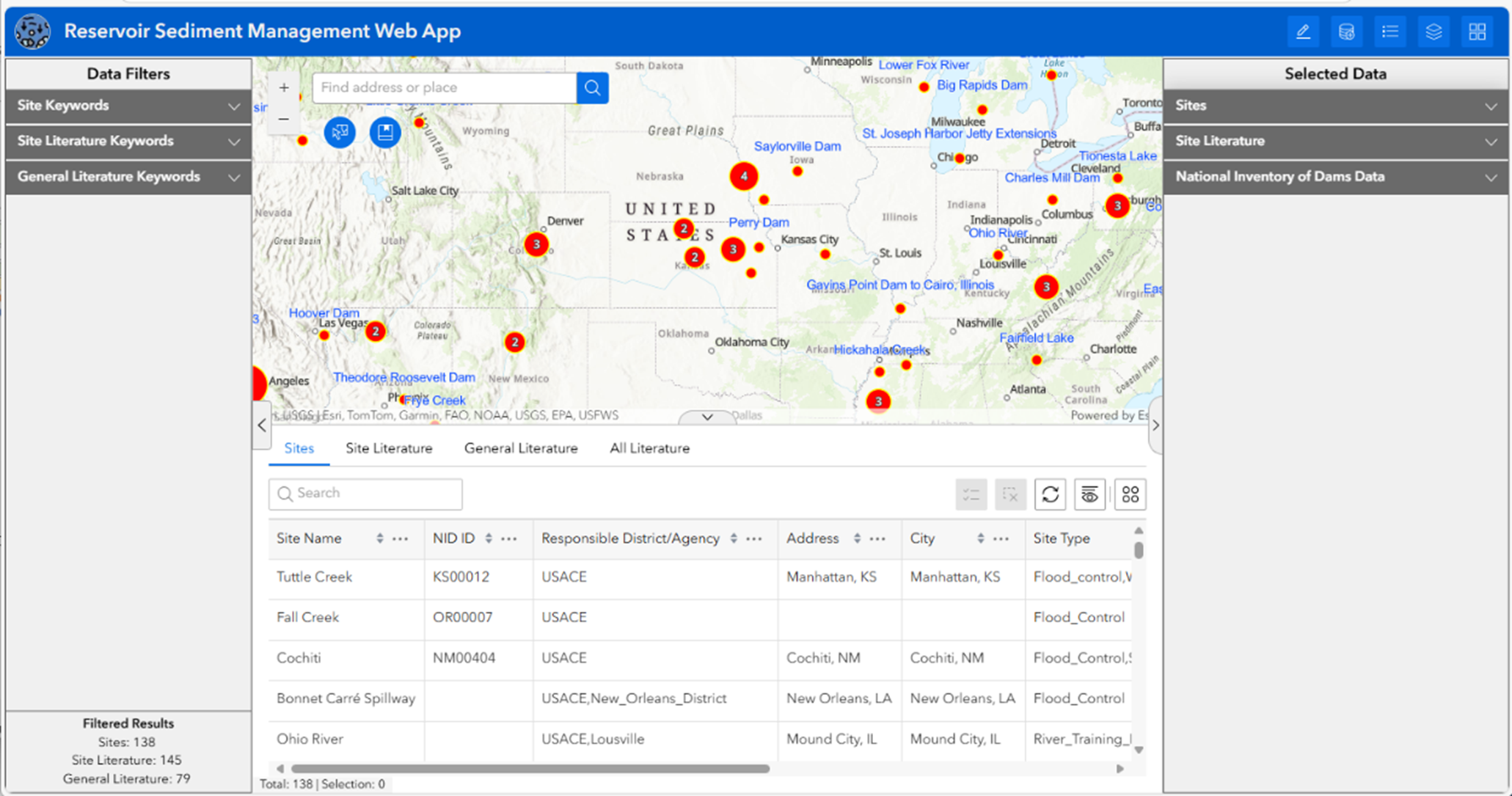
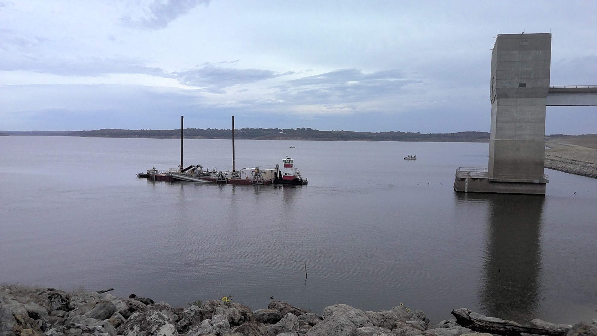
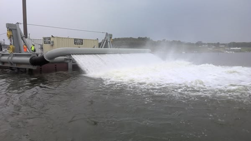
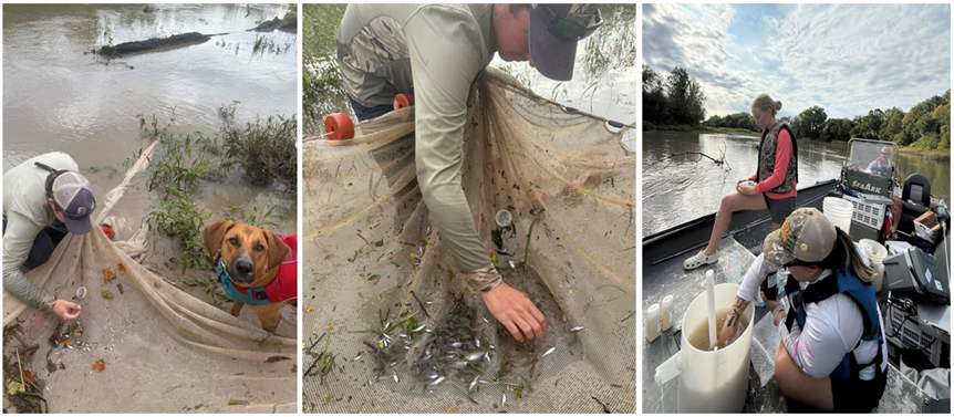
Emerging approaches for USACE Ecological Modeling
Fiscal Year Start: 2023; Fiscal Year Ending: 2026.
POC: Todd M. Swannack and Darixa Hernandez-Abrams (ERDC-EL)
Reference SON: SON 2020-1227
Factsheet
Reference SON: SON 2020-1227
Lead PI(s): Todd M. Swannack, Darixa Hernandez-Abrams (ERDC-EL)
Project Development Team (PDT): Harris, Menichino, Stowe, Quintana, Cushway, Juman
Proponent(s)/District Collaborators: Kat McCain (Eco-PCX), Nathan Kempf, Rodrigo Sedeno, Hira Walker (Albuquerque), Mick Porter (Sacramento), Jesse Miller (New York), Michael Dougherty (Rock Island), Angie Sowers (Baltimore), Danny Allen (Fort Worth), Kip Runyon (ret.)
Other Partners: Katie Irving (SCCWRP), Kate Buenau (PNNL), Jeff Janvrin (WI-DNR), Nicole Ward (MN-DNR), Charles Yackulic, Jeff Hauser (USGS), Thomas Archdeacon (USFWS), Mike Hatch (NM State Univ), Phaedra Budy (Utah State), Lynette Gieson (USBR), Eric Gonzales (USBR), Cait Rottler (West Consulting)
Funded: FY23-FY26
Keywords: ecological models, population modeling, agent-based models, machine learning
Last updated: 11/03/2025
Emerging approaches for USACE Ecological Modeling
Research Need
USACE projects directly influence a diversity of ecological outcomes such as restoration of habitat, impacts to imperiled species populations, movement of migratory organisms, and nutrient dynamics. However, assessments of ecological outcomes typically focus on habitat impacts and benefits (often with 30–40-year-old USFWS “blue book” models). Although habitat models are useful in many contexts and applications, ecological modeling methods have grown to include dozens of approaches that could improve USACE project outcomes from planning through operation. Specifically, these tools often more directly measure project objectives and may improve communication regarding restoration benefits. This study examines a variety of ecological modeling approaches that would help USACE improve decision-making and better “tell the story” of its restoration programs.
Project Purpose & Objectives
This project will compile and demonstrate ecological modeling tools in the context of USACE studies and actions, specifically:
- Provide recommendations that may improve the use of ecological models in project planning
- Review key modeling approaches and demonstrate techniques with ongoing USACE restoration projects.
- Provide advanced ecological modeling training.
Value of Research and Development (Payoff)
The USACE state-of-practice for ecological models undeniably emphasizes habitat models applied in a static environment with traditional approaches for documentation. This project looks to provide recommendations to improve ecological modeling practices within USACE, provides concrete examples of applications of these tools, and gives USACE practitioners guidance on application of novel methods and techniques. The study not only develops methods that may improve USACE modeling but also provides methods for more directly measuring ecological outcomes associated with USACE projects.
Products and Deliverables
Journal Articles (JAs)
- Irving K., R. Mathwin, C. Kotalik, J.A. Webb, D.M. Walters, S.E. Lovett, S.K. McKay, C. Torrens, J. Olson, and El Z. Jack. Adaptive modeling to inform environmental management. Submitted to Frontiers in Ecology and the Environment.
- Quintana, V.M., J. Galaitsi, A. Jacobs, A. DuPuy, S.K. McKay, K. Huguenard, and T. Swannack. 2024. Weaving Traditional Ecological Knowledge into Ecological Modeling. Manuscript in preparation.
- Quintana, V.M. Journal Paper: Participatory Science from Workshop. (Manuscript 50% drafted; anticipated FY26)
- Stowe, S.G. 2025. Rio Grande Silvery Minnow Recruitment Model. (Manuscript drafted; anticipated FY26)
- Stowe, E. Machine Learning for Ecological Modeling: Upper Mississippi River Restoration Case-Study. (anticipated FY26)
Technical Reports (TRs)
- Stowe, S.G., D.D. Hernandez-Abrams, A.E. Harris, T.M. Swannack, K.E. Buenau, K. Irving, S. Jumani, M.D. Porter, V.M. Quintana, M.P. Dougherty, K.N.S. McCain, K.R. Runyon, D.L. Smith, and S.K. McKay. Exploring the Application of Novel Ecological Modeling Approaches and a Path to Future USACE Practice: RoadMap. Technical Report. U.S. Army Engineer Research and Development Center, Vicksburg MS. In management review.
- Quintana, V.M., K. Huguenard, J. Stevens, J. Galaitsi, A. Jacobs, and S.K. McKay. 2024. River Herring Habitat in the Eastern United States. In preparation.
Other Reports/Models/Tools/Datasets
- McKay, S.K., D.D. Hernández-Abrams, and K.C. Cushway. Package ‘ecorest’. Version 2.0.1. CRAN Reference Manual, 2025.
- Stowe, E., D.D. Hernández-Abrams, A.E. Harris, T.M. Swannack, and S.K. McKay. 2024. Emerging Ecological Modeling Approaches to Benefit USACE Projects. White paper. U.S. Army Corps of Engineers, Engineer Research and Development Center, Environmental Laboratory.
Models
- 2D Hydraulic models for San Acacia, Isleta and Angostura Rio Grande reaches. Model purpose: outcomes used for hydrological and flow augmentation scenarios in Silvery Minnow Population model. Hydraulic models lead by Harris. (100% completed; certification not required)
- Stowe, E. 2025. Rio Grande Silvery Minnow Recruitment/Population Model. Model purpose: to estimate Rio Grande Silvery Minnow recruitment under different hydrologic, restoration and management scenarios. (100% completed; not certified)
- Quintana, V. Habitat model: Contamination Risk Across Anadromous Fish Life Stages (100% completed; not certified)
- Quintana, V. Habitat model: River Herring. (90% completed)
- Quintana, V. Agent-Based Model: Anadromous Fish Mercury Exposure Pathways. (50% completed)
- Quintana, V. Github/Netlogo model library Anadromous Fish Behaviors and Processes (50% completed)
Interactive Modeling Web-tools
- Quintana, Vanessa, Katie Huguenard, John Stevens, James Galaitsi, Andrew Jacobs, and Kyle McKay. River Herring Ecological Modeling. Shiny web application (Under THPO review).
- Stowe, S. G. 2025. Rio Grande Silvery Minnow Recruitment Model. Shiny web application. https://wrises.shinyapps.io/rgsm-recruit/
Online Training Material
- Quintana, Vanessa. 2025. GitHub Skill Building Tutorials for Students & Researchers. https://usace-wrises.github.io/USACE.EcoMod.Training/
- Stowe, S. G. 2025. USACE Ecological Modeling Training. https://usace-wrises.github.io/USACE.EcoMod.Training/
Conference Presentations/Webinars/Workshops/Demos
- Emerging Modeling Approaches and the USACE. 2023. Workshop, ERDC, Vicksburg, MS
- Quintana, V. 2025. River Herring Population Model: Developing ecological models for adaptive management in Aquinnah, Martha's Vineyard. EMRRP Webinar.
- Quintana, V. 2025. Agent-Based Modeling Workshop. University of Maine.
- Stowe, E. 2024. Rio Grande Fish Modeling: Integrating hydraulic analyses and population models to predict ecological effects of floodplain restoration for the Rio Grande Silvery Minnow. EMRRP Webinar.
- Stowe, E. Machine Learning for Ecological Modeling: Upper Mississippi River Restoration Case-Study. EMRRP Webinar (anticipated FY 2026).
- Stowe, E. Machine Learning for Ecological Modeling: Upper Mississippi River Restoration Case-Study. Demo (anticipated FY 2026; 75% completed; practice run demonstrated to WRISES Team Oct FY26).
Communication (Social Media, Videos, Podcasts, Photos, etc.)
Images


Establishing Sustainable Aquatic Vegetation Communities in Rivers and Reservoirs
Fiscal Year Start: 2025; Fiscal Year Ending: 2028.
POC: Lynde Dodd (EL) and Emily Russ (EL)
Reference SON: 2024-2109 Aquatic plant restoration threshold identification & 2024-2112 River and reservoir aquatic plant restoration and establishmentson
Factsheet
Reference SON: 2024-2109 Aquatic plant restoration threshold identification & 2024-2112 River and reservoir aquatic plant restoration and establishment
Lead PI(s): Lynde Dodd (EL) and Emily Russ (EL)
Project Development Team (PDT): Todd Slack (EL), Miranda Goss (EL), Nicky Faucheux (EL), David Ruppel (EL), Jay Collins (EL), Aaron Schad (EL)
Proponent(s)/District Collaborators: Mark Cornish (MVP), Collin Moratz (MVP), Jon Lane (SAJ), Nick Wilson (SWF)
Funded: FY25-FY28
Keywords: Aquatic vegetation, river and reservoir systems, restoration, revegetation, scaling-up, herbivory
Last updated: 09/18/2025
Establishing Sustainable Aquatic Vegetation Communities in Rivers and Reservoirs
Research Need
Aquatic ecosystem restoration (AER) projects are necessary to overcome environmental impacts and restore native aquatic vegetation on USACE-managed reservoirs and rivers. The current paradigm is to establish small-scale, protected (from direct biotic disturbance and herbivores) plant colonies, which will contribute to seed and tuber banks and produce propagules to promote recruitment at broader spatial scales. However, factors limiting spread and recruitment at active restoration sites are poorly understood, increasing uncertainty for large-scale implementation.
Current restoration strategies need further refinement to better understand how to overcome biotic and abiotic factors inhibiting recruitment and spread across a larger landscape. Knowledge gaps exist in identifying thresholds (not just factors) that must be overcome to establish sustainable aquatic vegetation communities arising from AER efforts.
Project Purpose & Objectives
The proposed project aims to identify thresholds required to scale-up aquatic vegetation establishment efforts to a broader landscape through the following approach:
- Identify factors that limit scaling-up aquatic plant establishment efforts related to biotic disturbance impacts (benthic feeding or fish nesting activities) compared to direct grazing/herbivory; and abiotic impacts (water level fluctuations, water clarity, prolonged inundation/ desiccation),
- Evaluate methods experimentally to determine thresholds,
- Demonstrate methods in the field.
Value of Research and Development (Payoff)
This work will help establish restoration methods that are resistant and resilient to biotic and abiotic factors limiting large scale revegetation to improve design and operation of aquatic vegetation management, reduce overall project costs, and minimize technical and ecological risk over the life of the project.
Products and Deliverables
Journal Articles (JAs)
- Goss, M., L. Dodd, T. Slack, N. Faucheux, D. Ruppel, J. Collins, and A. Schad. (In preparation). Identifying Thresholds to Improve Methods to Establish Native Aquatic Vegetation.
Technical Reports (TRs)
- Dodd, L., E. Russ, T. Slack, M. Goss, N. Faucheux, D. Ruppel, and A. Schad. (In preparation). Guidance for establishing sustainable submersed and emergent aquatic vegetation communities in rivers and reservoirs, Technical Report. U.S. Army Engineer Research and Development Center, Vicksburg, Mississippi.
Other Reports/Models/Tools/Datasets
- Dodd, L., E. Russ, T. Slack, M. Goss, N. Faucheux, D. Ruppel, and A. Schad. (In preparation). Identifying knowledge gaps in establishing native aquatic vegetation in rivers and reservoirs, Special Report. U.S. Army Engineer Research and Development Center, Vicksburg, Mississippi.
- Dodd, L., T. Slack, M. Goss, N. Faucheux, D. Ruppel, and A. Schad. (In preparation). Annual report on Year 2 study findings and activities: Field and mesocosm studies to identify thresholds to improve methods to establish native aquatic vegetation, Project Report. U.S. Army Engineer Research and Development Center, Vicksburg, Mississippi.
- Goss, M., L. Dodd, T. Slack, N. Faucheux, D. Ruppel, and A. Schad. (In preparation). Mesocosm experiment to determine flood and desiccation, and herbivore tolerance of establishing macrophytes. Dataset, U.S. Army Engineer Research and Development Center, Vicksburg, Mississippi.
- Slack, T., M. Goss, N. Faucheux, D. Ruppel, J. Collins, A. Schad, and L. Dodd. (In preparation). Faunal surveys of active aquatic plant restoration sites. Dataset, U.S. Army Engineer Research and Development Center, Vicksburg, Mississippi.
Conference Presentations/Webinars/Workshops
- Dodd, L., E. Russ, T. Slack, M. Goss, N. Faucheux, D. Ruppel, and A. Schad. (In preparation). Benefits and challenges of active restoration of emergent and submersed aquatic vegetation efforts in rivers and reservoirs. Workshop. U.S. Army Engineer Research and Development Center, Vicksburg, Mississippi.
- Dodd, L., E. Russ, T. Slack, M. Goss, N. Faucheux, D. Ruppel, and A. Schad. (In preparation). Findings of technical development workshop: Benefits and challenges of active restoration of emergent and submersed aquatic vegetation efforts in rivers and reservoirs. Webinar. U.S. Army Engineer Research and Development Center, Vicksburg, Mississippi.
- Dodd, L., E. Russ, T. Slack, M. Goss, N. Faucheux, D. Ruppel, and A. Schad. (In preparation). Field demonstration: Guidance for establishing sustainable submersed and emergent aquatic vegetation communities in rivers and reservoirs. Workshop. U.S. Army Engineer Research and Development Center, Vicksburg, Mississippi.
Identifying Opportunities and Guidance for BUDM to Promote SAV Resilience
Fiscal Year Start: 2024; Fiscal Year Ending: 2026.
POC: Elizabeth Holzenthal (CHL) and Emily Russ (EL)
Reference SON: 1947 BUDM Tampa Bay & 1933 Great Lakes BUDM
Factsheet
Reference SON: 1947 BUDM Tampa Bay & 1933 Great Lakes BUDM
Lead PI(s): Elizabeth Holzenthal (CHL) and Emily Russ (EL)
Project Development Team (PDT): Thomas Huff (EL), Dylan Robinson (CHL), Sean McGill (CHL)
Proponent(s)/District Collaborators: Monica Chasten (NAP), Alex Renaud (NAP), Laurel Reichold (SAJ-RSMX), Chanda Littles (NWP), Julie Beagle (SPN)
Funded: FY24-FY26
Keywords: Submerged Aquatic Vegetation (SAV), Beneficial Use of Dredged Material (BUDM), geospatial analysis, guidance framework
Last updated: 09/18/2025
Identifying Opportunities and Guidance for BUDM to Promote SAV Resilience
Research Need
Historical negative impacts from dredging and placement in and around submerged aquatic vegetation (SAV) habitats (i.e., plant removal, burial, increased turbidity; Erftemeijer and Robin Lewis, 2006) have limited the opportunities for beneficial use of dredged material (BUDM) to restore these ecologically critical, federally protected habitats, despite their growing disappearance due to changing conditions and increased anthropogenic disturbances (Waycott et al., 2009). However, recent monitoring of SAV habitat response to co-located or nearby BUDM placement indicates that the long-term (3-5+ years) gains in SAV habitat health/coverage outweigh any short-term (days-weeks) impacts to water quality (e.g., Russ et al., 2023 and Figure 1). In a recent workshop, USACE practitioners identified multiple ways ERDC can help overcome the inertia surrounding BUDM for SAV, including facilitation, tool development, educational resources, and monitoring support (Russ et al. 2025).
Project Purpose & Objectives
This project seeks to address the gap in resources that collectively illustrate the purpose, benefits, and best practices of BUDM placement for SAV. The deliverables proposed for this project include:
- Synthesize literature, PDT insights, and data (where available) to clearly articulate the benefits and value added/saved by implementing BUDM for SAV habitat.
- Develop a geospatial framework to identify light-limited areas of coastal inlet/estuary where BU lift could create suitable SAV habitat.
- Apply framework at test site(s) and document key findings, best practices, data/information gaps, and future directions. Present findings via ArcGIS Knowledge Hub, webinars, conference presentations, written publications (Technical Documents and journal article.
Value of Research and Development (Payoff)
The value of the proposed geospatial framework and knowledge hub includes a potential increase in BUDM by Districts, resulting in reduced navigation costs and time by decreasing dredged material transport distance (and rehandling) by utilizing nearby open water placement sites instead of upland CDFs, and reduced maintenance dredging costs by reducing shoaling due to increased sediment stability within the SAV beds. SAV species are also highly valued for the many economic, ecological, and cultural services that they provide, including shelter for fisheries and improving ambient water quality (Barbier et al., 2011; Sherman and DeBrukeyre, 2018).
Products and Deliverables
Technical Notes (TNs)
Initial Geospatial Framework TN
- Holzenthal, E.R., E.R. Russ, K. Richards, S.P. McGill, D.M. Robinson, and T.P. Huff. (2025). Light Availability Calculator for Identifying Suitable Habitat for Light-Limited Aquatic Vegetation. ERDC-TN EMRRP-RQ-4. Vicksburg, MS: US Army Engineer Research and Development Center, Coastal and Hydraulics Laboratory. https://dx.doi.org/10.21079/11681/49919
Geospatial Tool User Feedback TN (FY26 deliverable)
- Russ, E., E. Holzenthal, and T. Huff. (est. Sep 2026). Light Availability Calculator: User Feedback and Future Directions. ERDC-TN EMRRP-XX-X.
Final Tool Documentation (FY26 deliverable)
- Huff, T., E. Russ, and E. Holzenthal. (est. Sep 2026). Light Availability Calculator: Updates to Geospatial Tool. ERDC-TN EMRRP-XX-X.
Conference Presentations/Webinars/Workshops
ASBPA Conference Presentation
- Robinson, D., E. Holzenthal, and S. McGill. “Development and Validation of an ADCIRC Model for Barnegat Bay, NJ to Predict Optimal Locations for Submerged Aquatic Vegetation Habitat for a Range of Sea Level Rise Scenarios.” American Shore and Beach Preservation Association (ASBPA) 2024 National Coastal Conference.
Initial Geospatial Framework Demo
- Russ, E., E. Holzenthal, and S. McGill. “Light Availability Calculator: Scientific basis, demo, and assumptions and limitations.” EMRRP Webinar. March 2025.
Final Tool Webinar (FY26 deliverable)
- Huff, T., E. Russ, and E. Holzenthal. “Light Availability Calculator: Updates to Geospatial Tool and Future Directions.” EMRRP Webinar. Q4 2026.
Works Cited
- Barbier, E.B., S.D. Hacker, C. Kennedy, E.W. Koch, A.C. Stier, and B.R. Silliman. (2011). The value of estuarine and coastal ecosystem services. Ecological monographs, 81(2), 169-193.
- Erftemeijer, P.L.A.; Robin Lewis, R.R. Environmental impacts of dredging on seagrasses: A review. March Pollut. Bull. 2006, 52, 1553–1572, doi:10.1016/j.marpolbul.2006.09.006.
- Russ, E.R., Yarnall, A.H., and Altman, S. 2023. Dredged Material Can Benefit Submerged Aquatic Vegetation (SAV) Habitats. ERDC/TN EWN-23-1. Vicksburg, MS: US Army Engineer Research and Development Center– Environmental Laboratory
- Sherman, K., & DeBruyckere, L.A. (2018). Eelgrass habitats on the US West Coast: State of the knowledge of eelgrass ecosystem services and eelgrass extent. Tech. rep.
- Waycott, M., C.M. Duarte, T.J.B. Carruthers, R.J. Orth, W.C. Dennison, S. Olyarnik, A. Calladine, et al. 2009. “Accelerating Loss of Seagrasses across the Globe Threatens Coastal Ecosystems.” Proc. Natl. Acad. Sci. U. S. A. 106:12377–381. doi:10.1073/pnas.0905620106.
Communication (Social Media, Videos, Podcasts, Photos, etc.)
Images
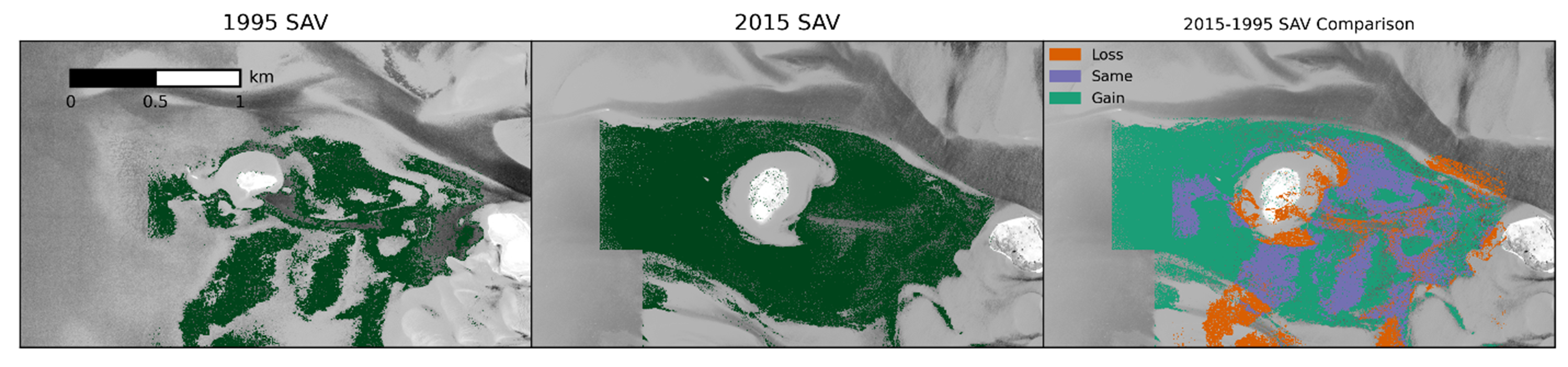
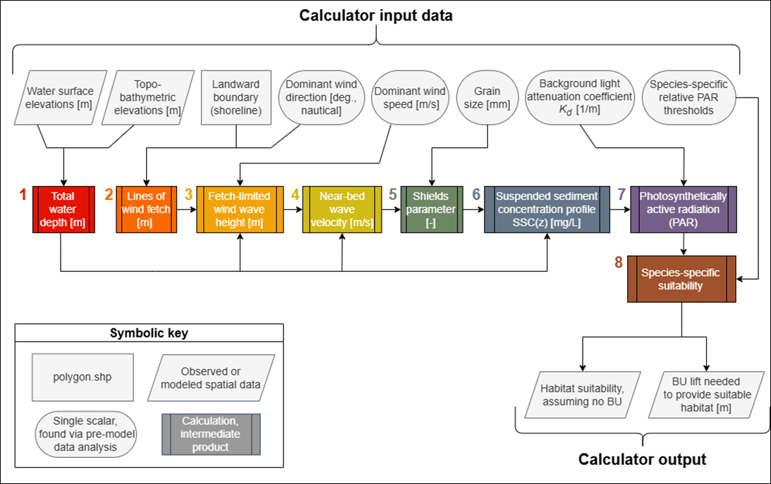
| 49.2% total accuracy | SAV presence (obs) | ||
|---|---|---|---|
| 96.8% SAV-suit. overlap | True | False | |
| Suitability (predicted) | True | 13.9% (TP) | 50.4% (FP) |
| False | 0.5% (FN) | 35.2% (TN) | |
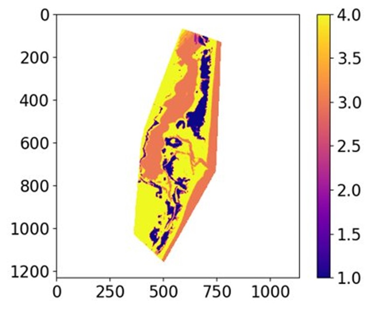

Identifying the Influence of Soil Conditions and Site Placement on Beneficial Use Floodplain Forest Restoration Design and Outcomes
Fiscal Year Start: 2024; Fiscal Year Ending: 2026.
POC: Nia R. Hurst (ERDC)
Reference SON(s): 2023-1897/1909
#1909: Land Cover Associations on Sites Constructed using Dredged Material
#1897: Physical and Biological Soil Characteristics Influencing Floodplain
Factsheet
Reference SON(s): 2023-1897/1909
#1909: Land Cover Associations on Sites Constructed using Dredged Material
#1897: Physical and Biological Soil Characteristics Influencing Floodplain Forest Restoration Success
Lead PI(s): Nia R. Hurst (ERDC)
Project Development Team (PDT): Carina Jung (ERDC)
Proponent(s)/District Collaborators: Aaron McFarlane (MVP), Andy Meier (MVP), Lewis Wiechmann (MVP), Benjamin Vandermyde (MVR), Robert Cosgriff (MVS)
Funded: FY24-FY26
Keywords: Floodplain Forest Restoration, Beneficial Use, Dredged Sediment, Upper Mississippi River System
Last updated: 09/16/2025
Identifying the Influence of Soil Conditions and Site Placement on Beneficial Use Floodplain Forest Restoration Design and Outcomes
Research Need
Floodplain forests across the U.S. have significantly declined due to historic harvest, riverine management, and both agricultural and urban development. The USACE management of river systems and availability of dredged sediment provides opportunities for floodplain forest restoration, where dredged sediment can be beneficially used (BU) to offset forest loss by constructing islands to restore geomorphic diversity. USACE districts in the Upper Mississippi River System (UMRS) have spent millions creating floodplain forest islands and planting desirable tree species, but achieving consistent vegetative success has proven difficult and numerous sites fail to meet restoration goals.
Opportunities to investigate the influencing characteristics of dredged sediment placement sites and soil properties on floodplain vegetation outcomes are needed to inform and improve the restoration success of floodplain forest creation projects across the USACE.
Project Purpose & Objectives
The project will: 1) Identity the soil physical, chemical, and biological properties in created floodplain forests that promote vegetation restoration success and, 2) Determine land cover associations between floodplain vegetation and placement site geomorphic characteristics to better predict long-term vegetative outcomes.
Primary project objectives are to:
- Develop a comprehensive geodatabase of dredged sediment placement and BU restoration sites within the UMRS.
- Evaluate land cover associations of placement sites to identify historic site characteristics that influence present vegetation communities.
- Assess floodplain vegetation health in relation to soil physical, chemical, and microbial properties to identify soil conditions that promote successful floodplain forest development.
- Provide recommendations on design criteria for floodplain forest creation.
Value of Research and Development (Payoff)
- Provide guidelines and refine design criteria for the successful creation of floodplain forest islands.
- Better anticipate near, future, and long-term project outcomes based on current available data.
- Predict the development of desired vegetation in BU floodplain creation projects, saving millions in project costs and adaptive management.
- Support ecosystem, navigation, and flood risk management benefits, helping create a more resilient floodplain system.
Products and Deliverables
Journal Articles (JAs)
- Influence of site placement characteristics on BU floodplain vegetation outcomes. 2026. Soil Science Society of America Journal.
Technical Reports (TRs)
- Recommendations for Successful Floodplain Forest Establishment and Development through the Beneficial Use of Dredged Material. 2026.
Other Reports/Models/Tools/Datasets
- Geodatabase of BU Sites in the UMRS. 2026.
- UMRS Soil/Vegetation Field Database. 2026.
- Field data for soil and vegetation sampling results will be incorporated into the BU geodatabase. Data will also be provided as appendices/supplementals to Tech Reports/Journal Articles and as spreadsheets for reference in the geodatabase.
Conference Presentations/Webinars/Workshops
- UMRS BU Floodplain Forest Restoration Workshop. 2024.
- Enhancing Carbon Storage Through the Beneficial Use of Dredged Sediment. Soil Science Society of America International Meeting. 2024.
- Soil Physical, Microbial, and Chemical Characteristics Influencing Floodplain Forest Resilience and Restoration Success. Soil Science Society of America International Meeting. 2026.
- Upper Mississippi Conservation Committee (UMRCC) Presentation. 2026.
- “Utilizing UMRS BU Database for Project Outcomes”. Webinar. 2026.
- “Influence of site placement characteristics on the trajectory of BU floodplain forest creation projects”. Webinar. 2026.
Communication (Social Media, Videos, Podcasts, Photos, etc.)
- PAO video for release. 2025.
Images
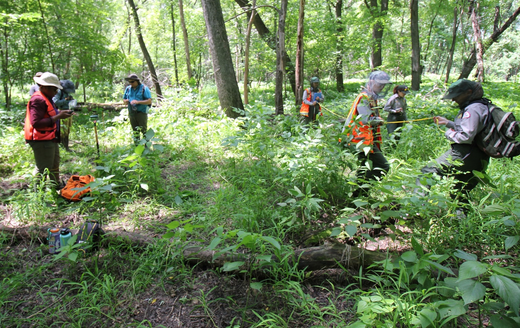
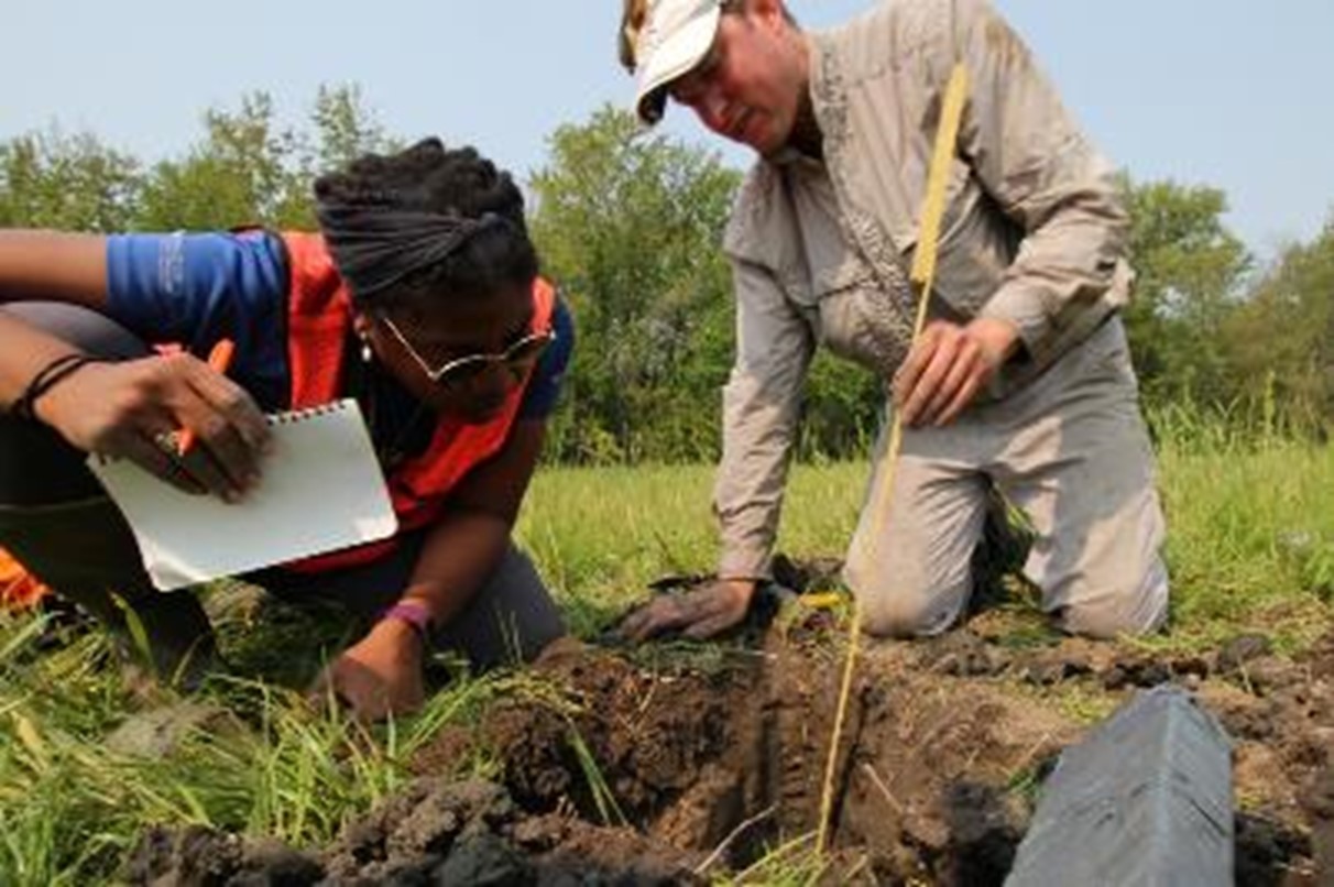
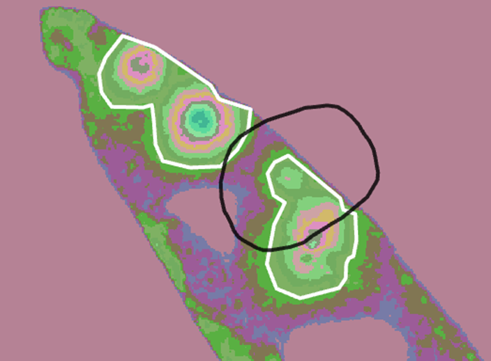
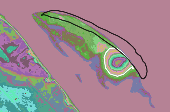
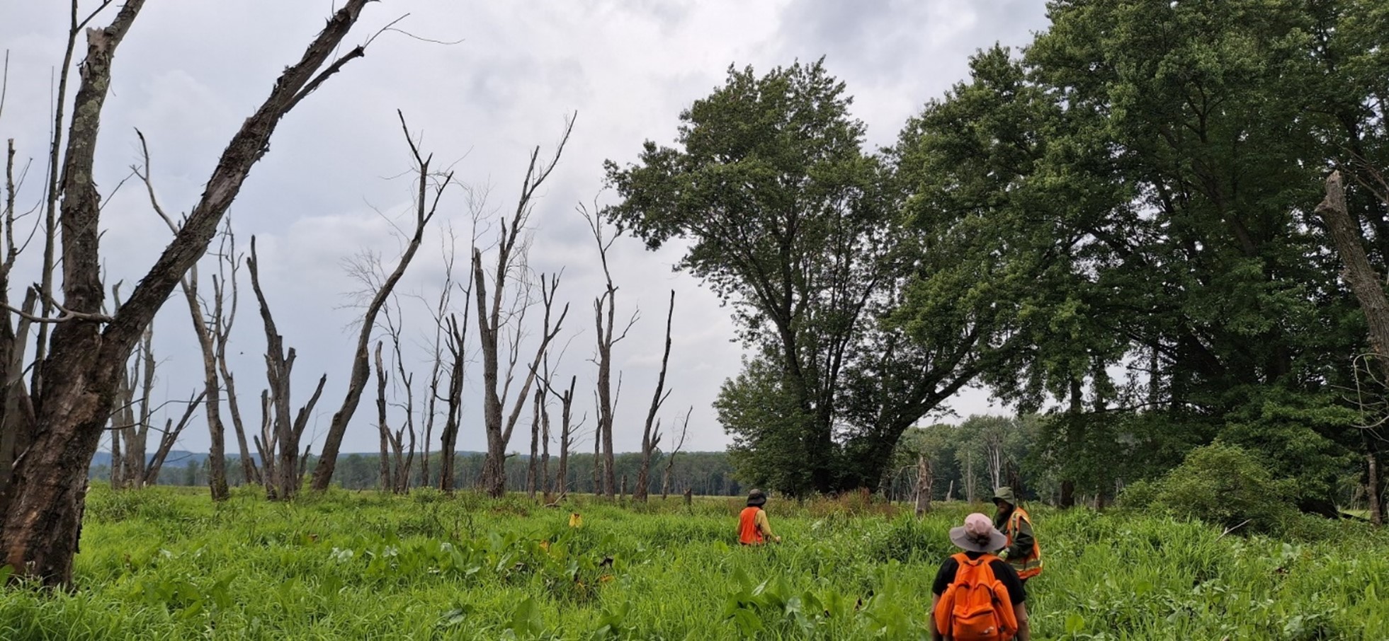
Improvement of Pollinator Habitat on USACE Levees via Pollinator-facilitating Seed Mixtures and eDNA Analysis
Fiscal Year Start: 2024; Fiscal Year Ending: 2029.
POC: Mark Johnson (ERDC-CERL)
Reference SON: 2023-1945- Improving pollinator habitat along Federally managed levees.
Factsheet
Reference SON: 2023-1945- Improving pollinator habitat along Federally managed levees.
Lead PI(s): Mark Johnson (ERDC-CERL)
Project Development Team (PDT): ERDC-CERL: Heidi Howard, Jinelle Sperry, Daniel Gambill, Aron Katz, Sasha Tetzlaff, Patrick Wolff, Dylan O’Hearn
Proponent(s)/District Collaborators: Yari Johnson (Sacramento District), Lorena Guerrero (Levee Safety Center), Anthony Heddlesten (Rock Island District), Joseph Lundh (Rock Island District), Andrew Barnes (Rock Island District), Daniel Rose (Rock Island District)
Other Partners: Tim Lecher (University of Illinois), Rabin Bhattarai (University of Illinois), Franz Lichtner (ERDC-CRREL)
Funded: FY24-FY29
Keywords: Levee, Pollinator seed mixtures, Environmental DNA, Pollinator ecology, Levee Stability, Ecosystem Services
Last updated: 09/30/2025
Improvement of Pollinator Habitat on USACE Levees via Pollinator-facilitating Seed Mixtures and eDNA Analysis
Research Need
The U.S. Army Corps of Engineers manages or monitors a network of approximately 8,000 levees spanning nearly 30,000 miles. Pollinator species have experienced drastic declines, with numerous pollinators becoming federally listed under the Endangered Species Act. The loss of pollinator biodiversity is of substantial importance, as it reduces plant reproductive success, diminishes ecosystem services provided by pollination, and drives economic losses. Given that levees are built on riparian corridors, appropriate management of levee habitats could significantly improve connectivity and migration routes for impactful pollinators. Most levee management guidelines limit the use of flowering plants and have consistent mowing, reducing the effectiveness of this habitat for supporting pollinator ecosystem services. If levee habitat can be assessed and improved for pollinator communities while ensuring levee functionality and structural integrity, pollinator habitat could be greatly enhanced across the country, improving pollinator populations and providing more ecosystem services.
Project Purpose & Objectives
To improve pollinator habitat associated with levees, while maintaining (or improving) levee stability, we are conducting a study that combines erosion analysis of pollinator-supporting species (i.e., forbs interseeded with low-growing grasses) and pollinator community assessment via cutting-edge environmental DNA (eDNA) analysis. Three primary objectives are proposed for this project:
- Evaluate viability of pollinator-facilitating plant species for levee functionality in a controlled and natural environment.
- Establish baseline efficacy of current pollinator habitat on USACE levees and test efficacy of developed seed mixtures for pollinator diversity and levee functionality in a real-world setting.
- Develop regional guidelines for the design and application of pollinator-facilitating seed mixtures for levees.
Value of Research and Development (Payoff)
Pollinators provide a variety of ecosystem services for both humans (crop pollination, food production, etc.) and natural systems (food chain, natural plant community propagation, breakdown of detritus, etc.). Estimates have found that pollinators provide approximately 150 dollars/hectare and over 10 billion dollars in the United States in ecosystem services. These estimates typically focus solely on crop production and not the value gained in natural systems, indicating the number is most likely much higher. This suggests, that for every acre of levee land that establishes pollinator-friendly plant communities, hundreds of dollars could be gained in ecosystem services for the local community. Further, our results and guidance documents will help land managers make confident decisions on how best to improve pollinator habitat while maintaining levee functionality.
We will also demonstrate the utility of eDNA analysis for reducing the cost and improving capabilities of large-scale levee pollinator improvement needs. Studies suggest that eDNA surveys can be upwards of 70 times more cost-efficient than conventional methods which, if adopted across the USACE, would represent millions of dollars in savings. eDNA surveys for pollinator species could facilitate a more complete survey effort (including for federally listed endangered/threatened pollinator species), bypass the need for traditional surveys, and, due to the flexibility in collection and sampling processes, be used across the diverse lands managed by the USACE.
Products and Deliverables
Journal Articles (JAs)
- Anticipated publication in the journal Science of the Total Environment highlighting the impact of plant community biodiversity on levee stability and pollinator biodiversity for Texas or Louisiana levees (Dec 2026).
- Anticipated publication in the journal Environmental DNA highlighting the utility of eDNA analysis for assessing the performance of a novel levee seed mixture (Oct 2028).
Technical Reports (TRs)
- Anticipated- Johnson M.D., H. Howard, J. Sperry, D. Gambill, A.D. Katz, S. Tetzlaff, P. Wolff, D. O’Hearn. Update on novel seed mixture development and artificial testing., Technical Report. U.S. Army Engineer Research and Development Center, Vicksburg, Mississippi (Sep 2026).
- Anticipated- Johnson M.D., H. Howard, J. Sperry, D. Gambill, A.D. Katz, S. Tetzlaff, P. Wolff, D. O’Hearn. Guidelines for developing pollinator-facilitating novel seed mixtures for use on levee systems, Technical Report. U.S. Army Engineer Research and Development Center, Vicksburg, Mississippi (Oct 2028).
- Anticipated- Johnson M.D., H. Howard, J. Sperry, D. Gambill, A.D. Katz, S. Tetzlaff, P. Wolff, D. O’Hearn. Residual pollinator eDNA analysis on levee systems, a summary and guide for future work. Technical Report. U.S. Army Engineer Research and Development Center, Vicksburg, Mississippi (Oct 2028).
Other Reports/Models/Tools/Datasets
- Anticipated- Dataset of performance metrics for tested seed mixtures on our experimental levee. This will include measurements for bare ground percentage, aerial coverage, erosion metrics, and categories of cover crop, weeds, seeded grasses, and seeded pollinators (Sep 2026).
- Anticipated- Raw Illumina NextSeq Arthropod CO1 results (FASTA files; Oct 2028).
- Anticipated- Dataset of all taxa detected with our eDNA analysis and the associated plant community (Oct 2028).
Conference Presentations/Webinars/Workshops
- Anticipated- Interim project webinar where we will present our study design and preliminary results (Sep 2026).
- Anticipated- Academic conference (BSA, ESA, etc.) and workshop/demonstration day to discuss transitioning these approaches across USACE (Fall 2028).
- Anticipated- Final project webinar where we will present our results, conclusions, and recommendations (Dec 2028).
Communication (Social Media, Videos, Podcasts, Photos, etc.)
Images
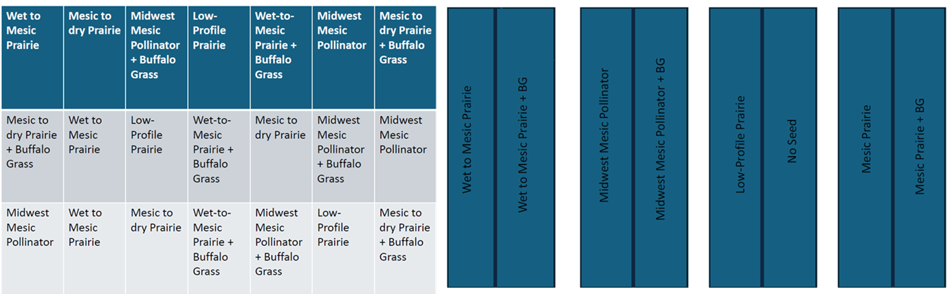
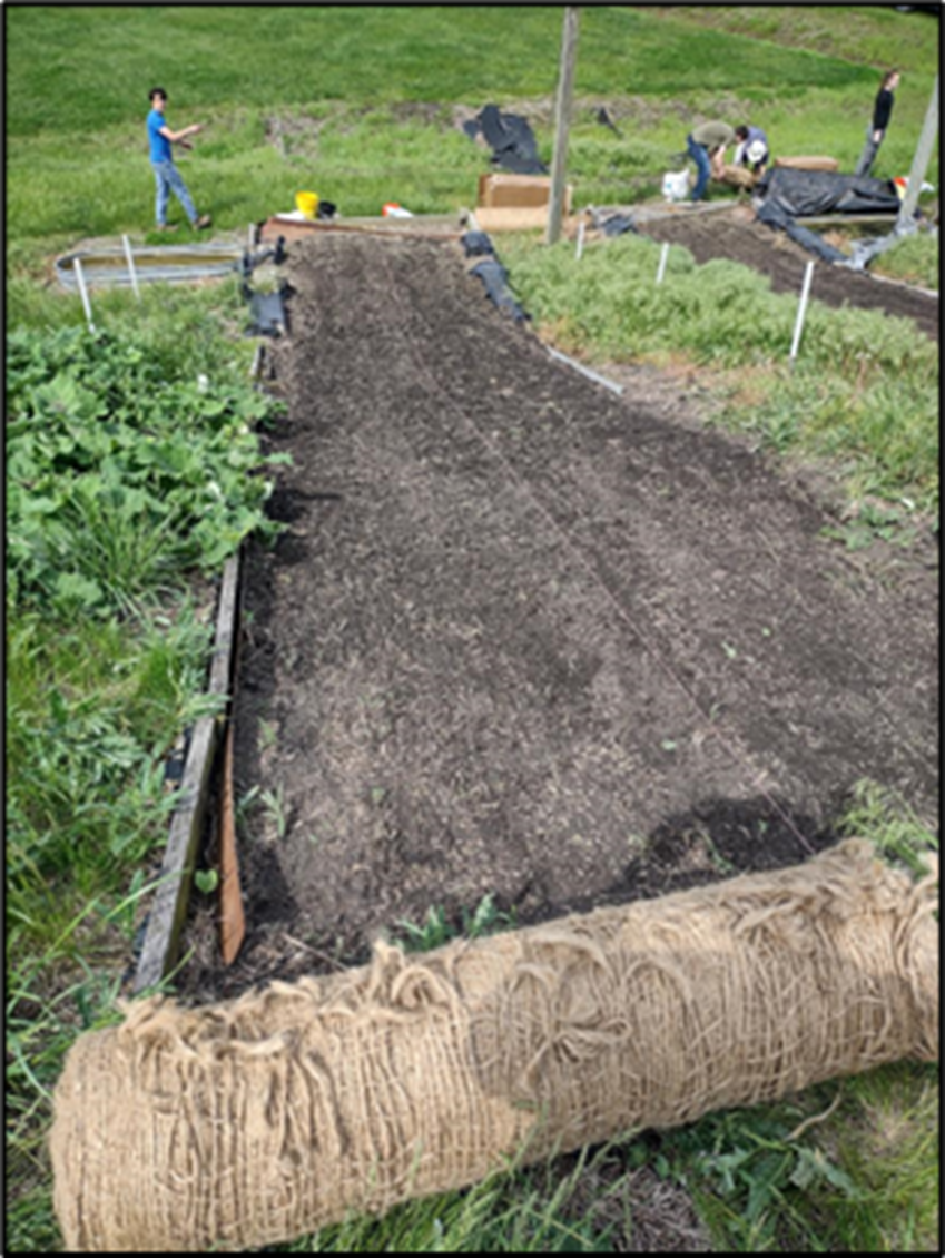
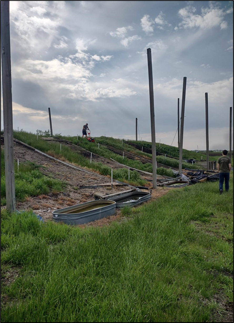
Integrating Field and Remote Sensing Methods to Improve Riparian and Aquatic Vegetation Mapping in Support of Ecosystem Flow Recommendations: Allegheny River Case Study
Fiscal Year Start: 2023; Fiscal Year Ending: 2026.
POC: Molly Reif (ERDC-EL)
Reference SON: 2021-1723 Integrating Field and Remote Sensing Methods to Improve Riparian and Aquatic Vegetation Mapping in Support of Ecosystem Flow Recommendations: Allegheny River Case Study
Factsheet
Reference SON: 2021-1723 Integrating Field and Remote Sensing Methods to Improve Riparian and Aquatic Vegetation Mapping in Support of Ecosystem Flow Recommendations: Allegheny River Case Study
Lead PI(s): Molly Reif (ERDC-EL)
Project Development Team (PDT): EL: Nathan Beane, Safra Altman, Matt Balazik, Jack Shallock, Lance Umlang, Wesley Cowan, Sam Jackson; GRL: Megan Maloney; CHL: Jennifer Wozencraft
Proponent(s)/District Collaborators: LRD: Hank Jarboe; LRP: Carl Nim, Andrea Fitzgibbon, Marion Divers, Kristen Scott, Matt McClure; SAM: Christopher Macon, David White, Heath Harwood, and Nick Johnson
Other Partners: Pennsylvania Natural Heritage Program (PNHP), The Nature Conservancy, (TNC), and the U.S. Geological Survey (USGS)
Funded: FY23-FY26
Keywords: Riparian habitat mapping, SAV habitat mapping, Reach-scale mapping, remote sensing.
Last updated: 09/08/2025
Integrating Field and Remote Sensing Methods to Improve Riparian and Aquatic Vegetation Mapping in Support of Ecosystem Flow Recommendations: Allegheny River Case Study
Research Need
This project will address the need to update monitoring and assessment methods for identifying ecosystem restoration impacts across large river reaches. The work aims to evaluate the integration of multi-platform/multi-sensor data (e.g., high-resolution satellite and airborne imagery and topobathymetric lidar) with strategically coordinated field surveys designed to maximize image analysis techniques for mapping reach-scale riparian and SAV vegetation. In addition, the proposed research will evaluate and develop methods for broad application and use in planning, operations, and Adaptive Management and Monitoring Plans (AMMPs) using a case study along the Allegheny River, representing an ideal location for developing methods to characterize and map near-baseline conditions of riparian forest and SAV habitat.
Project Purpose & Objectives
The overall purpose is to develop approaches that embrace new technologies for examining specific water resource issues and produce operational efficiencies that support USACE’s ecosystem restoration and flood risk management missions. Specifically, the goal is to evaluate and develop methods for integrating field-based techniques with emerging remote sensing technology, in which the outcomes and products will improve ways to consistently and comprehensively document maintenance, success, or impact to terrestrial and aquatic riparian environments resulting from restoration or operational activities.
Data integration will focus on geographically and analytically complementary methods for mapping vegetation in challenging areas, while providing valuable data at the project-scale. The proposed foundational research will include the following objectives:
- Collect high resolution airborne and satellite imagery (e.g., Sentinel-2 and WorldView 2/3) in coordination with field surveys to identify and map major riparian vegetation/forest communities by dominant species with descriptive data for each mapped vegetation type to include density and abundance for species,
- In collaboration with the U.S. Geological Survey, explore airborne hyperspectral imagery and topobathymetric lidar reflectance data and SAV field data collected simultaneously to evaluate efficacy for mapping SAV presence (e.g., assess data limitations), and
- Provide a detailed report/publication(s) with data series highlighting methods and results for broad application and use in AMMPs. Tech transfer (publications and webinars) will enable Districts to incorporate new, integrative approaches for improved mapping of challenging riparian and SAV habitats. Stream and reservoir capabilities will allow users to characterize watershed-scale water quality impacts.
Value of Research and Development (Payoff)
Traditional field-based methods for monitoring riverine ecosystems are time-intensive and may not accurately capture conditions over expansive areas. However, better coupling of field-based techniques with remote sensing technology provides opportunities to document, quantify, and map larger areas on a more comprehensive level and to better prepare for and adapt to future water resource needs. Strategic integration of field surveys, through collaboration with local partners and stakeholders, and remote sensing techniques (maximizing resources available to DoD) offers a way to provide an integrated, interdisciplinary technical approach for consistent and comprehensive data collection and development (e.g., coverage and detail) and for linking restoration or operational impacts, such as those connected with riverine restoration projects or ecosystem flow (e-flow) implementation to ecosystem improvement. As such, research and development of integrated and updated mapping techniques, captured in multiple reports and a webinar, will ultimately enable Districts to implement new approaches for documenting riparian/SAV habitat condition, extent, and density. In turn, the proposed research and resulting products will help build foundational knowledge to improve riparian/SAV habitat evaluation and monitoring of impacts associated with all USACE restoration efforts. Additionally, the products and methods from this proposed research will likewise benefit planning efforts in which riparian ecological modeling requires habitat type and canopy characteristics as critical variables to inform stream and riparian restoration.
Products and Deliverables
Technical Reports (TRs)
- Reif, M.K. and N. Zamani. (2025). Review of remote-sensing methods for mapping riparian and submerged aquatic vegetation : support for ecosystem restoration monitoring and flood risk management (ERDC/EL SR-25-06), Special Report. U.S. Army Engineer Research and Development Center, Vicksburg, Mississippi. https://dx.doi.org/10.21079/11681/49792
- Maxent model comparison for riparian vegetation: Allegheny River Case Study (Planned for FY26)
- Integrating Field and Remote Sensing Methods to Improve Riparian Vegetation Mapping in Support of Ecosystem Restoration: Allegheny River Case Study (Planned for FY26)
- Integrating Field and Remote Sensing Methods to Improve Freshwater Aquatic Vegetation Mapping in Support of Ecosystem Restoration: Allegheny River Case Study (Planned for FY26)
Technical Notes (TNs)
- Lidar data evaluation for extracting detailed forest metrics (Planned for FY26)
Other Reports/Models/Tools/Datasets
- Reif, M.K., S. Altman, M.T. Balazik, N.R. Beane, J.R. Shallock, L.C. Umlang, W.G. Cowan, C.J. Nim, A.S. Fitzgibbon, D.F. White, H. Harwood, E. Zimmerman, B. Daggs, S. Schuette and N. Yawn. (2025). Integrating Field and Remote Sensing Methods to Improve Riparian and Submerged Aquatic Vegetation Mapping: Habitat Field Data, Allegheny River, Northwest Pennsylvania. Dataset. U.S. Army Engineer Research and Development Center, Vicksburg, Mississippi. https://dx.doi.org/10.21079/11681/49866
Conference Presentations/Webinars/Workshops
- Recorded Webinar. Integrating Field and Remote Sensing Methods to Improve Riparian and Aquatic Vegetation Mapping in Support of Ecosystem Restoration: Allegheny River Case Study (Planned for FY26)
Communication (Social Media, Videos, Podcasts, Photos, etc.)
- CW Weekly Highlight, “Allegheny River Reconnaissance Site Visit and Survey Scoping Meeting” (Aug 2023)
- CW Weekly Highlight, “Coordinated Field and Airborne Data Collection Surveys on the Allegheny River” (July 2024)
- Riparian and SAV data collection and survey plan, “Allegheny River Recon Site Visit and Scoping Meeting Summary & Draft Survey Plan for FY24” (White paper and supporting documentation, July 2024)
Images

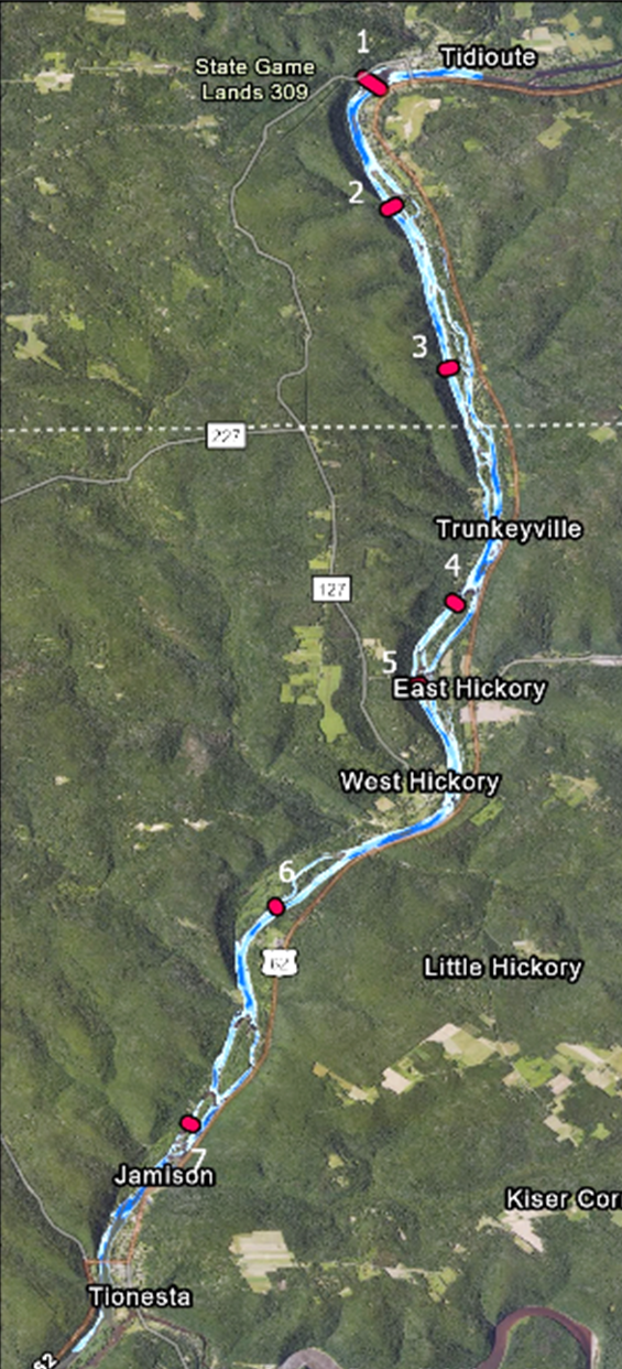
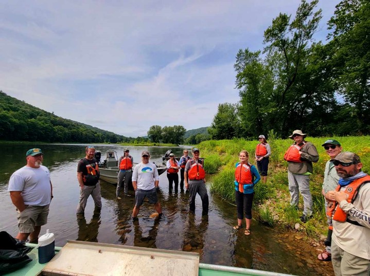
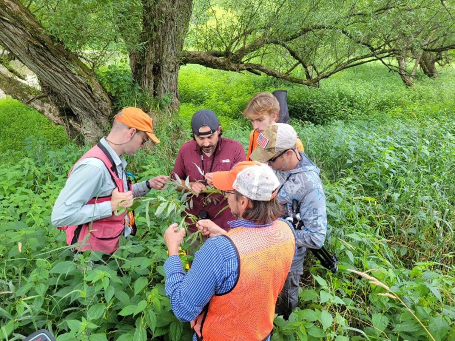
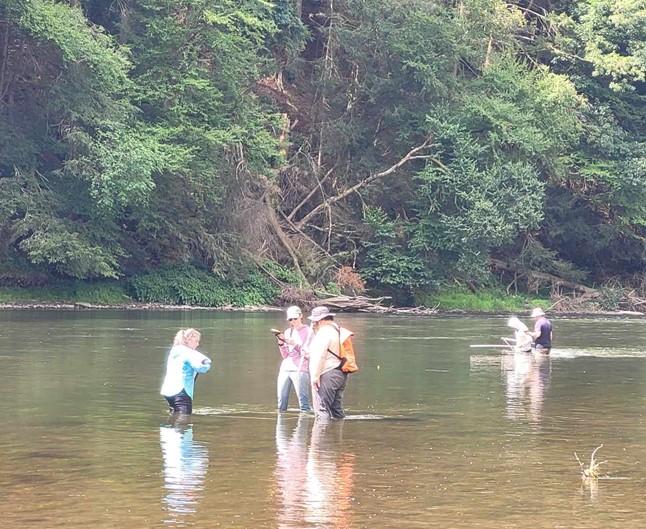
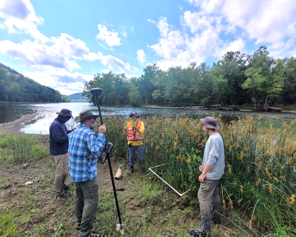
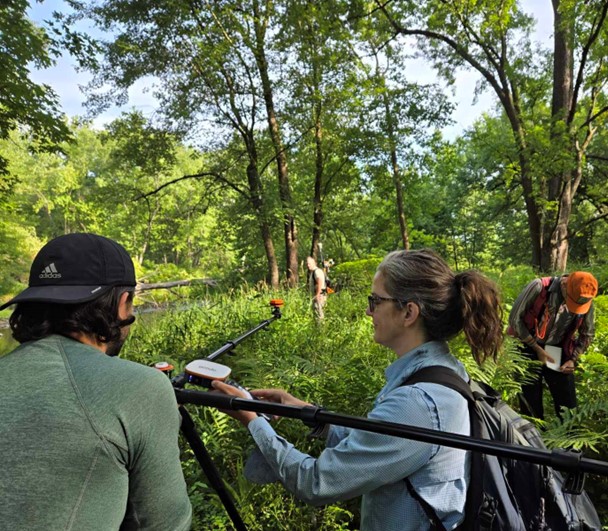
Proactive Ecosystem Restoration: Improving Native Plant Establishment Performance Through Assisted Population Migration
Fiscal Year Start: 2026; Fiscal Year Ending: 2028.
POC: Aaron Schad (ERDC)
Reference SON: Strategic Research Initiative: Proactive Ecosystem Restoration
Factsheet
Reference SON: Strategic Research Initiative: Proactive Ecosystem Restoration
Lead PI(s): Aaron Schad (ERDC)
Project Development Team (PDT): Lynde Dodd (ERDC), Nathan Harms (ERDC), Christopher Manchack (ERDC), Sean Lee (DoE-ORISE)
Proponent(s)/District Collaborators: Kat McCain (HQ-AER BL), SWF, SWG, MVR
Other Partners: University of Florida, University of North Texas, University of Wisconsin-Whitewater
Funded: FY26-FY28
Keywords: Pro-active ecosystem restoration, Assisted migration, Aquatic vegetation restoration, SAV, ecology, drought tolerance
Last updated: 09/12/2025
Proactive Ecosystem Restoration: Improving Native Plant Establishment Performance Through Assisted Population Migration
Research Need
Research and development are needed to ensure the long-term persistence and performance of vegetation communities associated with USACE Civil Works (CW) projects under environmental variation. Historically, native plant restoration projects have sourced plants from adjacent local native plant populations. However, range shifts, evolving plant distributions, and environmental disturbance are beginning to challenge this long-held best practice. An emerging approach utilizes assisted population migration, the intentional movement of native species or subspecies to adjacent areas within or slightly beyond their traditional range. While these proactive restoration techniques have been successfully applied in upland ecosystems, utilization in wetland and aquatic environments has not been widely explored. This research work unit is testing a variety of plant establishment methods in replicated field studies under different environmental variations. The goal is to lead to improved establishment, performance, and resilience of native plant communities while decreasing monitoring and adaptive management costs.
Project Purpose & Objectives
Identify and evaluate efficacy of assisted population migration in restoration-relevant aquatic plant species for CW vegetation establishment efforts.
Primary objectives:
- Evaluate how different aquatic plant species population’s provenance types (project area local v. not) persist and perform.
- Assess the effects hydrologic disturbance (static v. fluctuating) on said aquatic plant species populations.
- Compare the environmental and biological benefits, functions, and services of assisted migration v. traditional local AER approaches/populations.
Value of Research and Development (Payoff)
Development of new USACE ecosystem restoration (ER) methodology in sourcing plant material for wetland vegetation restoration. Research will inform future USACE ER efforts on where best to source potential focal plant species populations to maximize the resilience and long-term ecosystem services provided by restored habitat. Increasing the sustainability of USACE ER efforts will decrease the frequency of follow-up efforts due to disturbance events, biotic interactions, etc. in-turn increasing the return on investments (ROI) of ER projects.
Products and Deliverables (Scheduled)
| DELIVERABLE DESCRIPTION | SCHEDULED DUE DATE | CURRENT PERCENT COMPLETE | PROJECTED COMPLETION DATE |
|---|---|---|---|
| (Mon/Yr) | (%) | (Mon/Yr) | |
| 1. Pond set 1 preparation, propagation, and planting | 06/2025 | 100% | 08/2025 |
| 2. Pond set 1 data collection & analysis | 06/2026 | 35% | 06/2026 |
| 4. Pond set 1 comm. of results (JA & conference) | 09/2026 | 10% | 09/2026 |
| 5. Pond set 2 preparation, propagation, and planting | 05/2026 | 30% | 05/2026 |
| 6. Pond set 2 data collection & analysis | 06/2027 | 0% | 06/2027 |
| 8. Pond set 2 comm. of results (JA & conference) | 09/2027 | 0% | 09/2027 |
| 7. Long-term veg, disturbance monitoring (JA) | 09/2028 | 5% | 09/2028 |
Initial Progress

Table 1. Provenance, MAT, mean monthly precipitation, and Palmer’s Z-index associated with of S. platyphylla, V. americana, and V. neotropicalis used in the mesocosm pond study. (±) indicates the standard error associated with each value.
| Species | Site Name | State | Latitude | Longitude | Mean Annual Temperature (ºF) | Mean Monthly Precipitation (inches) | Palmer's Z-index |
|---|---|---|---|---|---|---|---|
| Vallisneria americana | Potomac River | VA | 38.6601 | -77.15017 | 57.31±1.14 | 3.53±0.14 | -0.24±0.15 |
| Huron | IA | 41.02701 | -90.96471 | 49.22±1.42 | 3.18±0.16 | 0.42±0.15 | |
| Vallisneria neotropicalis | Merritt's Millpond | FL | 30.77839 | -85.16777 | 68.19±0.85 | 4.70±0.23 | -0.01±0.17 |
| Lake Athens | TX | 32.21324 | -95.74828 | 66.39±1.03 | 3.67±0.19 | 0.10±0.17 | |
| Sagittaria platyphylla | Lewisville Lake | TX | 33.06913 | -96.95655 | 66.03±1.11 | 3.13±0.18 | 0.08±0.16 |
| Pine Bluff | AR | 34.25861 | -92.02074 | 63.09±1.07 | 4.48±0.19 | 0.08±0.14 | |
| Addick's Reservoir | TX | 29.82079 | -95.63925 | 70.74±0.86 | 4.24±0.27 | 0.08±0.19 |
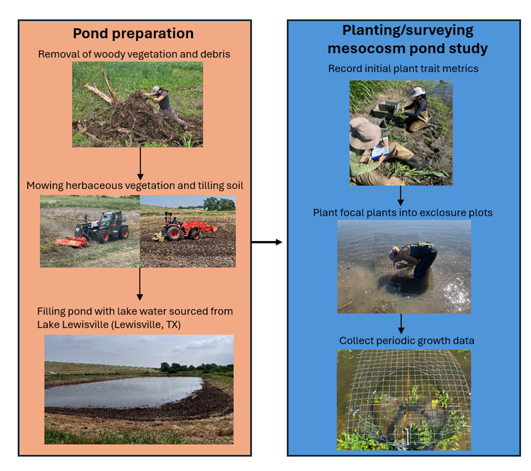
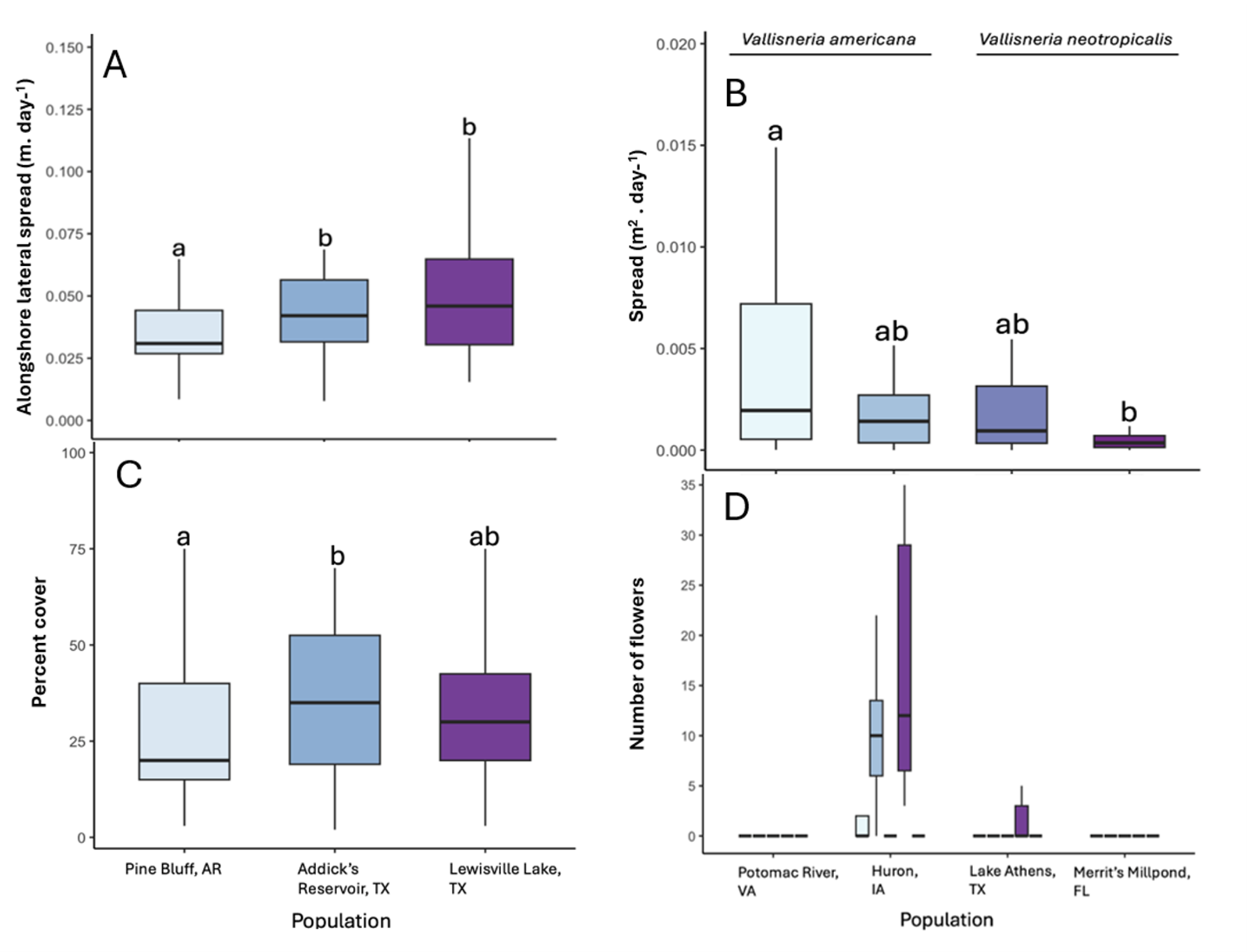
Riparian Model Development for Impact and Benefit Assessment
Fiscal Year Start: 2021; Fiscal Year Ending: 2026.
POC: Samantha Wiest and Garrett Menichino (ERDC-EL)
Reference SON: 2020-1593 Riparian model development for mitigation requirements and ecosystem restoration actions
Factsheet
Reference SON: 2020-1593 Riparian model development for mitigation requirements and ecosystem restoration actions
Lead PI(s): Samantha Wiest and Garrett Menichino (ERDC-EL)
Project Development Team (PDT): McKay, Hernandez, Ayala, Guilfoyle (ERDC)
Proponent(s)/District Collaborators: Danny Allen (Fort Worth), Steele McFadden (Louisville), Michael Scuderi (retired), Peter Weppler (New York), Brian Zettle (Mobile)
Funded: FY21-FY26
Keywords: ecological models, stream assessment
Last updated: 09/17/2025
Riparian Model Development for Impact and Benefit Assessment
Research Need
USACE actions often affect riparian ecosystem structure and function in both positive and negative ways (e.g., benefits of ecosystem restoration and impacts associated with flood damage reduction). While some regional tools exist, no nationwide models or modeling frameworks adequately capture the effects of USACE actions on riparian outcomes.
Project Purpose & Objectives
This project seeks to provide a structured, consistent approach for riparian modeling that provides continuity from early project planning to long-term operations. A preliminary model and riparian screening tool will be developed based on existing knowledge, largely by combining current USACE methods into a certified model. A rigorous riparian modeling framework will be developed in collaboration with external resource agencies and partners. This more detailed modeling approach will be evaluated relative to empirical field data for multiple taxa and outcomes.
Value of Research and Development (Payoff)
USACE practitioners currently lack broadly applicable techniques for assessing impacts and benefits to riparian zones, and existing models are currently regionally specific, inconsistent in approach, and ultimately do not meet project planning needs. This project will provide a consistent framework for accounting for the impacts and benefits of USACE in riparian ecosystems. This approach will facilitate communication nationwide, provide a mechanism for easier “roll-up” of environmental metrics, and align approaches across USACE business lines.
Products and Deliverables
Journal Articles (JAs)
- Ayala-Torres, R., L.H. Dietterich, S. Wiest and S.K. McKay. (2025). Developing predictive models of riparian buffer efficacy with meta-analysis. Environmental Challenges, 20, 101258. https://doi.org/10.1016/j.envc.2025.101258
Technical Reports (TRs)
- Wiest, S., G. Menichino and S.K. McKay. Submitted. Riparian Ecological Function Index (REFI). ERDC/TR. Vicksburg, MS: US Army Engineer Research and Development Center.
Technical Notes (TNs)
- Wiest, S., D.D. Hernandez-Abrams and S.K. McKay. 2023. Review of Riparian Models for Assessing Ecological Impacts and Benefits. ERDC/TN EMRRP-ER-26. Vicksburg, MS: US Army Engineer Research and Development Center. https://dx.doi.org/10.21079/11681/47706
- McKay S.K., S. Wiest, S. McFadden and J. Hawkins. Submitted. Riparian Model Evaluation in Beargrass Creek, Kentucky. ERDC TN-EMRRP-xx. U.S. Army Engineer Research and Development Center, Vicksburg, MS.
- Shaw, C. and S.R. Wiest. Submitted. A Web Application for Riparian Models (WARM). ERDC/TN. Vicksburg, MS: US Army Engineer Research and Development Center.
Other Reports/Models/Tools/Datasets
- Ayala-Torres, R., S.R. Wiest, E. Dorfmueller and S.K. McKay. 2022. Ecological riparian zones width by instream process. White Paper. University of Puerto Rico, Mayaguez.
- Shaw, C. and S.R. Wiest. 2023. Increasing accessibility of riparian assessment tools through web applications. Conference Proceedings Paper. ASCE Inspire Conference.
- Wiest, S., G. Menichino and S.K. McKay. Pending Certification. Riparian Ecological Function Index (REFI). Model. Vicksburg, MS: US Army Engineer Research and Development Center.
- Shaw, C. and S.R. Wiest. Pending Certification. A Web Application for Riparian Models (WARM). Web Application. Vicksburg, MS: US Army Engineer Research and Development Center.
Conference Presentations/Webinars/Workshops
- Wiest, S.R. 2022. Riparian Ecological Function Index (REFI). Poster. EWRI World Water Resources Congress. Atlanta.
- Wiest, S.R. 2022. Riparian Ecological Function Index (REFI). Poster. AWRA Annual Conference. Seattle.
- Wiest, S.R., G. Menichino and S.K. McKay. 2023. Riparian Ecological Function Index (REFI). EL Homecoming. Vicksburg, MS: US Army Engineer Research and Development Center.
- McKay, S.K. Riparian Ecological Function Index (REFI). 2023. ASLO Annual Meeting. Spain.
- McKay, S.K. 2023. Riparian Ecological Function Index (REFI). Symposium on Urbanization and Stream Ecology (SUSE). Australia.
- Shaw, C. and S.R. Wiest. 2023. Increasing accessibility of riparian assessment tools through web applications. Oral Presentation. ASCE Inspire Conference. Washington D.C., Virginia.
- Wiest, S.R., G. Menichino and S.K. McKay. 2024. Riparian Ecological Function Index (REFI). EMRRP Virtual Webinar.
- Ayala-Torres, R. and S.K. McKay. 2024. Developing predictive models of riparian buffer efficacy with meta-analysis. EMRRP Virtual Webinar.
- Shaw, C. and S.R. Wiest. 2024. Web Application for Riparian Models (WARM). EMRRP Virtual Webinar.
- Wiest, S.R. 2024. Riparian Ecological Function Index (REFI). Poster. National Conference on Ecosystem Restoration. Albuquerque, New Mexico.
- Wiest, S.R. 2024. Riparian Ecological Function Index (REFI). Oral Presentation. America Ecological Engineering Society. Blacksburg, Virginia.
- Wiest, S.R. 2024. Riparian Ecological Function Index (REFI). Oral Presentation. National Stream Restoration Conference. New Orleans, Louisiana.
- Wiest, S.R. 2024. Riparian Ecological Function Index (REFI). Oral Presentation. WRAP Stream Restoration Course. Missouri.
- Wiest, S.R. 2025. Riparian Model Evaluation in Beargrass Creek, Kentucky. Poster. River Restoration Northwest. Skamania, Washington.
- Wiest, S.R. 2025. Riparian Ecological Function Index (REFI). Oral Presentation. ECO-PCX Certification Meeting.
Communication (Social Media, Videos, Podcasts, Photos, etc.)
Images
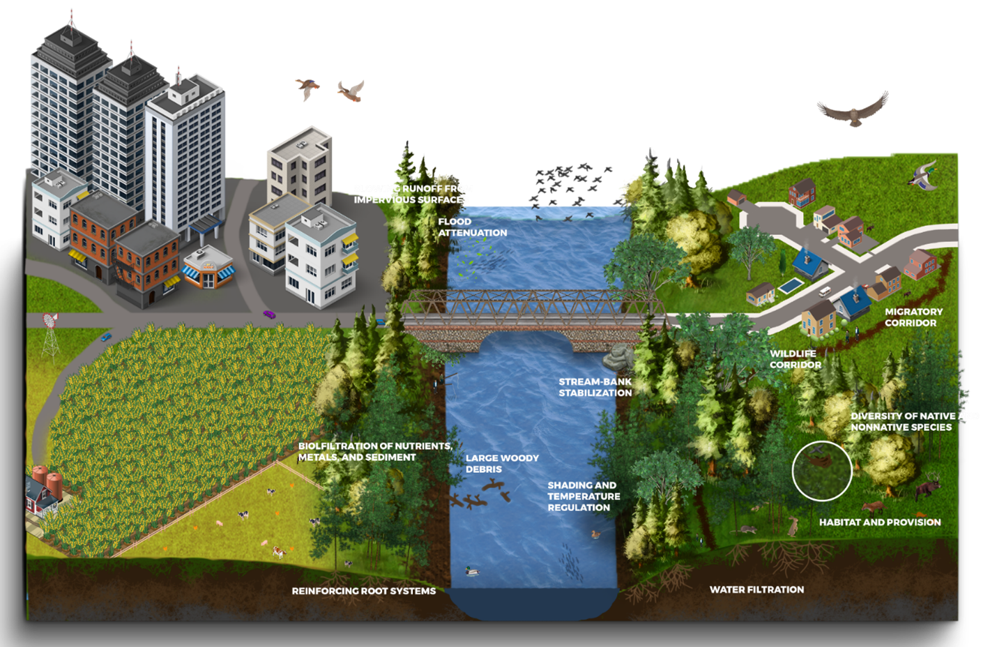
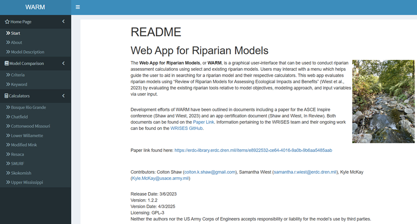
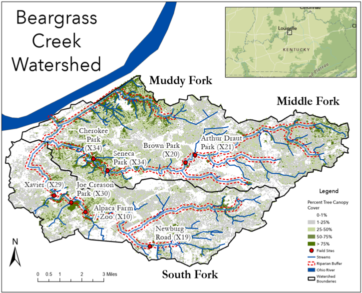
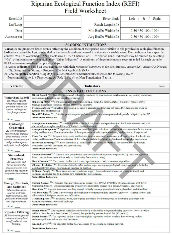
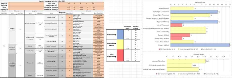
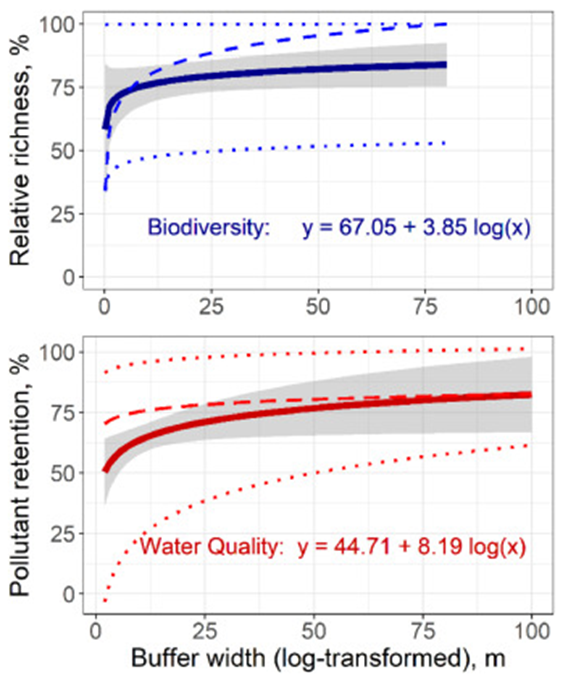
Stable Isotope Analysis and Fish Movement
Fiscal Year Start: 2021; Fiscal Year Ending: 2025.
POC: William T. Slack (ERDC)
Reference SON: 2021-1340 Mapping Fish Origins to Inform Restoration using Microchemistry
Factsheet
Reference SON: 2021-1340 Mapping Fish Origins to Inform Restoration using Microchemistry
Lead PI(s): William T. Slack (ERDC)
Project Development Team (PDT): Anthony Bednar, Jack Killgore (ERDC), Colin Moratz (MVP), Kyle Bales (MVP)
District Collaborators: Mark Cornish (MVP), Andy Ashley (MVD)
Funded: FY21-FY25
Keywords: Fish, Movement, Passage Issues, Stable Isotopes, Microchemistry, Isotopic Library, Watershed Connectivity, Ecosystem Restoration
Last updated: 08/25/2025
Stable Isotope Analysis and Fish Movement1
Research Need
Understanding large-scale movement patterns of fishes coupled with defining important life history attributes, such as identifying natal rivers for fishes including species of high conservation merit, non-native species as well as commercially and recreationally important riverine species, is critical for developing appropriate ecosystem restoration directives for 77 target species as well as defining functional operational conditions for required O&M activities typical in large riverscapes. Resource managers have identified the need to prioritize restoration efforts that maximize ecosystem restoration benefits on a watershed scale and have emphasized the importance of developing a tool that would facilitate this task. Microchemistry and stable isotope analysis has revolutionized the study of fishes and other aquatic fauna. This innovative and developing technology can be developed as an effective tool for providing information about geographic origin, seasonal migration patterns, ontogenetic habitat shifts, and diet in target species within identified watersheds.
Project Purpose & Objectives
The objective of this study is to identify unique water chemical signatures in fishes by incorporating elemental microchemistry analyses and stable isotopes of calcified structures. Isotopic profiles from target fish species will be compared to isotopic signatures obtained from water samples taken throughout the watershed to recreate movement history of the target species. Concordant patterns can be used to aid in the prioritization of restoration efforts focused on watershed connectivity, gauge success of ecosystem restoration projects related to fish passage issues and invasive species management and identify new restoration targets.
Value of Research and Development (Payoff)
Developing this approach across a broad geographic range such as the Mississippi River Valley, provides a unique perspective for addressing benefits from ecosystem restoration projects in addition to assessing impacts from USACE navigation and flood control missions. This broad perspective will provide utility across multiple water resource projects, address fish migration in relation to passage limitations, and enhance our understanding of trophic dynamics and ecosystem services related to ecosystem restoration, in addition to providing restoration metrics for new river engineering projects. The results from this project will also greatly expand our understanding of the biological needs of migratory riverine fish species, and a unique framework for assessing connectivity of watersheds.
Products and Deliverables
Journal Articles (JAs)
- Slack, W.T., G. Whitledge, A. Bednar and K.J. Killgore. (in prep). The utility of stable isotope analyses to address long-distance movement in fishes in a large riverscape with a focus on river sturgeon and invasive carp (proposed completion dates: DEC 2025).
Technical Reports (TRs)
- Slack, W.T., A. Bednar and K.J. Killgore. Development of a trace element signature library across a large watershed for assessing large-scale fish movement patterns (currently with ITL editor 25 AUG 2025).
- Slack, W.T., A. Bednar and K.J. Killgore. (2025). Development of a trace element signature library across a large watershed for assessing large-scale fish movement patterns: supplemental data. https://dx.doi.org/10.21079/11681/49787
Technical Notes (TNs)
- Slack, W.T., A. Scircle, A. Bednar and K.J. Killgore (in prep). Methodological approach for isotopic signature acquisition from fish structures to be utilized for elemental microchemistry studies in the Mississippi River Basin (proposed completion date: NOV 2025).
Software
Project Activities
Inventoried 300+ fin sections of River Sturgeon (Pallid and Shovelnose) and 350+ fin sections of Silver Carp from the Middle and Lower Mississippi rivers that are available for stable isotope analyses.
Seventy-seven spine sections from river sturgeon were submitted to Southern Illinois University (SIU) for processing with Laser Ablation (LA-ICPMS). An additional 25 samples of pectoral ray sections from Silver Carp were submitted to SIU and the ERDC Chemistry Lab for Laser Ablation processing. This effort will provide in-person training for the ERDC Chemistry team as well as provide a control condition to compare LA-ICPMS results.
Water samples from 49 stations (triplicate at each station) along Mississippi River and major tributaries extending from Dubuque, IA to Gramercy, LA (1387 river miles) were collected during low water conditions. Samples were submitted to ERDC Chemistry Lab for analyses to evaluate levels of Calcium, Iron and Lithium in addition to concentrations of Barium137 and Strontium86 isotopes.
1Project Alias – Work Unit Documentation Title: Utility of Using Stable Isotope Analysis in Understanding Fish Movement in the Mississippi River Valley
A Tiered Approach to Assessing Stream Ecosystem Condition
Fiscal Year Start: 2023; Fiscal Year Ending: 2026.
POC: Garrett Menichino (ERDC-EL)
Reference SON: SON-2021-1738, Application of Stream Condition Metrics to Calculate Average Annual Habitat Units to Include Structure, Function and Dynamic Processes
Factsheet
Reference SON: SON-2021-1738, Application of Stream Condition Metrics to Calculate Average Annual Habitat Units to Include Structure, Function and Dynamic Processes
Lead PI(s): Garrett Menichino (ERDC-EL)
Project Development Team (PDT): Garrett Menichino (EL), Leanne Stepchinski (ORISE Postdoc), Aubrey Harris (EL), Darixa Hernandez-Abrams (EL), Samantha Wiest (EL), Chris Haring (CHL), David Biedenharn (CHL), and Gabrielle David (CRREL)
Proponent(s)/District Collaborators: Mark Smith (MVM), TJ Rickey (SAM), Peter Francissen (SAJ), Joanna Curran (NWS), Steele McFadden (LRL), Max Headlee (NWK)
Funded: FY23-FY26
Keywords: Stream assessment and condition, Ecosystem health and function, Stream assessment toolkit
Last updated: 09/24/2025
A Tiered Approach to Assessing Stream Ecosystem Condition
Research Need
Stream ecosystems are a major focus of diverse USACE management activities ranging from aquatic ecosystem restoration to multi-purpose flood risk planning to regulatory mitigation. USACE planners, engineers, and regulators require tools for holistically assessing the structure, function, and dynamic processes of streams and rivers.
Historically, the agency has heavily relied on species-specific habitat suitability models developed by the US Fish and Wildlife Service in the early 1980s. These habitat evaluation procedures provided a useful framework for assessing streams relative to effects on focal taxa (e.g., imperiled or sport species). However, these models are well-acknowledged as limited due to factors such as: a myopic focus on a single taxon in a speciose system, minimal accounting of population dynamics, an absence of ecosystem-scale outcomes, and an overemphasis on metrics of ecosystem structure rather than function.
Furthermore, the USACE Civil Works planning process (i.e., SMART Planning) imposes different modeling needs as projects progress. At the Alternative Milestone, teams are often working with sparse data and very rapid timelines (i.e., 1-3 months) to screen sites and management measures. At the Tentatively Selected Plan Milestone (12-20 months), practitioners are working toward conceptual, site-scale designs (e.g., riparian planting, instream structures, or both). At the Agency Decision Milestone and throughout Pre-construction Engineering Design, teams are examining “scales” of an alternative (e.g., varying sizes of instream structures) and reporting ecological benefits to USACE Headquarters and Congress. Following implementation, project teams must monitor the effects of a project to inform adaptive management decisions.
In sum, USACE practitioners require a diverse toolbox of stream assessment procedures that vary in level of effort and the degree of input data resolution. These tools should assess ecological outcomes not only relative to habitat provision but also ecosystem functions. Additionally, these tools should be conceptually linked such that decisions are made in a consistent and repeatable manner as project planning and implementation proceeds. Ideally, this toolkit would be national in scope and create a standardized approach to stream assessment, which would be comparable across diverse applications.
Project Purpose & Objectives
This project seeks to develop a nested toolkit of methods for stream assessment that align with Civil Works project planning needs by providing varying levels of effort. The toolkit will be designed explicitly to provide a consistent structure to stream assessments at any scale of analysis. Objectives:
- Develop a common and transferrable structure for stream assessment, which can be applied at multiple scales and tailored to local needs.
- Compile tools for assessing stream outcomes associated with this structure at three scales: macro-scale outcomes aligned with “desktop” analysis, meso-scale outcomes associated with rapid field assessment, and local-scale outcomes tailored to regional needs and informed by empirical data collection.
- Develop select tools to fill gaps in the existing toolbox.
- Certify tools for use by USACE practitioners (as appropriate).
- Demonstrate application of the nested, multi-scale model framework as a "go-by" for users.
Value of Research and Development (Payoff)
The proposed approach will save resources and expedite USACE project delivery. Specifically, the development of a consistent framework provides an adaptable structure for teams to use as a basis for local development (analogous to the HGM modeling approach). Consistency in model structure also facilitates comparison of projects at programmatic scales and “roll up” of project benefits for national budgeting and reporting. The toolkits developed at each level of effort will provide users with a menu of options for their particular application.
Products and Deliverables
Journal Articles (JAs)
- Stepchinski, L.M., S.K. McKay, and G.T. Menichino. A Tiered Approach to Developing Function-Based Stream Assessments. Submitted.
- Stepchinski, L.M., S.K. McKay, and G.T. Menichino. A Synthesis and Inventory of Stream Functions. River Research and Applications. Submitted.
- Stepchinski, L.M., S.K. McKay, A.E. Harris, and G.T. Menichino. A Review of Stream Assessment Methods in the United States. Submitted.
Technical Reports (TRs)
- A rapid field assessment approach for stream assessment (2025 Sept)
Technical Notes (TNs)
- Haring, C.P., L.M. Stepchinski, and G.T. Menichino. Rapid Assessment Tool for Channel Hydraulics and Floodplain Connectivity. U.S. Army Engineer Research and Development Center. [In EPAS Review, anticipated publication 2025 Fall]
- Stepchinski, L.M., S.K. McKay, and G.T. Menichino. (2025). Review of Stream Assessments for Evaluating Ecological Impacts and Benefits. ERDC/TN EMRRP-EL-7. U.S. Army Engineer Research and Development Center, Vicksburg, MS. https://dx.doi.org/10.21079/11681/49710
- Stepchinski, L.M., G.C. David, and G.T. Menichino. Applying the Tiered Assessment Approach to the Development of a Detailed Assessment in a stream in the Northeastern United States. (Planned 2025 December).
- Stepchinski, L.M., G.C. David, and G.T. Menichino. Applying the Tiered Assessment Approach to the Development of a Detailed Assessment in a stream in the Pacific Northwest of the United States. (Planned 2026 May).
Other Reports/Models/Tools/Datasets
- Online database of stream assessment methods and tools (2024 July) https://usace-wrises.github.io/RiverEngineeringResources/
- Launch online database of assessments to support nested framework (estimated 2026 June)
Conference Presentations/Webinars/Workshops
- Stepchinski, L.M., G.C. David, & G.T. Menichino. (Expected 2026 July). Toolkit for Applying a Tiered Approach for Assessment [EMRRP Webinar]. U.S. Army Engineer Research and Development Center.
- Stepchinski, L.M., G.C. David, & G.T. Menichino. (Expected 2026 June). Regionally tailored tools for assessment [EMRRP Webinar]. U.S. Army Engineer Research and Development Center.
- Stepchinski, L.M., G.C. David, & G.T. Menichino. (2025 August). Stream Functions Assessment and Rapid Index (SFARI) for Evaluating Ecosystem Condition [EMRRP Webinar]. U.S. Army Engineer Research and Development Center.
- Stepchinski, L.M, G.T. Menichino, S.K. McKay. (2025 May). A Stream Tiered Assessment Framework: Stream Assessment Model, Society for Freshwater Sciences.
- Stepchinski, L.M, G.T. Menichino, S.K. McKay. (2025 February). A Comprehensive List of Stream Functions for Function-Based Stream Assessments: River Restoration Northwest.
- Stepchinski, L.M., G.T. Menichino, S.K. McKay. (2024 December). A Tiered Approach for Assessing Stream Ecosystem Condition, American Geophysical Union Annual Meeting.
- Stepchinski, L.M. & G.T. Menichino. (2024 October). Stream Tiered Assessment Framework: Model [EMRRP Webinar]. U.S. Army Engineer Research and Development Center.
- Stepchinski, L.M., G.T. Menichino, S.K. McKay. (2024 September). A Tiered Framework Approach for Stream Assessment: ORISE Postdoctoral Symposium.
- Stepchinski, L.M. & G.T. Menichino. (2024 July). Review of Stream Assessments for Evaluating Ecological Impacts and Benefits [EMRRP Webinar]. U.S. Army Engineer Research and Development Center.
- Stepchinski, L.M., G.T. Menichino, S.K. McKay. (2024 June). Developing a Tiered Approach for Assessment of Biological and Ecological Stream Condition: Society for Freshwater Sciences.
- Stepchinski, L.M., G.T. Menichino, S.K. McKay. (2024 June). Toward a Tiered Approach for Assessing of Stream Ecosystem Condition: National Stream Restoration Conference.
Communication (Social Media, Videos, Podcasts, Photos, etc.)
Images
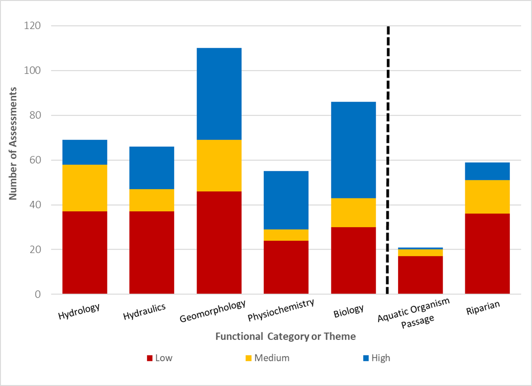
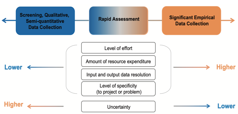
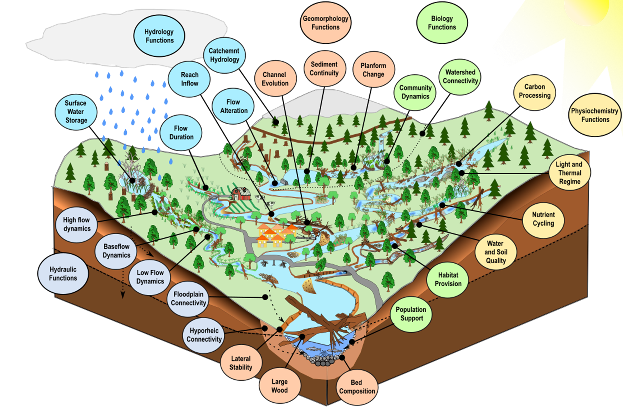
No results found